My new guidebook Trail Running Western Massachusetts (click here to view the book's page on Amazon) profiles 51 of the best trail running sites in the region. It was a challenge to whittle the final list to be included in the book down to just 51 sites, and some sites that I really like had to be cut for a variety of reasons. There were even a couple of "deleted scenes" where a site profile had actually been written but the trail got cut in favor of including a different site. As promised earlier, I will be posting some of those sites here and linking to them from the book's Facebook page. Consider them "bonus sites" in addition to the ones included in the book.
In this case, the trail profiled is a relatively little traveled local favorite. Located just a ways up the road from where we live, it is very fun to run and we like to run it often. I've actually written about it on this blog before here. The reason it got cut from the book was that the two sites it connects did get included, and there were just too many profiles lumped into one part of the region. Anyway, end of blathery introduction. Enjoy!
Distance: 4–6 miles, with several options for more at either end
Difficulty rating: Moderate
Trail style: Out-and-back
Trail type: Singletrack
Towns: Ashfield / Goshen
This 3-mile trail connects The Trustees of Reservations’ (TTOR’s) Chapel Brook Reservation in Ashfield to the to D.A.R. State Forest in Goshen. Roaming across a variety of terrain types, it’s interesting both geographically and ecologically. As an out-and-back run it makes for a greater medium-intensity workout on its own, and has several potential turn-around spots for shorter workouts as well as an option to make a longer loop out of it at the far end. At present, the trail is saddled with the rather unwieldy official name of "Chapel Brook Reservation to DAR State Forest Trail," which is shortened slightly here for ease of use. Conceived as a way to link trail networks on two larger conservation properties, it was created as a collaboration by the Town of Ashfield, TTOR, and the Franklin Land Trust. The trail passes by several rustic wooden benches, crosses a couple of scenic streams, skirts a pond, and comes close to two old stone foundations. It's all very runnable, and it’s a real pleasure to run on this trail. It can be combined with a five-mile out-and-back on the Two Bridges Trail (see Site 25: Two Bridges Trail on p. 107 of Trail Running Western Massachusetts) for an 11-mile run with a water stop back at your vehicle in the middle. It can also be combined with a roughly 2-mile loop (the Moose Run Trail) at its western end at D.A.R. State Forest. Larger loops at D.A.R. are possible too, any of which would make for a very nice long, scenic, and fun trail run (see D.A.R. State Forest on p. 103 of Trail Running Western Massachusetts).
Site map (click to link to larger version):

NOTE: This is what the "enhanced maps" that you can link to with the QR codes (those little pixelated black squares on the maps in the book) look like.
Directions: The parking area at Chapel Brook Falls is about 7 miles north of Rte. 9 in Williamsburg on North Street (which becomes Ashfield Rd, then becomes Williamsburg Rd), and about 2 miles south of Rte. 116 in Ashfield on Williamsburg Rd. In the pullouts on either side of the road (on opposite sides of the brook), there is parking for about ten cars.
Trail: From the parking lot along the Ashfield/Williamsburg Rd, a wide doubletrack trail leads up the slope to the west from a locked metal gate and soon arrives at a junction below Chapel Ledges on Pony Mountain. A large wooden signboard offers information about the ecology and history of the area and encourages responsible recreational practices for climbers at the ledges.
Optional Extension (~0.5 miles): From the big sign, a set of wooden steps cut into the hillside leads up to the base of the ledges. This site is very popular with rock climbers, and it's easy to see why. From the base of the ledges you can take either leg of a loop trail that goes to the summit. Going straight up the steeper part, the trail ascends along the base of the ledges via a series of impressively constructed log cribs. Near the top, a spur path leads up to the actual top of the knob. The true summit is mostly forested, but the tops of the steep ledges are open and there are very nice views to the southwest from there. From the spur path junction, the loop trail continues traversing along the west side of the hill and soon swings back around and drops down to the saddle below, where it then heads south over occasional loose rocks back to the start of the loop.
Behind the sign, a barely noticeable singletrack trail heads southwest up the slope to the west. The trail gently rises and falls, but in general it climbs as it heads towards D.A.R. State Forest. Early on, it passes by several rustic wooden benches, crosses a couple of scenic streams, and comes close to a few large boulders and lichen-encrusted ledges.
About 0.5 miles from the start, the trail crosses a stream on a wooden bridge and then begins a sustained climb up the east side of a hill. Swinging around a southern ridge and turning north briefly, the grade levels off and you proceed across an upland area with a series of short dips down into small drainage swales. At one point, the trail swings left (south) and briefly coincides with the route of the Old County Road that connected Williamsburg to Ashfield. Then it bears right off the old road and continues west. You will cross and/or parallel several old stone walls in this section too. The well-marked trail zig-zags past several intersections with unofficial side trails, and, at 2.0 miles from the start, arrives at West Road.
Cross West Road (go a few feet to the left/south and pick up the trail at the far end of the guardrail) and then follow the trail around the edge of a wetland, across a scenic woodland stream on a bridge, and through a marshy area on boardwalks. Continuing west and climbing gently, the very well-constructed trail uses several long sections of plank bridges to cross a few perennially wet areas. At about 2.8 miles, the trail skirts the south side of a beaver pond, where a very short spur leads across planks to a wooden bench overlooking the water (Note: as of October 2014, the beaver pond had drained and had become more of a marsh). From the pond, the trail briefly dips just below the beaver dam and then climbs 0.2 miles to its end at a junction with the Moose Run Trail in D.A.R. State Forest.

Lush ferns along the eastern (lower) end of the Chapel Brook to D.A.R. Trail

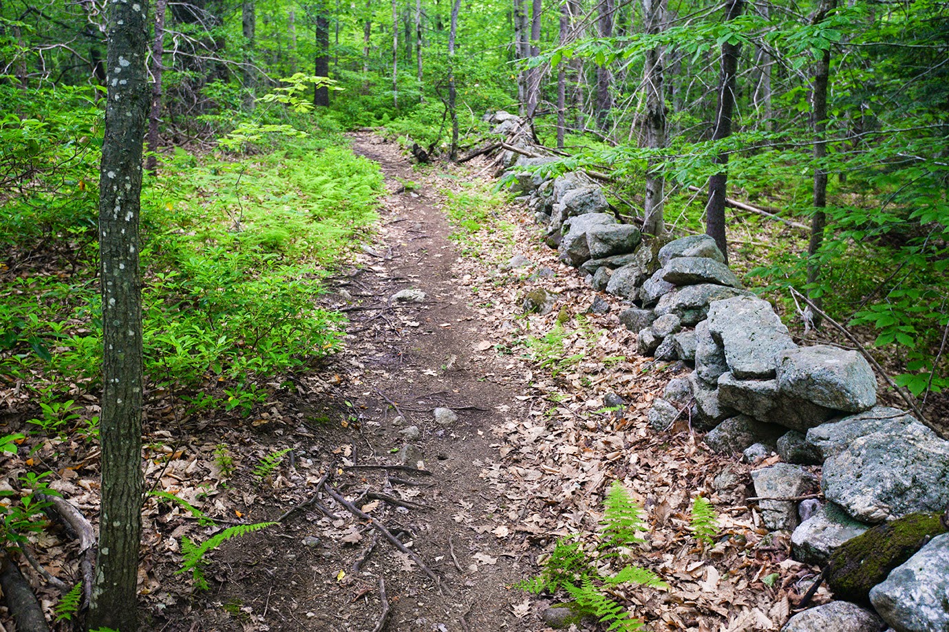 The Chapel Brook to D.A.R. Trail briefly paralleling a stone wall
Bridge along the Chapel Brook to D.A.R. Trail

Switchback along the Chapel Brook to D.A.R. Trail
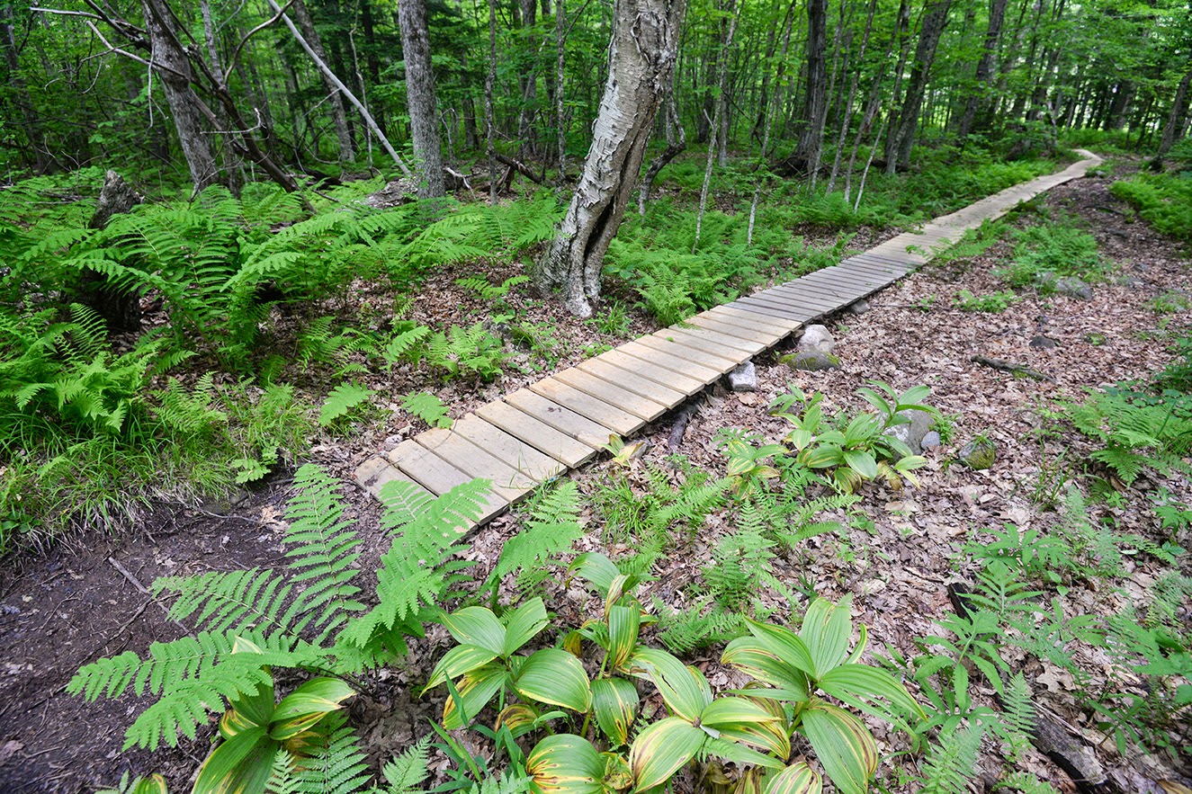
Boardwalk section of the Chapel Brook to D.A.R. Trail

short spur to a bench by a beaver pond along the Chapel Brook to D.A.R. Trail
No comments:
Post a Comment