I was lucky enough to grow up on the island, where I developed lasting loves both of the trails and of running. By the time I graduated from high school, I had run or hiked every existing mile of trail or carriage trail that I knew of (I had an AMC map with every last trail line colored orange). My mother still lives there and I try to get back once or twice a year, though often those visits are far too short.
This summer, Jen and I set aside a full week and made a legitimate vacation out of it. Our visit came on the heels of several very exhausting (yet excellent) days in the White Mountains (see separate post here), and also it was the hottest week of the summer, so our outdoor adventure days were interspersed with low-key rest and relaxation days.
lounging at the Blagden Preserve on the island's quiet side
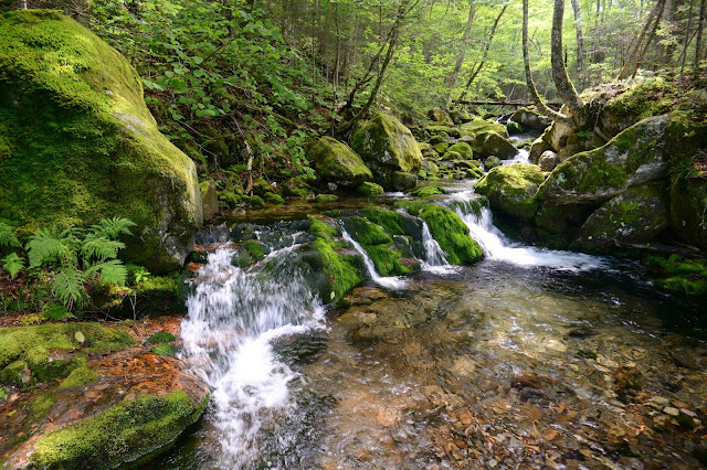
After spending a day basking by the shore far away from the crowds at The Nature Conservancy’s Blagden Preserve in Somesville, we dipped our toes in the carriage trail waters by running the 4-mile Witch Hole Pond / Paradise Hill loop from Duck Brook Bridge. As always on the carriage trails, the running was fairly mellow despite the rolling hills. The soft dirt roadbed is easy on the body, and the occasional scenic views are definitely easy on the soul. We ran slow and steady, shaking some of the White-Mountains-induced soreness out of our legs. Then we soaked our feet in the amazingly warm stream below the bridge afterwards, and were amazed that there wasn’t a single mosquito or blackfly to tarnish the moment.
The first classic singletrack trail run we did was a short 4-mile loop up and over Cedar Swamp Mountain. Starting at the Gate House parking area just up the hill from Northeast Harbor, we followed the Upper Hadlock Carriage Road north to the waterfall bridge, where we then started hiking up the rooty Hadlock Brook Trail. I was very pleased to see that the rootiest section of trail I know of anywhere is currently receiving a much-needed makeover. Trail crews are hard at work creating a new switchback near the junction with the trail (that we took) leading south up to Birch Spring. At Birch Spring we took a right and climbed the last little steep pitch to the summit of Cedar Swamp Mtn. After enjoying the late afternoon views, we headed off for the very fun mile and a half or so descent down the south ridge. The footing alternates between bony granite ledge and soft, conifer needle coated forest duff, and we couldn’t keep ourselves from letting out little whoops and whees as we darted down the mountain and enjoyed occasional unnecessary springs off of boulders. At the bottom, we closed the loop with a short jog back along the Amphitheater Carriage Trail to the Gate House. This run was of course followed up by a refreshing swim in Echo Lake.
The next classic trail run involved the Cadillac South Ridge Trail. The day was warm and sunny to start, but we could tell that a persistent sea breeze was beginning to bring in some fog from over the ocean. Copying a really fun route my brother and I had devised a few years earlier, we left a car along Rte. 3 near Blackwoods Campground and had my mother shuttle us north up the road a few miles to just south of the Tarn. From the trailhead, the trail drops gently down the slope for a few tenths of a mile to a set of wooden bridges along a beaver dam and then connects with the Tarn Trail. Taking a left at that junction, we followed the flat (and recently well-renovated) Tarn Trail south for a mile or so. After beginning to climb, then curving right and passing junctions with the Dorr South Ridge and Canon Brook Trails, we started north up the mostly runnable A. Murray Young Path, which offers an excellent example of the frequently magnificent stonework along trails in Acadia. Well-placed rocks guide the way and provide amazingly flat footing as you slowly rise up the slope of the gorge between Cadillac and Dorr. Eventually you need to climb a short open talus section just south of the top of the saddle between the two mountains, but it’s always easily navigable (though it does help to use your hands in a few places). At the open area, we could see the fog beginning to surge in fast from the south.
Trail running Cedar Swamp Mountain
fog rolling in
From the saddle, it’s a very strenuous 4-mile ascent up to the summit of Cadillac Mountain and all of its hoards of people. I wanted to buy a Snickers bar or something in the gift shop, but I swear the product selection in there is just about the worst I’ve ever seen. And no Snickers bars. Don’t tell me this was some attempt to offer healthy snacks to visitors, because I saw a lot of garbage for sale in there. Just… ugh. I started to get antsy in there right away and we just left and hit the trail again.
surging over the summit
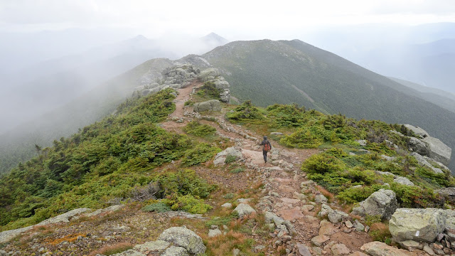
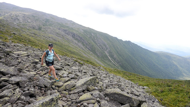
To reach the South Ridge Trail, and the highlight of the run, we followed the trail across the forested part of the summit to the open section near the Beech Hill overlook and the West Face Trail. From there, the next mile is simply glorious. Heading due south, the trail gently descends the wide-open granite ridgeline, offering a sort of natural pavement that feels like a real runner’s playground. It’s impossible to not catch yourself grinning and feeling extra bursts of energy. The fog had begun to sweep in over us, but on a clear day there are views far out to sea over the outer islands. After a steep drop down to a small saddle with a wetland called The Featherbed, the trail briefly rises again over a section of rugged ledge and then continues descending gently again, this time along the now slightly more vegetated but still semi-open ridge. If anything, this section is even more runnable than the previous one. Parts of it feel like a roller coaster and others remind me of carving soft turns while downhill skiing. After passing the Eagles Crag spur trail, it becomes fully forested and there are some rocks and roots to contend with, but time passed quickly and before we knew it we’d arrived back at our car.
running down the Cadillac South Ridge Trail
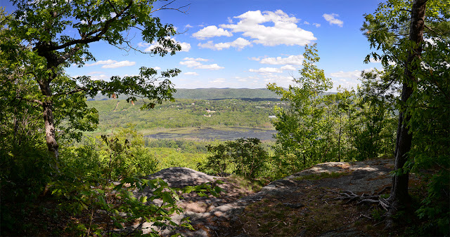
Our final trail run was a complex loop at Beech Cliffs and Beech Mountain that included running south along the Valley Trail and north up the well-switchbacked South Ridge Trail. The final push to the summit is steep and demanding, but the views northwest out over Long Pond near the end of this run are always breathtaking.
Beech Mountain vista panorama
We were very pleased with the routes we ran, but there are many other great ones out there (see map of the island here). Some fun routes to consider for trail running adventures on the island include: Pemetic Mountain (especially the south ridge), all trails on Sargent Mtn. (especially the South Ridge Trail and the one that passes by the swimmable Sargent Mtn. Pond), Penobscot Mountain, the North Ridge of Dorr Mtn., Champlain to the Beehive and Gorham, Western Mountain, the Asticou Trail, and the Around Mountain Carriage Trail, among others. You see the pattern here. Basically, any trail that trends north-south along a ridge on the island is fantastic for running (the ones through gorges and ravines are very scenic but not always as runnable so you need to choose wisely there).
Numerous guidebooks and websites have been written about the trails; two of my favorites are Tom St. Germain’s A Walk in the Park (Tom is an avid trail runner and skilled old trail finder) and Joe’s Guide to Acadia National Park by Joe Braun (he has some really fantastic photos too). The island is also home to a host of fantastic annual races, including the Northeast Harbor 5-Mile Road Race, the Bar Harbor Half-Marathon, and the Mount Desert Island Marathon.


