Sunday, December 10, 2017

Cleaning Trail


In northwestern Massachusetts, the mostly singletrack Mahican - Mohawk Trail runs like a broken necklace from Deerfield to North Adams. I say "broken" for three reasons. Partly because there are missing sections, such as between Shelburne Falls and Mohawk Trail State Forest; partly because there are two newly closed sections in Conway and Shelburne (one due to washouts south of Bardwell's Ferry and one due to a landowner's reluctance to allow people to cross his property); and partly due to general decay of the trail's infrastructure.

I included the eastern part of the trail as a profiled site (#27) in my guidebook Trail Running Western Massachusetts. Since publication of that book the washout closure happened and the lack of general maintenance has seemed more and more evident to me. The big fiberglass bridge over the Cold River at Polly's Crossing is still safe and spectacular, but the descent to the bridge from the southern side is heavily eroded and could probably use some new switchbacking work. And in various places along the trail, small wooden bridges and log stair steps have rotted to the point where they may be unsafe to use (be careful if you do).

Furthermore, there seems to be a tendency along the section south of Polly's Crossing to collect leaves. A LOT of leaves. They accumulate along the trail in tremendous volume and perhaps because of the north-facing aspect of the slope above the Deerfield River they don't seem to rot away during the course of the summer. As a result, the trail becomes ever-more obscured year after year and it can be hard to tell where it is sometimes, even with the white blazes on the trees. Also, the impressive depth of leaves covers the log stairs and over time causes them to rot away prematurely.

As a result, this section of trail doesn't seem to get a lot of use, and it's hard to blame people for staying away. And I think that's a shame. People generally really like long-distance trails like the AT, the NET, the Long Trail, the Windmill Ridge Trail(s) in southeastern Vermont, and the Mid-State Trail, etc. In time, the Mahican-Mohawk Trail seems like it could be as popular as those other ones, and also be one of the few east-west routes in the region. If enough people discover it and talk about it, the appeal could catch on. But at the moment the trajectory seems to be heading in the other direction.

Which is a very long preamble to me saying that I recently went out and cleaned up this section of trail a little bit. I raked some of the parts where the trail was entirely obscured, cleaned all the leaves out of the rotting log stairs, and moved countless blowdowns that were lying across the trail. Much more could be done, like edging the upslope side of the trail with digging tools, creating new switchbacks on the steepest sections, replacing the rotted log stairs, trimming back branches growing into the path, and cutting through or moving the larger blowdowns, but at least this feels like a start.


I've since gone back and run the section between Deerfield and Conway, and I have to say it was pretty fun. I've contacted the Deerfield River Watershed Association about future volunteer maintenance opportunities and hope that more people discover this hidden gem. Who's with me?

For more info about the Mahican - Mohawk Trail, check out this page on the MA DCR website. 

Tuesday, November 14, 2017

The November Challenge (or, The Audacity of Leaves)

Since my birthday falls in early November, I probably like the much-maligned month more than most. A child’s happy memories of coming downstairs and seeing what is obviously a Star Wars action figure (“I hope it’s a new stormtrooper!”) wrapped in last weekend’s Sunday funnies (way back when Garfield was still funny) sitting on the coffee table… those can last a lifetime; thanks, Mom! The daylight savings time change seems to affect others more than me; just plop a headlamp on me and I’m good to go. No SAD issues for me, thankfully. And I don’t even mind the gray. Or grey? Or brown, or whatever color November actually is. But one thing does frequently hassle me on my early November runs: downed leaves.

an actually not-too-bad section of leaf-covered trail

Whether you’re running on narrow trails or old woods roads, a coating of dead leaves can make things difficult. On twisty mountain-bike singletrack, like the kind you find at Earl’s Trails in Hadley or the Saw Mill Hills conservation area in Northampton, the route can be completely obscured, and important trail junctions rendered invisible. This year I tried navigating the maze of faint paths just east of Fitzgerald Lake after leaf-fall, and even though I had a good map and knew the way I still found myself missing turns and bushwhacking by mistake. At times like that I stop to silently thank the oft-unappreciated ranks of Those Who Rake.

On the other end of the spectrum, wide open routes like the “carriage trails” at Northfield Mountain feature their own autumnal challenges. You can always find your way, but with a lot of leaves covering the surface you can still manage to somehow go astray. The likelihood of turning an ankle on uneven ground increases a lot, and the possibility of kicking a buried branch or protruding rock becomes a real threat. 

And what happens if you just add water? Oh, that’s a special treat. Wet leaves are slippery anytime, but just wait’ll you try to run across some on a slanted ledge in the woods. Whooooops!!! Ouch. The D.O.C., M-M, and Teabag Trails on Mt. Tom have a couple of spots where that’s a real concern. Wet leaves also make you slide backwards on uphills and can cause you to slip to your doom on steep downhills. 

Naturally, there ARE some upsides as well. The leafless trees let in more light, so it takes darkness longer to really set in, which is a nice (if somewhat slight) offset to a shorter day length. The decomposed foliage on the ground will eventually make new soil to replenish the ever-eroding trail’s treadway. And often the less-than-ideal conditions will drive fair-weather runners back to roads or onto treadmills, so you’ve got those sweet forest miles all to yourself for a change. 

Also, let’s be honest here, aren’t those leaves better off rotting away in the woods than filling up your yard? Plus, no matter how tough the leaves can make fall trail running, the snow won’t be too far off, and you know what that means… snowshoe racing season’s coming soon!!


Ben is the editor of The Sugarloaf Sun newsletter and author of the guidebook Trail Running Western Massachusetts


Sunday, November 5, 2017

Bear Hole Run for the Trails 10K

The first annual running of the Bear Hole Run for the Trails 5K and 10K trail race took place on 11/4/17 in West Springfield, MA. The race, intended to benefit the trails of the Bear Hole watershed (the area south and west of Ashley Reservoir in Holyoke), drew a small but energetic field of zany knuckleheads, including me. The weather was perfect (cool, sunny, and dry), though the sun dapple was blinding at times (wearing a cap with a visor that I could adjust definitely helped), and the downed leaves hid some of the rockier and rootier portions of the singletrack, especially along the NET on East Mountain.

Gareth Buckley of South Hadley won by a longshot in 45:44 (he must have had leaf-ray vision). I managed to snag third place, in 54:04, but only because the guy who’d been in second place and the lead woman for most of the race both took a wrong turn at a particularly tricky junction on a short but steep incline in the woods near mile 5. For an easy cool-down, local trail runner friend Wayne Stocker led me, John Torrone, and Wayne Ball to an incredibly scenic waterfall (it’s totally worth seeking out sometime) and the rather depressing old cage where the former owner used to keep a bear.


Monday, October 30, 2017

Fear the Running Dread

Bear with me. This does relate to running, I promise.

I love scary movies. I have watched a LOT of them, and I really enjoy it when a group of clever movie-makers can craft something that simulates a nightmare. Creating sensations that really make you feel alive. On a primal level, a good scare can be almost as enjoyable as a good laugh. Horror and comedy are strangely related. So, yeah, I love scary movies. But not all of them; there’s a pecking order. Let me explain. 

Zombies leave me cold (there is nothing frightening about slow, mindless idiots, unless… well, never mind); I’ve stared numbly through several George Romero films. Classic possessions generally bore me (I’m not Catholic, so…); after watching The Exorcist late one night as a teenager, I complained to my friends, “seriously? That’s what some people say is the scariest movie ever?” And various other monsters often just seem silly; I’m lookin’ at you, most giant animal movies. Oh, and cursed objects? Yawwwwn. 

But faint bumps in the night (what was that?), subtle tricks of the eye (did I just see…?), and body horror (how could one go on without that limb, etc.) terrify me terribly. Paranormal Activity, Halloween, and The Thing all fit the bill here. I’ve also found genuine frights in some creature features, like Jaws, Cloverfield, The Descent, and Alien, etc. Being eaten sucks! Your basic deranged maniacs even have an element of fearsomeness sometimes, because hey it could happen; thus the occasional slasher movie fright (also, actor/writer Gunnar Hansen who played the chainsaw-wielding Leatherface was my neighbor growing up, so there’s that). I enjoy those flicks so much, for their ability to create and sustain intense suspense and/or brief moments of pure terror.


So what does any of this have to do with running? Well, for one thing being on a run isn’t always that different from watching a movie. There’s a distinct beginning and a definite end, with some kind of progressively unfolding story in between. And much of what you get or take away from it is up to you. Each run is like a little movie we create for ourselves, and the movies aren’t always lighthearted comedies. As for running scared in general, we’ve all been there on some level. How many times have you been spooked on a run, either by an animal or a loud truck? Or by fading daylight, or a suspicious stranger, or even just the thoughts in your head? 

As a regular trail runner, I frequently find myself alone in the woods; for the most part I’m very comfortable there. Sure there are a few things to be wary of here in the Northeast. Bears with cubs. Moose in rut. Evil spiders (bulbous or hairy ones with striped legs are the MOST evil). But most of the animal scares I get are from squirrels that sound as loud as a pack of Brontosaurus in the underbrush. Sometimes I get wigged out by the potential threat of encountering someone sketchy out there. Most of the time though, the thing that gives me shivers is the notion that I could somehow lose a body part that I can’t grow back (why are there so many sharp dead branches sticking out exactly at my eye level on this trail??). Dismemberment. Oh please let me never need to refer to part of myself as severed, gouged-out, or sliced off. 

Usually the fear is pretty far from my mind. There’s a lot to think about on a run. Like where you are, where you’re going, why that conversation at work got you so worked up today. But sometimes it creeps in. The insidious infiltration of fear. I call it The Running Dread. 

As with movies, not all running dread is equal. Sometimes it’s pretty benign and you mostly forget about it and move on before too long. Other times it comes and goes, like a fleeting flash of an unexpected figure out of the corner of your eye. And still other times it takes hold and paralyzes part of your brain, more or less wiping out your capacity for rational thought. That last one can really ruin a run! But it can also serve to force a speed workout, so hey, it’s not all bad. Fortunately, the fear always seems to go away when the movie or run ends. Or… does it.


I don’t necessarily fear the running dread. I know it’s going to be a part of my life sometimes, and it’s best to just recognize that and accept it. Maybe write about it and share the notion with others. Hope that I’m not totally alone here and at least a few people get what I’m talking about. You know? Right? Guys? Hello…? Is anyone there? 


Monday, September 18, 2017

recovery day

Everyone should be so lucky to get a recovery day as sweet as this one. Despite Trump's best efforts to gross it all up with a misogynistic and juvenile-no-matter-how-you-look-at-it re-tweet of the golf ball "joke" video ("SO presidential"), Jen and I had a really good day.

I slept late after a night that thankfully didn't include any witching-hour post-marathon charleyhorses, enjoyed my coffee and late-morning Fareed Zakaria political analysis on TV, and wrote a short article on the couch with the cat at my side. Then I joined Jen outside for some watering of the garden and lawn, and realized just how hot and humid it still was out. After abandoning us for a bit around Labor Day, summer came back to play the past few days. We decided to head up into the hills for some chill beach time at Pelham Lake in Rowe, followed by some easy and very slow walking along the lower trails of the Pelham Hills network. The weather was absolutely gorgeous and we capped it all off with an especially fine evening of dinner and drinks at the West End Pub in Shelburne Falls. THIS is how late summer in New England should always feel.

The trails at this site are featured in site #7 of my guidebook Trail Running Western Massachusetts

sylvan swamp off to the side of a very cool esker on the Meadow Trail

beach girl

me in my element

2 miles of super-scenic easy walking

Beach Trail

Beach Trail bridge; this trail network is really something

L: jct of the Babbling Brook Trail and Meadow Trail, up on an esker between two ferny forested swamps
R: testing the filter.

Babbling Brook Trail

Babbling Brook Trail

botany girl

bogwalks

a particularly good night at the West End Pub

Saturday, September 16, 2017

my hardest marathon

Today I ran the marathon course (2 laps) at the Free to Run Trail Races in Pittsfield State Forest. Hosted by BURCS, this awesome annual event uses some of the toughest, funnest trails in the region, a bunch of which are profiled in site #11 of my guidebook Trail Running Western Massachusetts. I've photographed this race several times in the past (2016, 2015, etc.), but this year I decided I really wanted to step out from behind the lens and get to experience it firsthand, the runner's way.

It was easily the hardest marathon I've ever done. After several weeks of below-average temps, the mercury soared this weekend and the humidity was through the roof. I drove out from Greenfield around 7 a.m., and as I zipped across the hilltowns of the Berkshires to get there I had to use my windshield wipers almost the whole time despite the fact that IT WAS NOT RAINING. The mugginess never let up, and I sweat so many gallons during the course of the very long run.

I shouldn't complain, though. A super-hardy group of ultrarunners, including two incredible women wearing hijab headwear, set off into the pre-dawn fog at 5 a.m. and did a four-lap 50-miler. Those guys were so amazing.

Our race started at 9 a.m. and began with a mile out-and-back along the park road, where most people probably set their fastest pace of the day. Then we climbed about 1,000 feet up the scenic (it's all scenic, so I'll stop saying that) Lulu Brook Trail. Near the top we veered onto the less-steep Wendell Berry Way Trail, then left on the Taconic Crest Trail up to the amazing vista where my friend Jake's family staffed an aid station. Several more miles up and down along the Taconic Crest, past another aid station staffed by another friend, Jen, and then on to the best part of the course. This year the course changed to include the new switchbacks on the Turner Trail, which I LOVE running down. It was so fun to scream down around the tight, well-graded curves. At the bottom of the ridge, we reached an aid station staffed by my friend Ana and then went right back up again, this time via the relentless Parker Brook Trail. At the beaver pond near the top, we turned left on the Pine Hill Trail for one more ambling climb (with one steep pitch just before the end). Then the course dropped down a series of trails (Pine Mtn., Hawthorne, etc.) to the bottom, where we passed one more aid station staffed by friends (Ginger and Christopher) and set out for two final rolling miles of singletrack before the halfway point. Before setting out for lap 2, I changed into a dry top, which stayed not-soaked for almost 20 whole seconds.

Without any warning, I got an agonizing charleyhorse on the inside of my lower right thigh near the top of the Turner Trail switchbacks on the second lap. It forced me to come to a full stop and try to work it out as I watched the angry snakes squirm beneath the skin. It was excruciating. The cramping let up after a few minutes (you can see the short stall on my pace profile just before mile 18) and I was able to descend the mile or so down to the next station. When I got to the bottom I sat in Ana's chair and assessed my situation. I was really afraid of another debilitating and painful muscle seizure way out in the woods up on top of Pine Hill or something. With a mix of realism and subtle encouragement, Ana laid it out for me: You can DNF and that really is fine if that's what your body needs, but of course there's a subset of people who would say do what you need to do and get back out there and try and DO NOT DNF no matter what the cost. She asked me how much salt I'd taken in and I said 6 tabs and she said that seemed sensible given the conditions. But maybe I could stuff some more in? Something clicked and I decided to do it. I scarfed as much salty stuff and sport drink as I could, then dipped a big peeled orange slice in salt and gagged it down. WAY too salty, but apparently what I needed. I set off up the hill and didn't cramp again the whole way. 

Despite the crushing mugginess and supercharleyhorse near the top of the Turner Trail switchbacks, I did alright. My pace slowed a lot on the second lap, but I was able to finish in 6:12:37, which was actually faster than the pace that ultrasignup predicted for me, and just a few minutes off my goal pace. 


My GPS watch only recorded 24 miles, which seems alarmingly short until you remember that the kind of tight switchbacks that this course follows are notoriously hard to measure when you're zipping along them any faster than a slow walk (never mind that I felt like I was moving that slow a fair bit of this race!).


Thursday, September 7, 2017

my smallest marathon

A local guy wanted to put on a marathon and have it be a real-deal, certified BQ course, but without all the trappings of having to host a big race. So he did.

This past weekend I was one of five starters/finishers in the (official) Green River Marathon. Yep... five. The course started where the pavement ends on Green River Road here in Greenfield, MA then runs north along the river into Vermont. Around mile 11 in the village of Green River you pass through the covered bridge and then keep going north. At the junction with Hinesburg Rd you go left and run about a mile to the start of the pavement by the Deer Park Rd bridge near the Halifax town line (mile 14). Then you reverse course and head back to about 2 miles north of the start. It's very gradual uphill most of the way out and the reverse on the way back, with easy rolling hills the whole way. There were no water stations so you needed to either plan ahead or have a support person helping you out (I'm VERY lucky to have Jen).

I didn't train for it specifically, and only agreed to run it about a week beforehand. I had the bare minimum of training, but also the experience of twelve previous marathons and a handful of ultras under my belt. And the weather was PERFECT for running. The five of us lined up at 6:30 a.m. and set out in fairly brisk temperatures given the weather lately (NOT complaining; though it did mean I needed to stop and take off my windpants and extra shirt about 2 miles in, which equals a few minutes of lost time).

ready to go (I look like I had just woken up;
in fairness, though, I had just woken up)

Imagining that I might drop out around mile 20 or so, I held myself to 9-ish minute miles, hoping to get a good long training run out of it. Well. I just kept feeling good. By the time I got back to the covered bridge on the return (~ mile 17?) I had a pretty good notion that I'd be able to finish, maybe even under 4 hours. I did slow down some after mile 20, not surprisingly, but not a lot. No cramps (took 4 salt tabs overall), and no real wall to speak of. To my great pleasure, I crossed the finish line in 3:57:53.

~mile 3

mile 10

through the bridge

back through the bridge

across the finishing line

Now, several days later, I'm happy to say that it's been one of the easiest, quickest marathon recoveries I've ever had. I took two full days off, as everyone recommends. Then I biked easy for 15 miles the third day, Then the fourth day off. Then today I did 4 miles at 8:30 pace. I tried to go slower but it really didn't seem necessary. That's a great feeling just 5 days after a marathon! There've been some where I was still having trouble with STAIRS on the fifth day after. I am probably gonna lose a toenail, though.

So. Lucky thirteen, I guess. I decided to sign up for the marathon at the Free to Run Trail Races over in Pittsfield State Forest in a week and a half. Very much looking forward to that.


Thursday, August 31, 2017

Trail Running Acadia, Part 2

Two years ago I wrote a post about trail running in Acadia National Park on Mount Desert Island in Maine (see it here), and then a few months later I had an article published in New England Runner about running on the island in general (see article here). Jen and I (now engaged!) recently returned to the island for a little running relaxation and family time. In addition to doing the Northeast Harbor Road Race (in my hometown) and some hikes and swims, we enjoyed three more super scenic and fun trail runs, each described here.

my favorite shot of the trip, on Penobscot Mtn. 

Western Mountain (Bernard Mtn. and Mansell Mtn.)
For our first run, on our first full day on the island, I chose a route that I knew would 1.) not be crowded, and 2.) still give my girl a good gestalt of trails, mountains, and lakes on the island (something I really enjoy doing). Crowds can be brutal in August, and we had zero desire to fight for parking or solitude. So, sticking to the "backside" of the island, we drove over to the remote and little-used trailhead for the Great Notch Trail on Pine Hill near Hodgdon Pond. Turns out we were the only car in the lot. From there we ran a lollipop loop that included wooded Bernard Mountain and dramatic Mansell Mountain. We took it easy, enjoying the scenery, taking lots of photos, and chatting with the very few other people we encountered. 

The initial gradual 1.5-mile climb up Great Notch Trail took us over some blueberry ledges, up a somewhat eroded section, and through a patch of old growth forest (one of the few on the island). Approaching Great Notch, portions of the trail got extremely rooty, and one stretch climbed a steep set of wooden stairs, but it was still pleasant. From the notch we took a right and climbed steeply up to the eastern vista ledge on Knight's Nubble, then up and over the nubble itself and down to Little Notch. We ran right over the summit of Bernard Mountain and down along one of my all-time favorite stretches of trail anywhere, a pine-needle covered stretch where the ground beneath the conifers is almost completely covered in moss. You just know that part gets socked in with coastal fog a LOT. Then we dropped down to Gilley Field, traversed over to the south shore of Long Pond, and made our way to the base of the Perpendicular Trail on the eastern side of Mansell Mountain. With no shame, we fast-hiked the next mile or so, straight up the awesomely well constructed Perpendicular Trail. From the summit we dropped down to the Razorback Trail. We turned north on Razorback and zipped along the spine of the sub-ridge back down to the notch, and back out to Pine Hill.

so CROWDED!


up the Perpendicular Trail


sunset over Bass Harbor after Western Mountain run
dinnerlight later in Bass Harbor


Norumbega Mountain
For an easier day, we did a short-ish but still challenging loop near Northeast Harbor. Starting at the southeastern end of Hadlock Pond, we ran along the east shore of the pond to the waterfall where the brook comes in from the north. Then there was about a mile-long section along the eastern base of Norumbega Mountain that, I have to say, was a bit tough for running. Parts of it were great, but others were so incredibly rooty. Then up the very steep Goat Trail (which has actually been worked on quite a bit since I was a kid) to the summit. The fog was pretty thick that day, and there were zero views, which is a shame because there's some pretty good ones of Somes Sound, Northeast Harbor, and the Western Way. But it allowed us to really concentrate on how fun the next mile or so was as we descended the south ridge back towards Hadlock Pond. It's a classic Acadia ridge run alternating between granite "ramp" ledges, gravelly dirt tracks through scrub bushes and pine trees, and occasional stone steps where long-ago trail workers created enduring works of functional art, punctuated with short dips into magical, soft-bottomed conifer dells.


Sargent and Penobscot 
For our one big excursion on the more crowded eastern side of the island, I chose a route that I hoped would be less traveled. For the most part, it worked! We started at the Gate House near Northeast Harbor, ran about a mile out on the carriage trail and then turned left onto the trail up Cedar Swamp Mountain (see more full write-up of a run here from 2 years ago). After stopping briefly at the summit, we dropped down into the saddle and then continued climbing up about another mile along the partly open ridge to the junction on Sargent Mountain. From there, the mile or so out in the open to the summit is just glorious. Open granite bedrock with subalpine vegetation and occasional wet pockets... I love it so much. 

After summit Sargent we turned around and ran back south, stopping briefly at the pond for a swim (warmest I've seen the water there in decades; very pleasant) and some chatting with a few cool young couples. Then into the saddle between Sargent and Penobscot, and up and over Penobscot. Then the true gem of the day. Running down the south ridge of Penobscot. So fun. Flying over open granite ledges and ramps with spectacular views out across the Atlantic. Just bliss. Oh and from this point on we never saw another soul out there until we got back to the parking lot. At the southern end, we took a right on the relatively recently renovated trail that drops down into the Amphitheater. Happy to report that it is SPECTACULAR for running. Gently graded with swooping switchbacks. Near the bottom you cross carriage trails 3 times in rapid succession, then bottom out at a T-junction with the Asticou Trail. We took a right and headed west up a curving climb over big stone steps to a junction with a trail that headed south over to Eliot Mountain. Wanting to tack on a few extra miles and grab one more mountain, we turned left. The trail is narrower and MUCH less traveled here. 

From Eliot Mountain we dropped down the the Map House, where I'd intended to take the dirt road back to the Gate House. But the current landowner just west of there has posted a lot of unfriendly no trespassing and Beware of Dog / Violators Will Be Prosecuted signs. I wasn't sure about the legality of the situation, if they actually owned the road or just the land to the side, so opted to have us return via a fishhook back out the Asticou Trail and carriage trail to the Gate House.


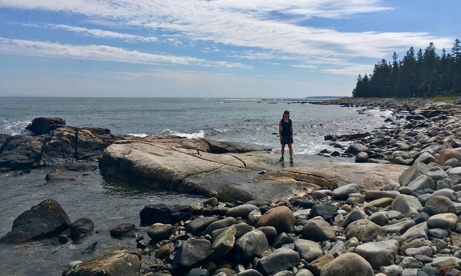
We also hiked the trail at Ship Harbor and hung out on granite ledges by the ocean, walked out to the twin red chairs by the shore at the Blagden Preserve, and joined my brother and his girlfriend for a hike/swim out the ledges on the western shore of Long Pond. Between all that and family time with as many people as we could manage, it was a plenty full trip.


On the last full day on the island I ran the 5-mile Northeast Harbor Road Race, which starts at the northern end of Sargent Drive and then heads south along Somes Sound to Northeast Harbor, finishing with a fish-hook around the south side of town past The Fleet in Gilpatrick Cove, my aunt's big house on South Shore Road, the Kimball family cemetery, and the house of my stepmother and twin half-brothers on Kimball Road before finishing up in front of The Kimball Shop on Main Street. You can see how it's a bit of a familiar trip for me. Despite being a bit heavy and having done several significant trail runs in the days prior, I felt fantastic.The weather was perfect and my body behaved in all the important ways. I ran a lot of the race beside or just behind Michael Westphal, and finished in 36:12 (7:15 pace).

 
That was it for this trip. Check back, though, as there's a really good chance part 3 will come along before too long. I've got a hankering to do an early morning loop of Ocean Drive path, Great Head, Beehive, Bowl, and Gorham from Fabri, as well as Triad, Pemetic, North Bubble, Dorr, and return trips to Cadillac South Ridge, Beech Mountain south ridge, and Bald Peak.