hiking in Mt. Revelstoke National Park
This August Jen and I took a long-overdue vacation away from New England. We flew to Calgary, rented a car, and lit out for the Canadian Rockies. The travel was mostly smooth, though I could write a long diatribe about how user-unfriendly the Toronto Airport can be, especially for international passengers making a connecting flight, and there was a slight snafu on arrival when I discovered that the car rental reservation was for downtown Calgary, not the airport. Overall, we ended up spending a little more than we'd planned, but so it goes with travel.
Interesting physical geography tidbit: In that part of Canada, the topographic landscape is reminiscent of, but not quite similar to, Colorado. Calgary is at 3,500 feet, while Denver is around 5,200 feet. From each city, you plow right into a wall of mountains when you head west. It's just that in Canada you're lower down to start with; Canada basically skips the high plains ecoregion altogether and goes straight to montane.
On the first day we drove to Canmore, which is the first major town in the mountains. We got some Canadian cash from the ATM, had a great lunch at The Grizzly Paw tavern, and headed up a twisty dirt road that led southwest up to a scenic mountain valley. From there, we parked at what we guessed was the trailhead for Miners Peak and hiked about 2 miles up a steep, switchback trail to a junction where we opted to climb Ha Ling Peak. The views were ridiculously spectacular from the summit, where one side of the mountain dropped away in a sheer cliff.
at the top of Ha Ling Peak
view towards Canmore from the summit cliff
destroying our quads on the descent
Feeling giddy, we ran back down to the trailhead. It turns out that was a fun but stupid idea. We thought we were smartly acclimating and breaking ourselves in, but little did we know we were just wrecking our quads for the next few days. Near the bottom we saw some bighorn sheep along the trail.
a tasty meal in Canmore
That night we stayed at a nice lodge just outside of Banff (we splurged on accommodations this trip) and had dinner in town. The actual town of Banff seemed like Bar Harbor meets Aspen, with all the crowds of each. When we told the friendly waiter at the restaurant that we were heading to Revelstoke, he suddenly looked perplexed and said, "Why do you want to go to Revelstoke?" It was a question we lightly mocked many times in the coming days.
The next day's forecast threatened rain and thunderstorms, and our quads were very sore from the day before. So we reluctantly let go of our plans to hike the Cory Pass loop, which we still wonder about, and opted to take in a scenic drive in the morning and a very pleasant alpine hike/run in the afternoon.
Vermillion Lakes drive in Banff
light rain on the trail at Sunshine Meadows along the Continental Divide
Rock Isle Lake at Sunshine Meadows
Rock Isle Lake at Sunshine Meadows, from the high point
sweet trail running on the Citadel Trail at Sunshine Meadows
at the Paint Pots
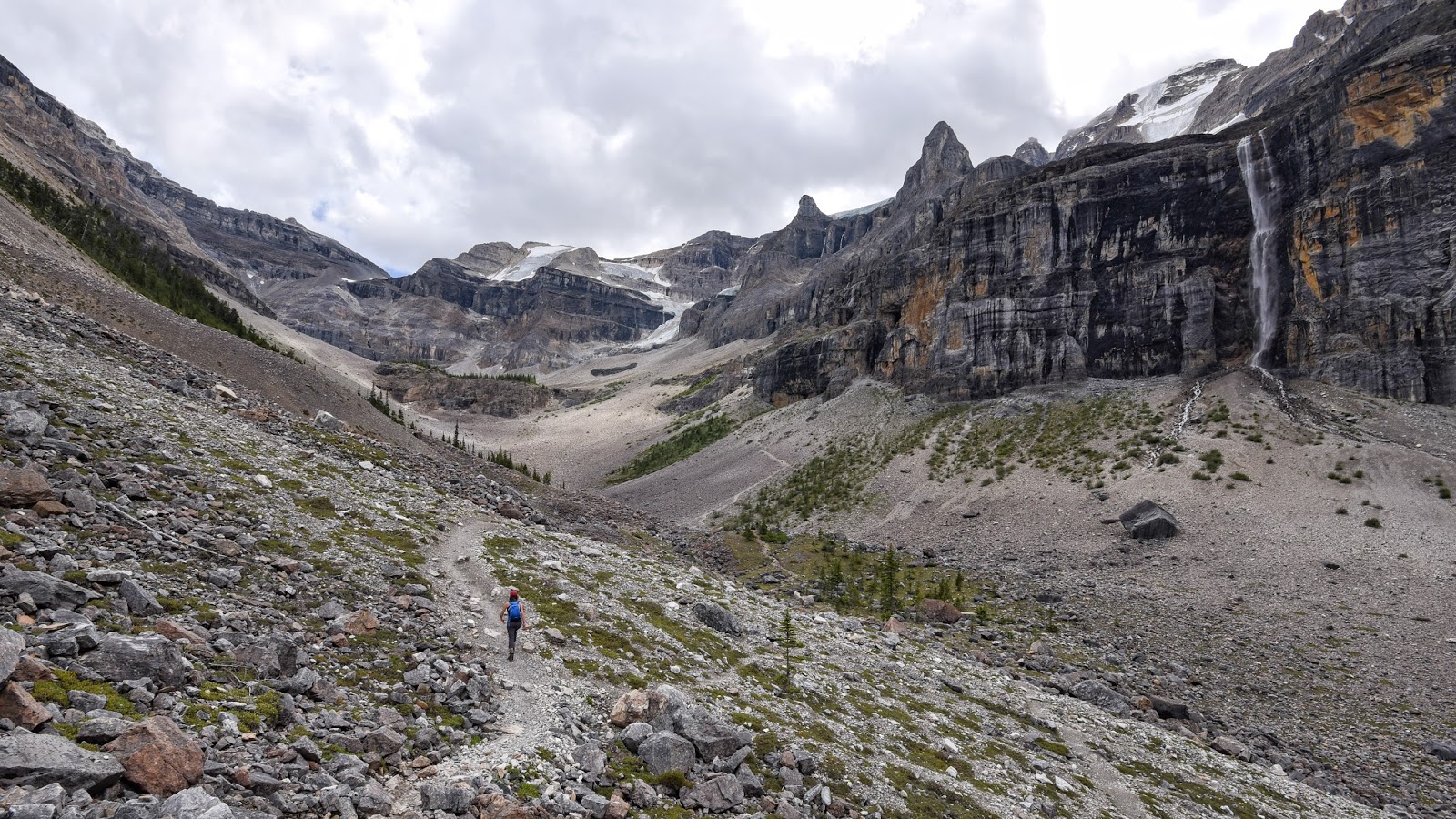
From Banff, we crossed into Kootenay National Park and made a quick stop at the Paint Pots trail, where you can see some neat natural spring "pool" formations along a stream. That night we spent the first of two nights in a semi-rustic cabin at the Kootenay Park Lodge. The next day we chose to spare our sorry quads and forgo a 10+-mile trek up to Flow Lake and the Rockwall Trail, yet another hike we had really been looking forward to. Instead, we visited the fairly easy out-and-back trail at Marble Canyon (which was pretty cool) and hiked a 5 or 6-mile round-trip route up the Stanley Glacier Trail. Our runner-up option was actually quite cool, with scenery reminiscent of Yellowstone, Glacier, and the Tableland serpentine barrens of Newfoundland. Also, the trail passed through an area that had burned by a huge forest fire years ago, which added some interesting scenic and ecological variety.
ascending through the burn zone on the Stanley Glacier Trail
climbing up into the Stanley Glacier valley
The next day we rested a bit. Driving down out of Kootenay on the supremely scenic Highway 93 (where every mile looks like the cover of a Rand McNally atlas), we stopped for a fairly cheap and much-needed soak in the pool at Radium Hot Springs, which was developed but not nearly as bad as it might have been, and felt good on our sore legs and feet. Then, after lunch at a German restaurant, I discovered that our hotel reservation for the next three nights had not gone through. Remembering the advice of a friends who had reminded us that things always went wrong somehow on vacation and that it's often best to find a solution, pay for it, and forget it. Which we did. That night we spent the night in Golden, BC, and had a nice walk along the Kicking Horse River followed by a good dinner in town.
The next morning we continued west along the Canadian Highway and ascended up to Rogers Pass and (the Canadian) Glacier National Park. With our big trail half-marathon the next day, we chose a 5-6 mile hike that included the Meeting of the Waters Trail and Marion Lake Trail.

Kootenay River at Vermillion Crossing
the Marion Lake Trail
on the Marion Lake Trail
vista near Marion Lake
at Marion Lake
Marion Lake in Glacier National Park
That night we stayed at a really nice hotel on a hillside just above Revelstoke. An excellent find for a good price, to replace our botched reservations. We sort of carbo-loaded at an Italian restaurant in town and took a brief stroll around the downtown area where there was a big outdoor concert going on. We're pretty big fans of the Revelstoke community.


The next day was Sunday, race day. We headed over to the nordic center lodge at the base of glaciated Mt. MacPherson and picked up our numbers at registration and got ourselves ready for what we weren't at all sure we'd gotten ourselves into. The half-marathon was part of the North Face Dirty Feet trail run series, and we'd gleaned as much as we could from the website, including course maps over aerial photos, but there were still a lot of unknowns for us. Fortunately, adventurous unknown exploration was what we were all about, so things went well.
The trails ended up being fantastic for running, as we'd hoped. Our times were slow, but we each had good runs and really enjoyed ourselves. Afterwards, we bumbled our way into a trip to Begbie Falls, where we took an impromptu hard hike and cooled off in an eddy of the Columbia River.
The next day we had to say goodbye to Revelstoke, but we weren't done with the place just yet. We drove up the auto road to near the summit of Mt. Revelstoke, then hiked out on the only trail that wasn't closed due to grizzly activity, the Eva/Miller/Jade Lakes Trail. About a half-mile into our trek, we came upon a glorious subalpine meadow. As Jen began to stroll out into it on the trail, I noticed the bear grazing in the meadow just upslope and told her to stop. We watched it from a safe distance for a while, then crossed to the other side of the meadow. I snapped a few photos, but only had the wide angle lens on my camera at the time, which is just terrible for wildlife photography since it actually makes things in the frame seem even farther away than they are. When the bear began to move our way, we boogied on down the trail, feeling lucky for having had our exhilarating wildlife encounter.
iconic Revelstoke
subalpine meadow glory at Mt. Revelstoke
the grizzly up the hill
grizzly on the move
From there the trail continued to wind around the mountainside, slowly gaining elevation as it climbed towards a trio of alpine lakes. We went to two of the lakes: Eva and Miller (Jade Lake is a significantly longer trek that takes you even higher, up over an above-treeline pass). This amount of hiking seemed just about right for our tired legs. We at lunch at Eva and I took a very cold swim in Miller.
on the way to Eva Lake
Eva Lake
Revelstoke and the Columbia River from above
To our delight, some of the best was still yet to come. Heading back east, we crossed over Rogers Pass and spent the night just outside the edge of Glacier NP at a place called Heather Mountain Lodge. This was our cabin for the next 2 nights:
The next day we had to choose which of several ridiculously awesome hikes we wanted to do in Glacier. Several waiters and waitresses had suggested Hermit Trail, which is one of the few trails to not leave from the park's main trailhead at the Illecillewaet (we learned how to pronounce it!) campground. We took a chance and chose it. And were very glad we did.
The Hermit Trail is the steepest trail in the park, which both makes it challenging and fun, and keeps the number of people on it to a minimum. In just 2 miles, it climbs up out of the lush forest to glorious alpine meadows with sweeping spreads of colorful wildflowers along the banks of glacial meltwater streams. We absolutely loved it.
click to look at this one as large as you can; there are hidden lakes in the mid-ground
That night we dined, hot tubbed, and passed out cold back at the lodge. Then, with two more days to go, we headed east again, and chose to spend a day hiking up the Iceline Trail in Yoho National Park, just west of Banff. It turned out to be yet another total winner.
several miles up the Iceline Trail in Yoho National Park, with Takakkaw Falls on the left
ascending the Iceline Trail in Yoho
near the high point just below the Emerald Glacier on the Iceline Trail in Yoho
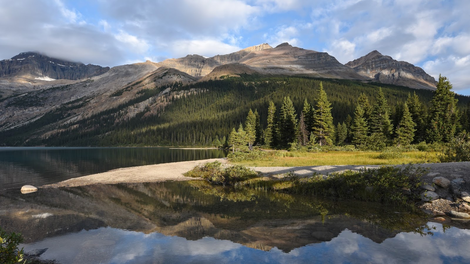
That night we stayed at the old Num-Ti-Jah Lodge in Banff. It looks amazing in photos and the blue color of the lake it's on the shore of (Bow Lake) is amazing in direct sunlight. But it didn't quite work for us. We like rustic, but in this case it just felt more like the staff was overworked (especially in the restaurant). The thin walls allowed us to hear way WAY too much intimacy in the room next door, and "hot" was more of a suggestion in the sink.
By this point in the trip my natural tendency to chameleon dialects and accents had me regularly speaking with a distinctly Canadian intonation, and liberally sprinkling my speech with various forms of "eh" and "fer shure" (that second one seemed to be particularly popular where we were). I enjoyed it the same way I enjoy mimicking a Monty Python or Aussie accent, but I also hoped it wouldn't get me into trouble with anyone who thought I was making fun of them.
moonrise at Bow Lake
morning loon at Bow Lake
morning at Bow Lake
Peyto Lake from tourist overlook hell
The next day we drove up the Icefields Parkway and suffered our first tourist horror of the trip at the overlook for Peyto Lake. We shared our time there with one MILLION loud and obnoxious people being disgorged from tour busses, and we could not get out of there fast enough. It was around about here that we knew for sure that we would NOT be attempting to get anywhere near Lake Louise or the Valley of the Ten Peaks; neither of us is much of a "mall person."
at the toe of the Columbia Icefield in Jasper
An hour farther north up the parkway, we reached the highest section of paved road in Canada and took a brief hike up to the toe of the Columbia Icefield glacier just across the line into Jasper National Park. It was a zoo there too, and we wanted to leave. We opted to hike up the Wilcox Pass Trail to meadows overlooking the glaciers dropping down out of the icefield, and that was MUCH better. Well, it was better once the tour group that had gone up before us made their loud and obnoxious way down. It is amazing how some people just seem to have absolutely no sense of the other people around them. Anyway, once they were gone, it was extraordinarily pleasant up there. A great last hike for our trip.

After that we left the mountains via the much, much less travelled route of the David Thompson Highway (Rte. 11) which skirts the edge of a big reservoir and more or less follows the Saskatchewan River as it drops east towards Rocky Mountain House and Red Deer. We watched some Olympic track races (everyone loves Bolt) at a tavern in Airdrie, spent our last night at an airport hotel, and flew out for home the next morning. Needless to say, we'd go back again in a heartbeat.