
one of the causeway trails at Ashley Pond
In this case, the bonus site is the Ashley Pond area in Holyoke and West Springfield. It includes the northern end of the Bear Hole Watershed (north of the Mass Pike) and the portion of East Mountain just south of the one profiled in the book (site #46). The reason for not including this one was a combination of a.) the book already having a number of sites right in that area, b.) the mix of land ownership and the closing of the McLean Reservoir area, c.) the inconsistent signage and marking of trails, d.) the fuzziness of parking legality (it's OK to park by the Ashley Reservoir entrances and at the south end of Millville Rd), and e.) the fact that the "trail" around the reservoir(s) is really more of a dirt road and arguably straddles the line between trail running and road running. That said, the trails to the south and west of the ponds are a mix of rugged old roads and winding singletrack, including a segment of the Metacomet-Monadnock (M-M Trail). Some of it is quite nice and fun to run on, while some of it is heavily eroded by many years of off-road vehicle use.
The dirt trails around the Ashley Pond reservoirs are wide, flat, and generally out in the open with great views across the water. Some of them are on causeways that remind me of a landscape out of Middle Earth. These are excellent trails for anyone looking for an easy introduction to trail running. A weekly series of alternating 5K and 10K cross-country races use the trails around Ashley in the summer, and several races take place here throughout the year, including the Jonno Gray 5K, the WMDP XC festival, and the 6-mile Talking Turkey Race on the Saturday after Thanksgiving.
A few notes about trail closures and off-limits areas: the trail that leads up to McLean Reservoir is currently closed to the public, as are all of the trails around it, probably due to security concerns? Also, there are a number of unofficial paths leading through the woods just southwest of Whitney Ave and the Elks Lodge, but visitors are asked to stay on the major trails in that area, and actually there's quite a bit of poison ivy in those woods anyway so, you know... not worth it.
At the southern end of Ashley Reservoir, a narrow foot trail leads across the railroad tracks (be VERY careful crossing the tracks) to a junction on the other side. From here, Millville Road (dirt) leads to the right and heads south, while a rough dirt road leads left towards the end of Quarry Road. In between is a segment of extremely fun, sinuous singletrack trail that curves back and forth on itself for nearly a mile until it ends at a wider path about a quarter of a mile to the south.

Southwest of the ponds, a network of old roads threads through the northern half of the Bear Hole Watershed, and the M-M Trail runs along the crest of East Mountain. Many of these trails are in very rough shape due to years of heavy off-road vehicle erosion, and in some spots there are deep, near-permanent(?) pools of stagnant green water. They are now officially closed to such traffic, but they are still used sometimes. I once even saw a Subaru Outback station wagon driven by two young men improbably make its way almost to the crest of the East Mountain ridge. The trails are also well-loved by mountain bikers, who have maintained various sections and named certain segments (Cauldron, Lower Yeti, etc.) and marked them with green trail signs. Some segments of the M-M Trail have also been marked with green signs (White Lightning, Armageddon, Widow Maker, etc.). One or two of the trails currently dead end where sections have been flooded by beaver activity.
While researching and mapping these trails, I came across several very confusing online posts suggesting the existence of newer singletrack trails that either aren't there or are very hard to find, or possibly are alternate names for parts of the M-M Trail. I wasn't able to find them despite several attempts. If you know anything about such trails that might be helpful to people out there, please share in the comments below!


While a good percentage of the trails in this area are heavily eroded, you will still come across the occasional very fun section of narrow singletrack trail, particularly just south of Ashley Reservoir. It's worth exploring (this map should help) and making a several hour trail running excursion of out it.
If you have any comments, complaints, corrections, praise, or suggestions about this bonus site or anything related to the Trail Running Western Massachusetts guidebook, please comment below or drop me an email with your thoughts!
The dirt trails around the Ashley Pond reservoirs are wide, flat, and generally out in the open with great views across the water. Some of them are on causeways that remind me of a landscape out of Middle Earth. These are excellent trails for anyone looking for an easy introduction to trail running. A weekly series of alternating 5K and 10K cross-country races use the trails around Ashley in the summer, and several races take place here throughout the year, including the Jonno Gray 5K, the WMDP XC festival, and the 6-mile Talking Turkey Race on the Saturday after Thanksgiving.
A few notes about trail closures and off-limits areas: the trail that leads up to McLean Reservoir is currently closed to the public, as are all of the trails around it, probably due to security concerns? Also, there are a number of unofficial paths leading through the woods just southwest of Whitney Ave and the Elks Lodge, but visitors are asked to stay on the major trails in that area, and actually there's quite a bit of poison ivy in those woods anyway so, you know... not worth it.

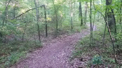
sweet, sinuous singletrack trail just south of Ashley Pond
At the southern end of Ashley Reservoir, a narrow foot trail leads across the railroad tracks (be VERY careful crossing the tracks) to a junction on the other side. From here, Millville Road (dirt) leads to the right and heads south, while a rough dirt road leads left towards the end of Quarry Road. In between is a segment of extremely fun, sinuous singletrack trail that curves back and forth on itself for nearly a mile until it ends at a wider path about a quarter of a mile to the south.

M-M Trail ascending East Mountain just north of the Mass Pike
Southwest of the ponds, a network of old roads threads through the northern half of the Bear Hole Watershed, and the M-M Trail runs along the crest of East Mountain. Many of these trails are in very rough shape due to years of heavy off-road vehicle erosion, and in some spots there are deep, near-permanent(?) pools of stagnant green water. They are now officially closed to such traffic, but they are still used sometimes. I once even saw a Subaru Outback station wagon driven by two young men improbably make its way almost to the crest of the East Mountain ridge. The trails are also well-loved by mountain bikers, who have maintained various sections and named certain segments (Cauldron, Lower Yeti, etc.) and marked them with green trail signs. Some segments of the M-M Trail have also been marked with green signs (White Lightning, Armageddon, Widow Maker, etc.). One or two of the trails currently dead end where sections have been flooded by beaver activity.
While researching and mapping these trails, I came across several very confusing online posts suggesting the existence of newer singletrack trails that either aren't there or are very hard to find, or possibly are alternate names for parts of the M-M Trail. I wasn't able to find them despite several attempts. If you know anything about such trails that might be helpful to people out there, please share in the comments below!

Cauldron Trail east of the main East Mountain ridge
While a good percentage of the trails in this area are heavily eroded, you will still come across the occasional very fun section of narrow singletrack trail, particularly just south of Ashley Reservoir. It's worth exploring (this map should help) and making a several hour trail running excursion of out it.
If you have any comments, complaints, corrections, praise, or suggestions about this bonus site or anything related to the Trail Running Western Massachusetts guidebook, please comment below or drop me an email with your thoughts!
No comments:
Post a Comment