Saturday, November 2, 2019

The Evolution of Ultra

Every two months my local running club, the Sugarloaf Mountain Athletic Club, puts out a sweet newsletter: The Sugarloaf Sun. For the past four years, I've been lucky enough to have the role of editor, helping shepherd each issue to publication. We've got a deep well of talented and generous writers and artists who contribute regularly, and honestly, although it takes a bit out of me each time, it's very rewarding.

The latest issue adhered (loosely) to the theme of running ultramarathons, and specifically the evolution of ultras over the years from simply being "any footrace longer than a marathon" to all sorts of crazy events that big-mile runners can think up to play with. A pdf copy of the issue can be read here on the Sugarloaf Mountain Athletic Club's website, and links to other past issues can be found here.


Tuesday, October 29, 2019

Toby

Dark clouds hunkered down and settled in over the Pioneer Valley of western MA on October 27. Rain fell steadily throughout the morning, and a chilly wind whipped the steel struts of the fire tower at the summit of Mt. Toby in Sunderland. Nevertheless, a sizable field of 65 apparently impervious runners turned out to line up at the start of the annual 14-mile Mt. Toby Trail Race.

Goofy smiles and stubborn good cheer remained evident on racers faces as they neared the aid station at mile 4. Some even leaped for the camera or remarked on how much fun they found themselves having despite being soaked to the bone already. By the time they re-passed the same spot around mile 10, after having climbed to and descended from the top of the mountain most seemed notably more tired, yet everyone still seemed to retain positive attitudes and spirit. I'll remember this race when I want to remember how tough runners can be when the going gets rough. Inspiration fuel!


Wednesday, October 16, 2019

Lithia

The trail network around Lithia Springs Reservoir on the south side of the western part of the Holyoke Range is a bit dense and complex, but once you get the general lay of it all you can craft a pretty sweet mid-distance trail run there. Here are some photos from a good one I took this fall.

Lithia Springs Reservoir

Holyoke Range trails

Lithia Springs Reservoir

Titan's Piazza

NET Trail / Dry Brook Trail junction

the view from Black Rock


Lithia Springs Reservoir

Monday, September 30, 2019

Savoy

Searching for a relatively secluded but fun mid-distance trail run that wouldn't require us to drive more than an hour from Greenfield, Jen and I settled on a return trip to Savoy Mountain State Forest (site #4 in Trail Running Western Massachusetts). We chose wisely.


trail running at Savoy Mountain State Forest in western MA

It had been five full years since I'd last been to the trails of Savoy, but little had changed. We started our run at North Pond and initially followed the suggested route from the book, past Balanced Rock and out the southern leg of the North Pond loop, then west again on the southern leg of the Blackburnian Loop. There was one spot at the first powerline crossing where the trail was a bit hard to follow after utility crew maintenance obliterated the track out in the open swath, and we fumbled about a bit before finding where the trail re-entered the woods on the opposite side (you have to drop downhill slightly, though there are cairns and flagging markers that make it appear otherwise).

Mahican-Mohawk Trail marker along the Blackburnian Loop at Savoy Mtn. SF

At the junction with Lost Pond Trail, we took that trail up towards the summit of Spruce Hill. Although the path is a bit overgrown in places and there's at least one tricky turn up near the crest of the ridge, this is still an extremely pretty and fun section of trail to run on. Well worth the "Optional Extension" trip listed in the book.

At the summit of Spruce Hill, DCR has apparently abandoned the section of steep trail that connects the top with the Busby Trail (though it doesn't appear to be officially blocked off, just entirely unmaintained). The route now only follows the link that connects the Busby Trail to the Hoosac Ridge Trail just northeast of the summit. It's kind of hard to describe, but makes sense if you look at old maps.

From the top, we flew down the Busby Trail all the way back to North Pond. The running was quite gentle on the legs and we made great time without feeling like we were banging ourselves up too much. A highly recommended section of trail for running.


the botanist at Lost Pond

Lost Pond

maidenhair fern

Goldie's fern

gorgeous cove of rich forest at Savoy

North Pond at Savoy Mountain State Forest

the quiet beach-shore of North Pond at Savoy

Monday, September 23, 2019

Hawley

Back in 2014 when I was choosing and reconnoitering sites for the Trail Running Western Massachusetts guidebook, I was aware of a dense, mostly unmapped network of trails near the old stone "beehive" kilns at the eastern edge of Dubuque State Forest in Hawley, MA. I would have loved to include this relatively remote gem of a site in the book, but at the time it was still too unclear what the official status of the trails was. Since then, DCR and NEMBA have partnered to create signs and update the park maps with the now-sanctioned trails. When visitors will find now is a wonderful, "flowy" network of winding, hilly trails that generally receive low amounts of visitation.


Entering the forest along Kiln Rd in Hawley

On September 22, a gorgeous early fall day, Jen and I went for a 6-ish mile trail run there and never saw another soul. We parked at the spacious lot near the Hawley Fire Dept., took phone photos of the trail map posted at the gate, and started our run. After a quick visit to the kilns, we entered the network of singletrack trails north of Kiln Rd and spent a pleasant afternoon winding around and around and around, first on the Kiln Trail West, then the Snowshoe Trail, Notch Trail, Snowshoe Trail again, and finally Roots and Rocks Trail.

inside one of the beehive kilns

curiosities along the Kiln Trail


It's a little hard to see, but the trails as currently mapped on OpenStreetMap are a fairly decent approximation of what's actually out there. It's not exact, but close enough. 


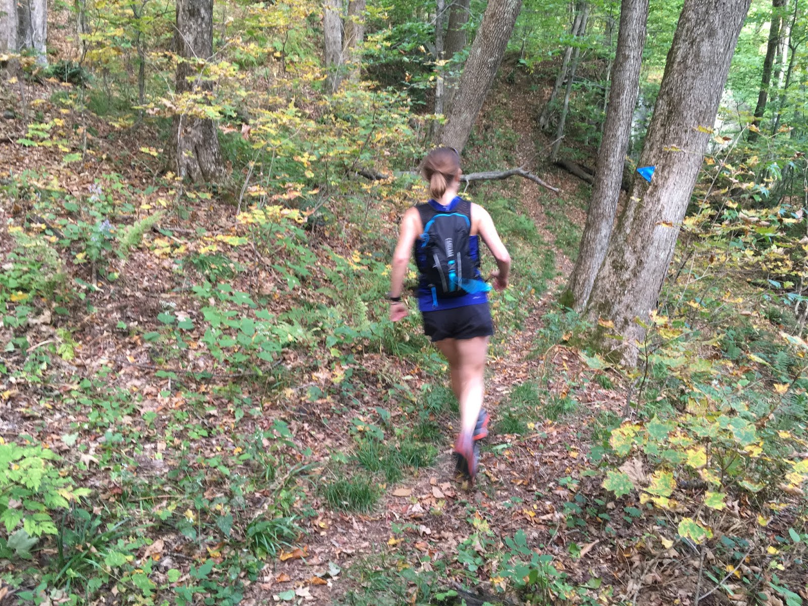
 finishing up our run along the "Roots and Rocks" trail

me and the early fall colors

After our run, we took a long-delayed but much-appreciated visit to Sidehill Farm in Hawley. They make Jen's favorite yogurt, and appear to overall just be pretty great people, based on the vibe of the honor system farm store and the really sweet cat that lives there. Highly recommended. 

The Sidehill Farm sign in Hawley

sights in the fantastic farm store up at Sidehill Farm

Thursday, August 29, 2019

Trail Running Acadia (Again)

Because it's become somewhat of an annual tradition for me, here's the 2019 Trail Running Acadia blog post. Just a very short version this time, without all the preamble or trail descriptiony-ness of previous years. Just the pretty pictures, please. You can see last year's edition here (and there are links to the prior years within). I guess this would technically be "Part 4" for this blog, though it'd be more like part 94 or more for my lifetime.

iconic

Beech West Ridge Trail along Long Pond

Overlooking Long Pond on the Beech Mountain Loop Trail

Beech Cliff Trail over Echo Lake

Beech Cliff Trail over Echo Lake

To be clear, it's Bald PEAK,
not Bald Mtn. (Acadia staff pls take note)

moonlight over the Shore Path in Bar Harbor

Around Mtn Carriage Trail

on Parkman Mtn. 

descending to Giant Slide Trail from Parkman Mtn.

across a fairly elaborate log bridge

cruising across the summit of Sargent Mtn.

trail running Acadia

Sargent Mtn Pond


Amphitheater Trail

Amphitheater Trail


Hadlock Brook Trail

beneath Waterfall Bridge

St. Sauveur Mtn

Valley Cove

Valley Cove


top of Norumbega

coming down Norumbega

Hadlock Brook bridge

Hadlock Brook Trail

Schooner Head Path

Champlain Mtn


The Beehive


Overlooking The Bowl

bogwalks by The Bowl

Racking up some vert on the north ridge of Champlain Mtn.