Thursday, November 26, 2015

Northeast Race Photo 2015 Highlight Gallery

There's still a full month (plus a few days) yet to go in 2015, but I've thrown together a highlight reel from my Northeast Race Photo shoots. There's more shots than usual this year because I wanted to include a variety of shots from each race in addition to showing the variety of races. Probably the completist in me.

Partly the album is just for fun and partly its to remind everyone that there's still plenty of time to order race photo prints and merchandise for holiday gifts. There's tons of stuff available, from prints to posters to magnets to mugs and more. Plus digital downloads, of course.

Here's the link to the full album on Smugmug:
https://northeastracephoto.smugmug.com/2015-Races/2015-Highlights/

and some cool sample shots to tease ya with =)


Tuesday, November 24, 2015

Bonus Site: Ashley Pond area

My guidebook Trail Running Western Massachusetts (click here to view the book's page on Amazon) profiles 51 of the best trail running sites in the region. It was a challenge to whittle down the final list to include in the book to just 51 sites, and some that I really like or that would have been nice to include had to be cut for space. I occasionally post profiles of some of those "bonus sites" here and link to them from the book's Facebook page. (see the Chapel Brook to D.A.R. Trail post for a previous example).

one of the causeway trails at Ashley Pond

In this case, the bonus site is the Ashley Pond area in Holyoke and West Springfield. It includes the northern end of the Bear Hole Watershed (north of the Mass Pike) and the portion of East Mountain just south of the one profiled in the book (site #46). The reason for not including this one was a combination of a.) the book already having a number of sites right in that area, b.) the mix of land ownership and the closing of the McLean Reservoir area, c.) the inconsistent signage and marking of trails, d.) the fuzziness of parking legality (it's OK to park by the Ashley Reservoir entrances and at the south end of Millville Rd), and e.) the fact that the "trail" around the reservoir(s) is really more of a dirt road and arguably straddles the line between trail running and road running. That said, the trails to the south and west of the ponds are a mix of rugged old roads and winding singletrack, including a segment of the Metacomet-Monadnock (M-M Trail). Some of it is quite nice and fun to run on, while some of it is heavily eroded by many years of off-road vehicle use.

The dirt trails around the Ashley Pond reservoirs are wide, flat, and generally out in the open with great views across the water. Some of them are on causeways that remind me of a landscape out of Middle Earth. These are excellent trails for anyone looking for an easy introduction to trail running. A weekly series of alternating 5K and 10K cross-country races use the trails around Ashley in the summer, and several races take place here throughout the year, including the Jonno Gray 5K, the WMDP XC festival, and the 6-mile Talking Turkey Race on the Saturday after Thanksgiving.

A few notes about trail closures and off-limits areas: the trail that leads up to McLean Reservoir is currently closed to the public, as are all of the trails around it, probably due to security concerns? Also, there are a number of unofficial paths leading through the woods just southwest of Whitney Ave and the Elks Lodge, but visitors are asked to stay on the major trails in that area, and actually there's quite a bit of poison ivy in those woods anyway so, you know... not worth it.

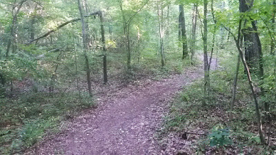
nice sinuous singletrack trail just south of Ashley Pond
sweet, sinuous singletrack trail just south of Ashley Pond

At the southern end of Ashley Reservoir, a narrow foot trail leads across the railroad tracks (be VERY careful crossing the tracks) to a junction on the other side. From here, Millville Road (dirt) leads to the right and heads south, while a rough dirt road leads left towards the end of Quarry Road. In between is a segment of extremely fun, sinuous singletrack trail that curves back and forth on itself for nearly a mile until it ends at a wider path about a quarter of a mile to the south.

M-M Trail ascending East Mountain just north of the Mass Pike

Southwest of the ponds, a network of old roads threads through the northern half of the Bear Hole Watershed, and the M-M Trail runs along the crest of East Mountain. Many of these trails are in very rough shape due to years of heavy off-road vehicle erosion, and in some spots there are deep, near-permanent(?) pools of stagnant green water. They are now officially closed to such traffic, but they are still used sometimes. I once even saw a Subaru Outback station wagon driven by two young men improbably make its way almost to the crest of the East Mountain ridge. The trails are also well-loved by mountain bikers, who have maintained various sections and named certain segments (Cauldron, Lower Yeti, etc.) and marked them with green trail signs. Some segments of the M-M Trail have also been  marked with green signs (White Lightning, Armageddon, Widow Maker, etc.). One or two of the trails currently dead end where sections have been flooded by beaver activity.

While researching and mapping these trails, I came across several very confusing online posts suggesting the existence of newer singletrack trails that either aren't there or are very hard to find, or possibly are alternate names for parts of the M-M Trail. I wasn't able to find them despite several attempts. If you know anything about such trails that might be helpful to people out there, please share in the comments below!

Cauldron Trail east of the main East Mountain ridge


While a good percentage of the trails in this area are heavily eroded, you will still come across the occasional very fun section of narrow singletrack trail, particularly just south of Ashley Reservoir. It's worth exploring (this map should help) and making a several hour trail running excursion of out it.

If you have any comments, complaints, corrections, praise, or suggestions about this bonus site or anything related to the Trail Running Western Massachusetts guidebook, please comment below or drop me an email with your thoughts!

Tuesday, November 10, 2015

12 Marathons

I've now run 12 official marathons (not counting the 2 ultras I've done in the last few years, and one that I ran/hiked in the mid-90s). Finishing times can't be reliably compared to one another since there are so many variables, including: how hilly the course, weather, temperature, nutrition, fitness level, terrain/course surface, number of tight turns, and quality of training. But it's really hard to not compare anyway.

Reflecting on the four that took me longer than last weekend's 4:01:53 trail marathon (which clearly OUGHT to take longer than a road one for the simple reason that it's trail not road), here are my reasons/excuses for why they were slower:

1997: Mayor's Midnight Sun Marathon, Anchorage, AK (4:19:00)
During the training for this one, which took place on the June solstice, I pulled a hamstring around mile 18 of a 20-miler about 3 weeks beforehand, and didn't run a step during the 21 days in between. Not too surprising, since the race came only 3 months after my fastest marathon, at the Shamrock Sportsfest Marathon in Virginia Beach (3:22:00). I cramped pretty bad somewhere around mile 19 and basically limped to the finish.

2006: Key Bank Vermont City Marathon, Burlington, VT (4:03:29)
I blame this one on the heat. After a record cold spring where I don't think I got to run in shorts and a t-shirt more than once, this Memorial Day race took place on a sweltering day where the temperatures climbed well into the 80s. I started well but suffered greatly in the later miles. Basically, I melted.

2008: Around the Lake Marathon, Wakefield, MA (4:12:38)
This one was a "novelty" race that I didn't really take seriously anyway. For one thing, it takes place at night, in the middle of the summer. For another thing, it was really just an extra-long long training run that I was using as build up for the Clarence Demar Marathon 8 weeks later. (photo from a later year here)

2008: Clarence Demar Marathon, Keene, NH (4:10:17)
I actually don't know why this one was so slow. Maybe it was the extreme humidity. Or maybe I was just taking it super easy to make sure I finished; I had to pull out of this race at mile 19 in 2007 due to a stress fracture in my foot, and I really wanted to complete it. I needed to finish it, for lots of reasons. (photos here)

Still, Stone Cat featured rugged trail terrain and endless twists, turns, and short, steep hills. Plus I fell/crashed hard, twice. And there were no mile markers. And I went into it with a seriously compromised Achilles. It should have been my slowest marathon. Which makes me feel extra good that it wasn't.

The other seven, from first to last:
1995: Marine Corps Marathon, Washington DC (3:44:00)
1997: Shamrock Sportsfest Marathon, Virginia Beach, VA (3:22:00) PR
2004: Mount Deserst Island Marathon, Bar Harbor, ME (3:44:15)
2005: Tucson Marathon, Tucson, AZ (3:42:59)
2006: California International Marathon, Sacramento, CA (3:33:22)
2010: Marine Corps Marathon, Washington, DC (3:36:50)
2012: Jacksonville Marathon, Jacksonville, FL (3:36:11)

Saturday, November 7, 2015

Stone Cat Trail Marathon recap

The Stone Cat Trail Marathon had been on my radar for decades but I’d never had a chance to try it until this year. It has a lottery that usually fills quickly but for whatever reason I got in easily when I signed up a few months back. I wasn’t sure if I would be able to run it due to a persistent, often painful Achilles tendonitis injury that had been dogging me since the summer, but my fall training and racing went well and it seems like I've able to “manage” it (with the promise to myself that I’d take a month or two off this winter to just bike and swim and let it heal). So today I gave it a go.

Pre-race

My good friends Micah and Kristen kindly allowed Jen and me to crash at their place in Newburyport, MA the night before. We rose at 4:30 a.m. and spent about an hour eating, dressing, toe lubing, Body Gliding, and making frequent visits to the bathroom, then zipped south the twenty minutes or so to the Doyon School adjacent to Willowdale State Forest in Ipswich. Registration was a breeze, and the bathroom lines weren’t too long, so without much ado and before I knew it I was out in the playing field behind the school watching the 50-milers take off at 6:15. The weather was incredibly nice: 60 degrees, light warm breeze, and not too humid.

Loop 1

At 6:30 we were off. I decided to start close to the front and go out strong to avoid getting stuck behind slower runners in the eventual pinch-down. The strategy worked well; we ran around the field once and people seemed to spread out sensibly according to their comfort level. Then we looped around the school and back into the woods on a narrow dirt lane. I didn’t feel boxed in at all.

Several new singletrack sections were introduced into the course this year, and it was run in the reverse direction as years past, so there wasn’t the big hill to climb in the early miles that veteran racers would have been used to. Instead, we mostly swooped around low hills on meandering mountain bike trails en route to the first aid station. It was very fun, and allowed for a decent pace. Except for a few wider sections, most of those miles were on that kind of singletrack. My Achilles was tight and my shoes felt like they might have been a bit snug (my right foot in particular felt disconcertingly close to numb), but for the most part it seemed like I was going to be OK.

Stone Cat Marathon course map
general map of one loop of the course

Leaves weren’t super deep, but there were enough to obscure occasional roots and rocks that you absolutely had to keep a constant look out for. About 3 miles in I caught a shoe-tip on a small root and did that violent lurch-forward thing and let out a sound that must have sounded like I was hurling, but I managed to catch myself and not fall. We passed the first aid station around mile 5(-ish), after which the course followed a 50/50 mix of singletrack and doubletrack. By this point, I was more or less settled in with a loose group or marathoners, many of whom I would recognize throughout the rest of the race, but we also were starting to catch up with some of the slower 50-mile racers, who we generally caught and passed very quickly.

After the second aid station there’s a stretch where the trail crosses an open wetland on a narrow low dirt causeway, which was a nice visual break from the woods of the rest of the course. Just on the other side, I took a second to glance at my watch--the wrong second. I kicked something unseen and fell down hard, gouging a chunk out of my right hand and crashing on my left hip. Much to my relief, I was able to get up quick and keep running. I looked for what tripped me at that spot on the next lap, and sure enough there was one lone nasty double-knob root thingy down there looking all evil and mean.

After that the big hill began. It’s not really that high, but it does switch back and forth rather steeply for a bit. I'd run consistently 'til then, but allowed myself to walk that part. I was still passing 50-milers, but the catch and pass time was taking longer as our paces grew closer and closer to being the same. After some fun rising and falling along the side of the hill, the trail dropped steeply to the north and then rejoined the doubletrack trail that led back towards the start/finish. I pulled into the halfway mark back at the school right exactly at 2 hours, feeling good and strong.

Loop 2

After quickly switching out the GPS unit I'd carried on the first loop (I map trails obsessively) for a hand-held water bottle, I ran under the timing arch and headed back out. The second loop felt slightly slower, but in general it was easier running in terms of being able to go at exactly the pace I wanted since the pack had thinned out a lot. When I caught up to 50-milers I would usually keep pace with them briefly and then pass them as soon as we reached an uphill.

The distance between the first and second aid station felt interminable this time, with multiple déjà vu moments where forks in the rolling doubletrack felt exactly like forks I’d turned at mere minutes before. Just as my mind began to wander away from the trail to think about how nice it would feel to finish another marathon, I took a second fall, this time along a slight downhill on doubletrack. I must have toed another root or something, and I pitched forward hard. My arms splayed out and I landed on my right shoulder, then somersaulted around and, to my astonishment, sprang back up on my feet, mostly unscathed other than minor abrasions and some soreness. The guy right behind me said, "Impressive tumble."

There were no mile markers out on the course, and one nice thing about that is that I ran by feel rather than by strict pace. No obsessing about exact pace per mile, and no real sense of exactly when I reached mile 20. My second time over the big hill in the final miles went well, and I felt thankful to not experience any of the late-race hamstring cramps that I’ve so often been afflicted by in marathons. My Achilles gave me an occasional sharp pain, and every now and then my shoe would slide sideways on some leaves or something and cause me to wince with an unpleasant foot pain, but those moments were mostly few and brief.

Finish

I felt strong at the end, and was able to fly fast across the field to the finish. My final time was 4:01:53 (22nd place out of 206 finishers). Full results are posted here. I felt pretty pleased with my performance, all things considered. It was my 12th marathon, and my 8th fastest. Stone Cat featured rugged trail terrain and endless twists, turns, and short, steep hills. Plus I fell/crashed hard, twice. And there were no mile markers. And I went into it with a seriously compromised Achilles. It should have been my slowest marathon. Which makes me feel extra good that it wasn't.


photos that Jen took about 200 feet before the finish 

As with most marathons, it felt extremely good to simply stop. I shuffled my way through the short chute, collected a Stone Cat vest (they ran very large and looked comically big on each runner I saw wearing one afterwards), grabbed a grilled cheese sandwich wedge, and sat down on a bench to just chat with Jen for a few minutes. But I felt remarkably good, considering. I’ve had one or two road marathons where everything worked and I felt great afterwards, but they’ve been exceptions. Except for my Achilles, this was one of the better ones in terms of how wrecked my body felt. I’m not saying I wasn’t beat, or walking stiffly and slowly, but for the most part this one left me relatively unscathed. I think most of the ache I felt was a result of the two big falls more than the cumulative effects of 26 miles. We hung around and watched finishers and 50-milers come through, then headed home to western Massachusetts and a 100% guilt-free dinner out on the town.

Shoes worn: ASICS Fuji Racers
Gels used: 3 chocolate Vi-Fuels
Salt tabs: 4 endurolyte tablets
Driver all the way to and from race from western MA in her new wagon that has HEATED SEATS: Jen

Sunday, November 1, 2015

a sort of a comeback

In 2013 I ran 15 races, including my first ever 50K and 40-mile ultras. That was on the heels of 21 races in 2012. But things slowed down after that. Way down. Battling both a string of injuries and a storm of financial hits, my racing schedule took a pretty big tumble in 2014, and I only ran 5 races total:

2014 races


The Traprock one barely counts, since it was really nothing more than a test to see if I could run a race at all, post-injury. That said, the final 2 were actually pretty good showings.

So far, this year has actually been pretty good, considering. I'm still trying to manage a newly chronic achilles tendon ache, but otherwise I seem to be gradually coming back. It's a bit hard to tell because the difficulty of each trail race is so different than the others, but my pace has generally steadily improved. Most of the races have been trail, which I love, and I've really enjoyed exploring some that I'd never tried before, like the Busa Bushwhack today in Framingham:

2015 races so far:

I'm hoping to cap off the season with my first go at the Stone Cat Trail Marathon in Ipswich, MA this coming Saturday. After that, if I'm still on my feet, all else is gravy. 

2015 Busa Bushwhack 10-Mile Trail Race

Part of what I like about trails, races, trail races, and trail race series is the opportunity to explore new terrain and experience different places. The Busa Bushwhack, with a twisty 10-mile course at Callahan State Park in Framingham, MA, has one of those names that beckons beguilingly to people like me. The race had been on my bucket list of regional events for a few years now (though as I write that I suddenly realize I'm not all that partial to the concept of a bucket list; I'm more in the camp of hoping to savor the experience rather than checking something off a list), and I was looking forward to trying it. 

There were 155 runners in the 10-miler, and another 160 or so in a 5.3-mile version. Conditions were very nice, with overcast skies and temps in the 50s, and the course was well-marked (except for one arrow near the end that was clearly pointing the wrong way, I think because it was on an out-and-back portion and it wasn't clear on the return that you were supposed to ignore it). 

After pre-race announcements by the Greater Framingham Running Club and Rich Busa himself at the Brophy school, we all jogged about half a mile north through residential streets to the starting line on Major Hale Dr., right where the road crosses an underground aqueduct. We took off en masse and stayed on pavement for about a quarter of a mile. Then we veered right onto a wide path in the woods. Following signs, flagging, and the directions of volunteers, we wound our way around mostly easy trails for a few miles. 

Callahan really seems to be A Tale of Two Parks. The property is more or less evenly divided into two halves, north and south, by a paved road. The south half has wide, gentle, rolling doubletrack trails with easy hills. The northern half has narrower, more rugged trails with harder hills and tougher terrain. 

I had taken photos near miles 4 and 7 of this race in 2013, and at that time the downed leaves were pretty thick over portions of the trail, enough so that I was concerned about hidden rocks and roots. But there were many fewer leaves this year, and everything seemed to be visible. At about mile 3 we crossed the road and hit the first water station, then climbed a sharp hill and headed out for a very meandering tour of the park’s northern half. 

With only six days left until my A-race of the season, the Stone Cat Trail Marathon, I’m in full-on taper mode, and as such I chose to keep my pace firmly in check despite feeling like I could have gone a good bit faster. Or at least a little bit faster. Early on I found myself keeping pace with fellow western MA trail runner Carolyn Stocker, but I soon realized that the pace wasn’t meeting my “take it easy” taper week rule, so I eased up and held back some. She kept flying and finished 6 minutes and 20 places ahead of me. 

There were other familiar faces along the way too. At about mile 7, I passed and said hello to fellow trail runner and photographer Anthony Tieuli, who I’d met briefly before. And I passed Amy Rusiecki directing racers as I exited the woods at mile 9.25, a surprise recognition that I was only able to acknowledge with a belated wave about 50 feet further along. 

trail sign in Callahan State Park

The course grew progressively easier after re-crossing Parmenter/Edmands Rd around mile 7. We flew back along Rocky Road, Pine Cone, and Coco Ridge Trails, which seemed to be mostly flat, doubletrack paths, and most of the final mile back to the school is on pavement. As I approached the end, I picked up the pace slightly, but not enough that there was any danger of overdoing it. I finished in in 52nd place in 1:21:34 (an 8:09 pace). 

finish line photo (courtesy of Manos Tsagarakis)

Afterwards, I chatted briefly in the school cafeteria with Carolyn and her father, Wayne, as well as Grand Tree series regulars Eric Wyzga and Kehr Davis; self-described new trail runner(??) and the winner of the women’s race, Kim Webster; and a representative of Sudbury Valley Trustees, a strong conservation land trust organization responsible for protecting lots of properties in the area (and the publisher of a great new guidebook: 40 Walks West of Boston).

Overall, it felt like a solid effort that I was well trained for, and at the risk of tempting fate, I feel confident about the marathon ahead. Oh, and I came away with a sweet Busa Bushwhack pint glass for finishing!

extras

generalized course map

my 2013 Busa Bushwhack race photos here

Scott Livingston's recap of the 2011 race here