Sunday, August 28, 2016

Interlude: Northwest Adventures


hiking in Mt. Revelstoke National Park

This August Jen and I took a long-overdue vacation away from New England. We flew to Calgary, rented a car, and lit out for the Canadian Rockies. The travel was mostly smooth, though I could write a long diatribe about how user-unfriendly the Toronto Airport can be, especially for international passengers making a connecting flight, and there was a slight snafu on arrival when I discovered that the car rental reservation was for downtown Calgary, not the airport. Overall, we ended up spending a little more than we'd planned, but so it goes with travel.

Interesting physical geography tidbit: In that part of Canada, the topographic landscape is reminiscent of, but not quite similar to, Colorado. Calgary is at 3,500 feet, while Denver is around 5,200 feet. From each city, you plow right into a wall of mountains when you head west. It's just that in Canada you're lower down to start with; Canada basically skips the high plains ecoregion altogether and goes straight to montane.

On the first day we drove to Canmore, which is the first major town in the mountains. We got some Canadian cash from the ATM, had a great lunch at The Grizzly Paw tavern, and headed up a twisty dirt road that led southwest up to a scenic mountain valley. From there, we parked at what we guessed was the trailhead for Miners Peak and hiked about 2 miles up a steep, switchback trail to a junction where we opted to climb Ha Ling Peak. The views were ridiculously spectacular from the summit, where one side of the mountain dropped away in a sheer cliff.

 at the top of Ha Ling Peak

 view towards Canmore from the summit cliff

destroying our quads on the descent

Feeling giddy, we ran back down to the trailhead. It turns out that was a fun but stupid idea. We thought we were smartly acclimating and breaking ourselves in, but little did we know we were just wrecking our quads for the next few days. Near the bottom we saw some bighorn sheep along the trail. 

a tasty meal in Canmore

That night we stayed at a nice lodge just outside of Banff (we splurged on accommodations this trip) and had dinner in town. The actual town of Banff seemed like Bar Harbor meets Aspen, with all the crowds of each. When we told the friendly waiter at the restaurant that we were heading to Revelstoke, he suddenly looked perplexed and said, "Why do you want to go to Revelstoke?" It was a question we lightly mocked many times in the coming days. 

The next day's forecast threatened rain and thunderstorms, and our quads were very sore from the day before. So we reluctantly let go of our plans to hike the Cory Pass loop, which we still wonder about, and opted to take in a scenic drive in the morning and a very pleasant alpine hike/run in the afternoon. 

Vermillion Lakes drive in Banff

light rain on the trail at Sunshine Meadows along the Continental Divide

 Rock Isle Lake at Sunshine Meadows

  Rock Isle Lake at Sunshine Meadows, from the high point

 sweet trail running on the Citadel Trail at Sunshine Meadows

at the Paint Pots

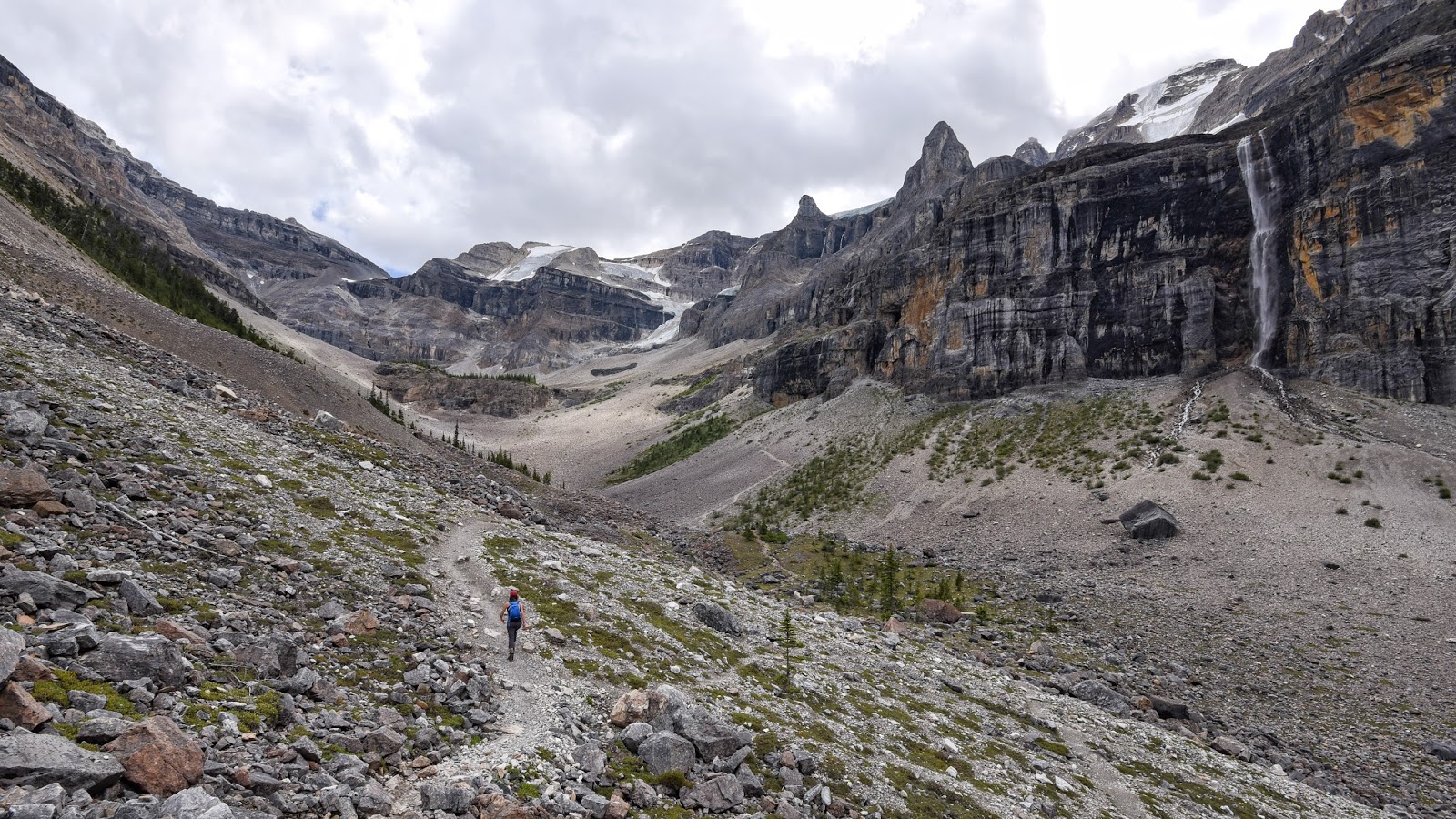
From Banff, we crossed into Kootenay National Park and made a quick stop at the Paint Pots trail, where you can see some neat natural spring "pool" formations along a stream. That night we spent the first of two nights in a semi-rustic cabin at the Kootenay Park Lodge. The next day we chose to spare our sorry quads and forgo a 10+-mile trek up to Flow Lake and the Rockwall Trail, yet another hike we had really been looking forward to. Instead, we visited the fairly easy out-and-back trail at Marble Canyon (which was pretty cool) and hiked a 5 or 6-mile round-trip route up the Stanley Glacier Trail. Our runner-up option was actually quite cool, with scenery reminiscent of Yellowstone, Glacier, and the Tableland serpentine barrens of Newfoundland. Also, the trail passed through an area that had burned by a huge forest fire years ago, which added some interesting scenic and ecological variety. 


ascending through the burn zone on the Stanley Glacier Trail


climbing up into the Stanley Glacier valley

The next day we rested a bit. Driving down out of Kootenay on the supremely scenic Highway 93 (where every mile looks like the cover of a Rand McNally atlas), we stopped for a fairly cheap and much-needed soak in the pool at Radium Hot Springs, which was developed but not nearly as bad as it might have been, and felt good on our sore legs and feet. Then, after lunch at a German restaurant, I discovered that our hotel reservation for the next three nights had not gone through. Remembering the advice of a friends who had reminded us that things always went wrong somehow on vacation and that it's often best to find a solution, pay for it, and forget it. Which we did. That night we spent the night in Golden, BC, and had a nice walk along the Kicking Horse River followed by a good dinner in town.

The next morning we continued west along the Canadian Highway and ascended up to Rogers Pass and (the Canadian) Glacier National Park. With our big trail half-marathon the next day, we chose a 5-6 mile hike that included the Meeting of the Waters Trail and Marion Lake Trail.

 Kootenay River at Vermillion Crossing

the Marion Lake Trail

 on the Marion Lake Trail

 vista near Marion Lake

 at Marion Lake

Marion Lake in Glacier National Park

That night we stayed at a really nice hotel on a hillside just above Revelstoke. An excellent find for a good price, to replace our botched reservations. We sort of carbo-loaded at an Italian restaurant in town and took a brief stroll around the downtown area where there was a big outdoor concert going on. We're pretty big fans of the Revelstoke community. 


The next day was Sunday, race day. We headed over to the nordic center lodge at the base of glaciated Mt. MacPherson and picked up our numbers at registration and got ourselves ready for what we weren't at all sure we'd gotten ourselves into. The half-marathon was part of the North Face Dirty Feet trail run series, and we'd gleaned as much as we could from the website, including course maps over aerial photos, but there were still a lot of unknowns for us. Fortunately, adventurous unknown exploration was what we were all about, so things went well.

The trails ended up being fantastic for running, as we'd hoped. Our times were slow, but we each had good runs and really enjoyed ourselves. Afterwards, we bumbled our way into a trip to Begbie Falls, where we took an impromptu hard hike and cooled off in an eddy of the Columbia River. 

The next day we had to say goodbye to Revelstoke, but we weren't done with the place just yet. We drove up the auto road to near the summit of Mt. Revelstoke, then hiked out on the only trail that wasn't closed due to grizzly activity, the Eva/Miller/Jade Lakes Trail. About a half-mile into our trek, we came upon a glorious subalpine meadow. As Jen began to stroll out into it on the trail, I noticed the bear grazing in the meadow just upslope and told her to stop. We watched it from a safe distance for a while, then crossed to the other side of the meadow. I snapped a few photos, but only had the wide angle lens on my camera at the time, which is just terrible for wildlife photography since it actually makes things in the frame seem even farther away than they are. When the bear began to move our way, we boogied on down the trail, feeling lucky for having had our exhilarating wildlife encounter. 

 iconic Revelstoke

 subalpine meadow glory at Mt. Revelstoke

 the grizzly up the hill

grizzly on the move

From there the trail continued to wind around the mountainside, slowly gaining elevation as it climbed towards a trio of alpine lakes. We went to two of the lakes: Eva and Miller (Jade Lake is a significantly longer trek that takes you even higher, up over an above-treeline pass). This amount of hiking seemed just about right for our tired legs. We at lunch at Eva and I took a very cold swim in Miller. 

on the way to Eva Lake 

Eva Lake

 Revelstoke and the Columbia River from above

To our delight, some of the best was still yet to come. Heading back east, we crossed over Rogers Pass and spent the night just outside the edge of Glacier NP at a place called Heather Mountain Lodge. This was our cabin for the next 2 nights: 


The next day we had to choose which of several ridiculously awesome hikes we wanted to do in Glacier. Several waiters and waitresses had suggested Hermit Trail, which is one of the few trails to not leave from the park's main trailhead at the Illecillewaet (we learned how to pronounce it!) campground. We took a chance and chose it. And were very glad we did. 

The Hermit Trail is the steepest trail in the park, which both makes it challenging and fun, and keeps the number of people on it to a minimum. In just 2 miles, it climbs up out of the lush forest to glorious alpine meadows with sweeping spreads of colorful wildflowers along the banks of glacial meltwater streams. We absolutely loved it. 

click to look at this one as large as you can; there are hidden lakes in the mid-ground


That night we dined, hot tubbed, and passed out cold back at the lodge. Then, with two more days to go, we headed east again, and chose to spend a day hiking up the Iceline Trail in Yoho National Park, just west of Banff. It turned out to be yet another total winner. 

several miles up the Iceline Trail in Yoho National Park, with Takakkaw Falls on the left

ascending the Iceline Trail in Yoho

near the high point just below the Emerald Glacier on the Iceline Trail in Yoho

That night we stayed at the old Num-Ti-Jah Lodge in Banff. It looks amazing in photos and the blue color of the lake it's on the shore of (Bow Lake) is amazing in direct sunlight. But it didn't quite work for us. We like rustic, but in this case it just felt more like the staff was overworked (especially in the restaurant). The thin walls allowed us to hear way WAY too much intimacy in the room next door, and "hot" was more of a suggestion in the sink.

By this point in the trip my natural tendency to chameleon dialects and accents had me regularly speaking with a distinctly Canadian intonation, and liberally sprinkling my speech with various forms of "eh" and "fer shure" (that second one seemed to be particularly popular where we were). I enjoyed it the same way I enjoy mimicking a Monty Python or Aussie accent, but I also hoped it wouldn't get me into trouble with anyone who thought I was making fun of them. 

moonrise at Bow Lake

morning loon at Bow Lake
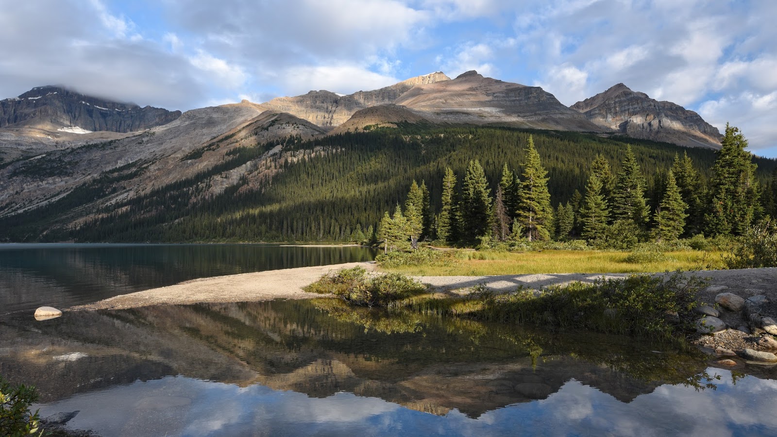
morning at Bow Lake

Peyto Lake from tourist overlook hell

The next day we drove up the Icefields Parkway and suffered our first tourist horror of the trip at the overlook for Peyto Lake. We shared our time there with one MILLION loud and obnoxious people being disgorged from tour busses, and we could not get out of there fast enough. It was around about here that we knew for sure that we would NOT be attempting to get anywhere near Lake Louise or the Valley of the Ten Peaks; neither of us is much of a "mall person."

at the toe of the Columbia Icefield in Jasper

An hour farther north up the parkway, we reached the highest section of paved road in Canada and took a brief hike up to the toe of the Columbia Icefield glacier just across the line into Jasper National Park. It was a zoo there too, and we wanted to leave. We opted to hike up the Wilcox Pass Trail to meadows overlooking the glaciers dropping down out of the icefield, and that was MUCH better. Well, it was better once the tour group that had gone up before us made their loud and obnoxious way down. It is amazing how some people just seem to have absolutely no sense of the other people around them. Anyway, once they were gone, it was extraordinarily pleasant up there. A great last hike for our trip. 


After that we left the mountains via the much, much less travelled route of the David Thompson Highway (Rte. 11) which skirts the edge of a big reservoir and more or less follows the Saskatchewan River as it drops east towards Rocky Mountain House and Red Deer. We watched some Olympic track races (everyone loves Bolt) at a tavern in Airdrie, spent our last night at an airport hotel, and flew out for home the next morning. Needless to say, we'd go back again in a heartbeat. 

Tuesday, July 12, 2016

Wow That Was Hard

Skyline Trail. The name may conjure up images of classic western North American mountain ridge-running, soaring through dry grassy meadows along an alpine trail high above Salt Lake City, or along the majestic Cascade Crest in the Northwest. But I’m from the east. I know better. I’ve been fooled before. The Skyline section of the Long Trail in Vermont is primarily rugged forest. Skyline Drive in the Shenandoahs mostly just features occasional scenic vistas at small rocky outcrops and man-made clearings.

And the Skyline Trail in the Blue Hills Reservation south of Boston spends most of its time in rock-strewn saddles between low hills. Nevertheless, the handful of amazing hilltop views of the city illustrate why the name is apt. For those fleeting few moments, the trail really does earn its name.

The 7-ish mile Blue Hills Skyline Trail Race, hosted this year by TARC on July 10th, was about as old school as it gets. Low tech, low frills, and no hand-holding. And as a result, cheap. Which is awfully nice these days. I’d photographed at this race a few years back, hiked part of it way back in 1994 (see scans of journal entries at the bottom of this post), and wanted to get back to check it out. So on a warm July morning I got up really early and zipped out east towards the coast from Greenfield and hoped that the extra pounds I've been carrying wouldn't hurt me TOO much..


The first few minutes of the race, traversing south along the lower slopes of Blue Hill, provide a nice warm-up on gentle trail with minimal rocks and roots (compared to later). You can actually open up your stride for a short while here, and pass people if you need to in order to place yourself well for the narrower part. Then you take a sharp left and climb steeply up the side of the hill, sometimes via stone steps and sometimes over wet ledges. It was very humid and you immediately felt it. I crossed the access road near the summit at the 11-minute mark. The first view was still socked in with persistent morning fog. After picking my way down the ankle-turning terrain along the North Skyline Trail on the back side of Blue Hill, I began to see why Ben Nephew described the route as “incessantly rocky, rooty, twisty, and undulating” in a 2014 race report.

At 33 minutes in, I reached the first major road crossing just after the State Reservation HQ buildings (where I lost a few seconds unsure of where to go next). The first water station was on the other side of the road. It was a “cupless” race and reality of what that means finally became clear to my dimwitted brain: it meant carry your own bottle or no water for you. I tried to pour some in my cupped hand but ended up with very little water to drink. My decision to not carry water was a dumb one this day. It was way too humid to go the whole way without hydration. I fretted about that a bit but pushed on.

The next section climbs a paved park road and then it levels off and you really get to open up your stride for a mile or so of dirt carriage road. At 50 minutes in I reached the halfway point where thankfully there were a few cups at the water station. I drank what I could and carried the cup with me from there.

At the top a steep ascent on Buck Hill, there was a fantastic view of Boston at the top of a hill covered in low scrub growth vegetation. That would be a sweet spot for a photographer to wait at some point. Then the trail descended steeply and traveled over more rugged terrain, rising and falling over North Boyce Hill and Tucker Hill, with a few sharp turns. Then we crossed the road, climbed steeply up Houghton Hill, dropped sharply yet again, and soon enough began a long gradual ascent back up Blue Hill.

Michael Wade finishing the Blue Hills Skyline Trail Race in 2013

After screaming down a dirt track on one of Blue Hill’s a grassy ski slopes at the end, I finished in 32nd place with 1:40:38 on the clock (the winner finished a full half hour earlier). There were 68 runners overall.

So, in summary, there were four general sections (or waves, as another blogger called them) to the course:
  1. The first half-hour (up and over Blue Hill and a few others)
  2. The carriage roads (some pavement at first, then long dirt straightaways)
  3. The roller coaster views (punishing climbs and steep descents)
  4. The finale (a final climb of Blue Hill followed by the ski slope run-out)

Overall, there were about a dozen sharp ascents / descents requiring a brief bit of scrambling on either end. The course was entirely unmarked and you kind of had to know where to go and which trail to follow. Believing that I had it memorized I didn’t bother to bring a course map with me. That was stupid. I was glad to find myself running with a pack for much of the race, as I’m certain I wouldn’t have known where to go at several junctions. If the race continues and I ever make it back out, I would definitely bring a hand-held water bottle, especially if it was as humid as it was this summer.

Blue Hills hiking journal entries from 1994!


Monday, June 27, 2016

Falling Apart on Greylock

"I don't always fall during trail races, but when I do I almost always write about it..."
    -me

They can’t all be good ones. Sometimes I feel guilty of tending to write primarily positive blog posts or articles, maybe due to some neurotic need to fight my innate cynicism and pessimism with intentional optimism, or a desire to not offend certain race organizers, participants, or volunteers. If so, well… this should begin to set things right. Sometimes the glass is genuinely just half full of disappointing emptiness. And it’s best to tell it like it is. This is one of those times.

I got my ass handed to me at Greylock last week.

To be clear: it was all my fault. The Western Massachusetts Athletic Club (WMAC), awesomely salt-of-the-earth folks that they are, put on as excellent an event as ever (and that’s not me blowing sunshine for an article; I really love their races). The Mt. Greylock Trail Race half marathon (13.5 miles) is a well-organized, highly affordable, and hard-as-hell New England run, just as I’d hoped. And though it was warm, the weather wasn’t too bad either. Sunny and clear with a bit of a breeze up top. The race starts at 10 am, which is kind of late for a June race, and temperatures did climb into the low 80s by the time I was finishing, BUT… it wasn’t humid. At all. Which is huge, especially for me. And the field of runners is small enough that getting blocked in on singletrack trail is no excuse here; you can pass when/if you want to. As it turned out, that wasn’t an issue for me anyway.

My first mistake was simply being heavy. Or more accurately, heavier than I used to be. I weigh 10+ pounds more than I did last fall. Not fully accepting this fact, I set my hopes too high. I knew better, but didn't admit that there was no realistic way I was going to claim my “usual” spot near the top quarter-to-third of the pack.

My second mistake was starting too close to the front of the pack. I’m not yet fully recovered from taking most of the winter off due to an Achilles injury and subsequent PT, and my pace simply is not what it was even a year ago. 

Start of the 2016 Mt. Greylock Half Marathon. (Photo by Scott Livingston)

The race begins by a picnic pavilion in a flat field at Greylock Glen, but you immediately need to bunch down where the trail becomes a 2-person doubletrack path as soon as it enters the woods. The grade is gentle for about 500 feet, then starts shooting straight up the side of the mountain. I could tell right away that something was off. My stamina and lungs felt fine, but the power wasn’t there and I felt every extra pound on my frame. People started to pass me right away—a warning flag.

From the Glen the course ascends the Bellows Pipe, Bucket, and Whitetail trails before eventually coming out onto the upper part of the Thunderbolt ski trail. After a relentless series of sustained power-hiking grinds up steep switchbacks (and some occasionally runnable less-steep sections), I reached the summit. My watch said 55 minutes, which was exactly the time I’d secretly been aiming for. Momentary sense of relief and reassurance. The climb had been tough, but I genuinely felt pretty good.


Alternating grades along the ferny Thunderbolt Trail

top of the Thunderbolt Trail on Mt. Greylock

crossing the road just below the summit

Clearing at the summit of Mt. Greylock

The course swings around the path that circles the tower up there, bypasses Hogwarts, then drops past Bascom Lodge and reaches a water station. I quickly refilled my carry bottle and then took off again. The course then drops over exposed ledges in the forest to the road, then begins a grueling traverse of a very rocky and rooty section along the Overlook Trail on the mountain’s west flank. Really adept technical trail runners can excel here, and some did, but I just felt clumsy and decided to let the pack I was with slip away from me in favor of keeping my front teeth intact.

a highly runnable section of The Hopper Trail, a little over a mile from the summit

Eventually you reach a runnable stretch of the Hopper / Deer Hill / CCC Dynamite Trails, then you have to ascend the Sperry Campground access road for a bit to a second water station. I walked that uphill. After that there’s about a mile and a half out to Jones Nose. Compared to the first three miles it’s mostly flat, but there are lots of small dips and climbs along the way, and after catching a toe on a rock I fell hard while crossing a small stream. I let out a loud "Ow!" when I landed. The guy ahead of me pulled away out of sight, and the woman just behind me checked to make sure I was OK. I was—mostly just pride. But my pace slowed even more afterwards.

The descent off Jones Nose was steeper than I’d remembered and I was surprised that I wasn’t running faster as I picked my way down the ledges. Coming out into the spectacularly scenic open field section, a woman passing me exclaimed, “now THIS is bucolic!”; she was not wrong. 

The view that greets runners coming down off of Jones Nose during the Mt. Greylock Half Marathon. (Photo by Ben Kimball)
The view that greets runners coming down off of Jones Nose during the Mt. Greylock Half Marathon.

Just after the final staffed water station (where I first realized how far behind my goal time I was), I recognized my final mistake: I’d forgotten to bring any salt tablets. It had gotten pretty hot by this point, and I felt the first familiar hamstring twinges soon after. Despite chomping on some cran-razz Clif shots and glugging as much water as I could, the actual cramps kicked in about a half-mile later, and they persisted for the rest of the race. As if on a schedule, my hamstrings seized up about every half mile, making me slow way down and occasionally walk to make the cramps go away. Frustrating.

I can’t say I love the final four miles of the course. It follows old fire roads down, then up, then dowwwwwn, and frankly the eroded ruggedness of it gets a little old, especially compared to the fun narrow singletrack trails earlier on. Another runner/blogger referred to it as "relentless loose-rock doubletrack"; not a particularly appealing description, right? Around mile 12 it gets nice again, though. There were a few steep drops, a couple more cramps, and a brief ascent before the final descent to the finish. My time was 2 hours and 56 minutes. A solid half-hour slower than I’d estimated and should have been capable of. I was disappointed in my time and pretty taken aback by my final place in the pack. 

My creaky finish. (Photo by Jen Garrett)

So how did I lose half an hour off my pace between the summit (when I was right on target) and the finish? I'm guessing 1/3 insufficient training, 1/3 hamstring cramping, and 1/3 plain ol' spare-tire-induced inefficiency (reality check: it's probably time to ease off the Newman-O's and goldfish, self...).

A guy I've seen at a bunch of Grand Tree trail races said to a friend just after finishing, "there is nothing easy about that race."

By the food at the finish, I spoke briefly with the winner of the race, all-around good guy Tim Van Orden of Bennington, VT, who must have not touched the ground much during his mere 1 hour and 43 minutes(!) of sprinting on the course (that is an astonishingly fast time). He suggested I try swishing some relish around in my mouth to make the cramps subside (something about the mix of vinegar and sugar). And by golly, he was right about that.

Again, the organization is great, the company top notch, and the scenery as good as it gets. And there’s a post-race barbeque. Plus I got to wash off in a waterfall about a quarter mile down the road, and Jen and I went to the nice outside patio by the bike path at CJ’s pub in Adams after that. But it simply was not the race I’d imagined.

So yeah, not my finest 3 hours. But, a silver lining: I set the bar pretty low for myself for next year.


For a more consistently runnable 13-mile loop on Mt. Greylock (except for the very steep ascent of Mt. Prospect), check out site #3 on p. 18 in my guidebook Trail Running Western Massachusetts.

An abridged version of this post appears as an article on page 21 of the July/August issue of The Sugarloaf Sun, the newsletter (that I am the current editor of) of the Sugarloaf Mtn. Athletic Club (SMAC). 

Saturday, June 4, 2016

Here Be Tygers

Source of All Waters. Here Be Tygers. Hell, Michigan. Nothing. Zap. People have put some pretty intriguing place names and labels on maps. Some that have caught my eye and piqued my exploratory interest over the years include Lost Pass, Ice Gulch, the Sluiceway Trail, Castellated Ridge, Titan's Piazza, Tumbledown Mtn., The Horn, The Knife Edge, Pumpkin Spring, and the Sinks of Gandy. All worth the journeys, for various reasons.

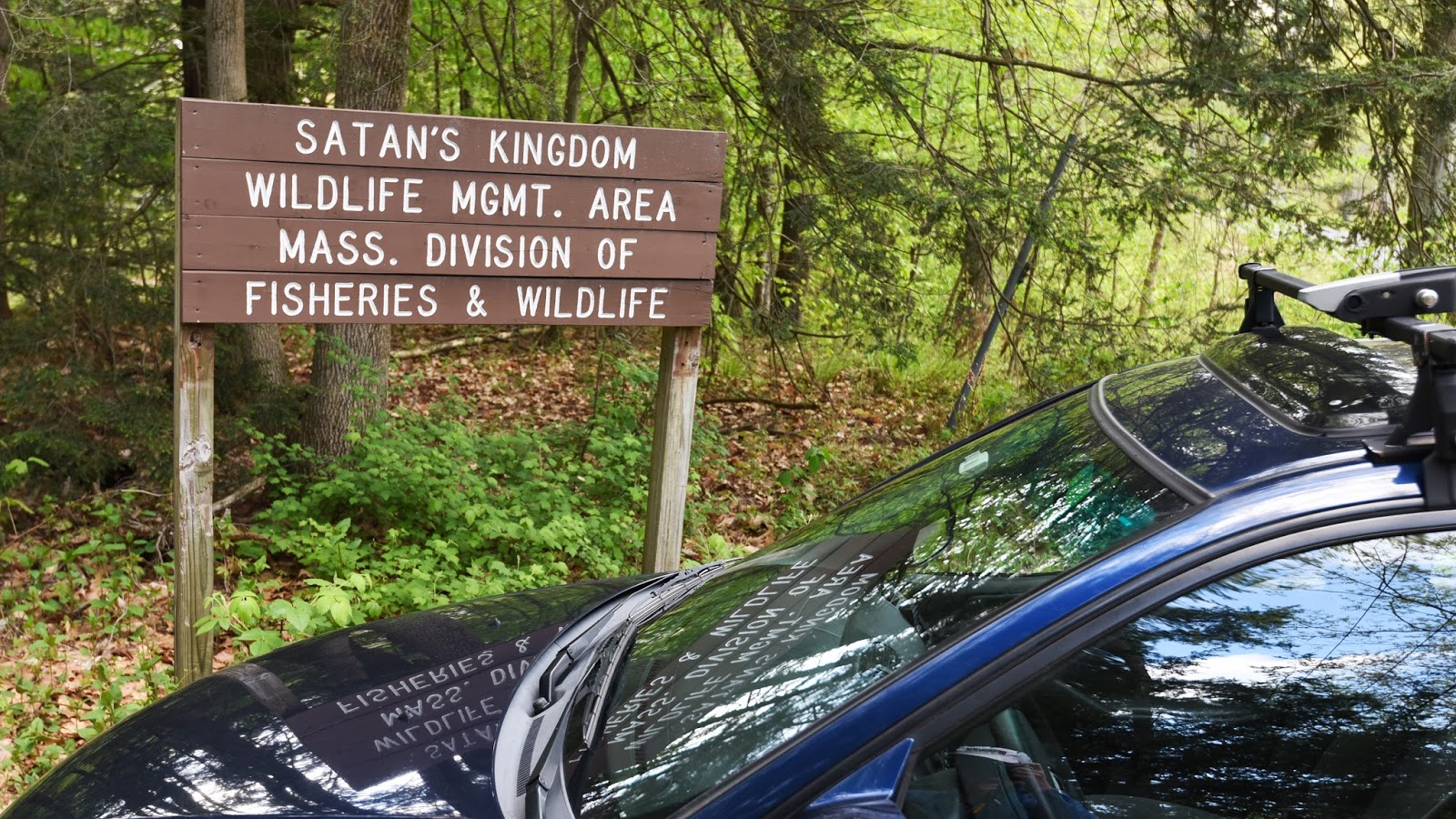
The area called Satan's Kingdom is located just south of Vermont in the northwest part of Northfield, MA, between Interstate 91 and the Connecticut River. I first became aware of it about ten years or so ago while perusing a USGS map of far southwestern NH with a co-worker at the NH Natural Heritage Program. The name immediately leapt out at us, as did the crazy patterning of the topography of part of the area. I'm sure there's a neat story behind the geology, and a "that makes sense" story behind the name.

Satan's Kingdom on a USGS topo map (CT River on right)


Fast forward to two years ago when I was researching good trail sites to include in Trail Running Western Massachusetts. The area certainly came to mind as a possibility since much of it is state-owned and it seems like a place where there should be good trails to run on. I ruled it out as a profile site pretty quickly, however, because I couldn't find any evidence of public trails or access or parking there.

Fast forward again to a few weeks ago. I've been living just south of the area since last fall, and recently found a map for a recommended 3-mile hiking trail there posted on the Town of Northfield's website. Well, I can't report that the map offered there is as useful as it might be. It shows a suggested lollipop route but doesn't show any topography or any of the connecting side trails or spur paths, etc., which makes it very challenging to use in the field. That said, it got me out there exploring and mapping on my own, and for that I am very grateful.

singletrack section of trail along an upland "bench" in Satan's Kingdom

Starting from a parking area with room for 10 or so vehicles just off Old Vernon Rd, the way in is through the closed metal gate and down a wide dirt road. After passing a small wetland, the road quickly begins a steep ascent to a junction with a snowmobile trail network leading off to the left. The road veers right and levels off, then undulates for a bit as it heads northwest into the property just uphill from West Wait Brook. There are several more junctions on the left, and soon you pass through some partially open areas and cut-over areas. The grass in these spots was about ankle-high when I went, but I would imagine it gets taller in summer.

After ascending through the first open area, the trail splits with one fork going sharply left up the hill towards an old cabin, and the the other leading more or less straight along a somewhat overgrown route. From here you can either go left for the 3-mile lollipop option or straight for the 4+-mile lollipop loop option (keep taking lefts if you choose this second way). Both routes will/can bring you up to to a forested "bench" along the hillside. A pleasant singletrack path leads north along the bench, and a short spur path to the left brings you to a partial view southeast out over a cut-over area to the mountains on the eastern side of the valley.

Land ownership there appears to be as complicated as the topography, but much of it seems to be either a WMA or Northfield State Forest. I did not explore on any non-public properties, though I didn't see any No Trespassing signs either. Hunting is both allowed and popular here, so be sure to be aware and wear bright orange during hunting season(s).

Here is a map and photos of the routes I've explored at Satan's Kingdom:


entrance to Satan's Kingdom (the parking area is in a bit from the road)

ascending the access road at Satan's Kingdom

access road at Satan's Kingdom

the dilapidated old cabin along the old road in Satan's Kingdom

singletrack trail in Satan's Kingdom

singletrack trail in Satan's Kingdom

singletrack trail in Satan's Kingdom

doubletrack trail in Satan's Kingdom

the partial view southeast across the CT River Valley to mountains above Northfield, MA

In the end, there's nothing particularly hellish about this part of Satan's Kingdom, though I can imagine the mosquitoes, blackflies, and deerflies all getting pretty bad at times. Worth a visit sometime, and hikers and trail runners alike can make challenging 3-ish or 4-ish mile lollipop loops out of it.

Saturday, May 21, 2016

Bonus Site: Northfield Gulf Road

As a brief recap of previous bonus site posts: my guidebook Trail Running Western Massachusetts (click here to view the book's page on Amazon) profiles 51 of the best trail running sites in the region. It was a challenge to whittle down the final list included in the book to just 51 sites, and some that I really like or that would have been nice to include had to get cut for space. I occasionally post profiles of some of those "bonus sites" here and link to them from the book's Facebook page. (see the Chapel Brook to D.A.R. TrailMormon Hollow, and Ashley Pond posts for previous examples).

This bonus site comprises portions of three major properties in Northfield: Northfield Town Forest, Northfield State Forest, and Brush Mountain Conservation Area. Whether you approach from the north (or technically, the west) via Northfield or the south via Erving/Orange, the parking area for this site is at the height-of-land on Gulf Road in Northfield (hence the name). The Metacomet-Monadnock (M-M) Trail / New England Trail (NET) crosses the road here. You can do out-and-backs on the M-M Trail, and there are two nice short loop options, one on either side of the road.


Northfield Gulf Road map -- click here to download a full-size pdf


From the small parking area on the west side of the road, where there is space for maybe 3-4 cars, cross the road and head east on the M-M Trail into Northfield State Forest. Follow the white blazes east about 0.1 miles, to a signed junction where a blue-blazed trail leads left. Go straight for now and follow the M-M Trail east for about 0.5 miles, crossing over an unmarked woods road and gently rising and falling a few times, to a junction with the eastern end of the blue-blazed trail. From here, you can continue north on the M-M Trail towards Hidden Pond and Stratton Mountain. The trail is quite good for running, but there is an initial steep descent via switchbacks and the eventual ascent to Stratton Mountain goes on for quite a ways. You can also access a very dense network of blazed trails in Northfield State Forest that way, but most of the trails are currently unmaintained (though the paint blazes were very fresh in spring 2016; ditto the blazed-but-overgrown network north of Alexander Hill Rd).

Go left at the junction and return to Gulf Road via the 0.9-mile "Over-the-Top" loop trail that climbs gradually up the forested slopes of the Bald Hills. It zig-zags over the crest of the ridge and then drops via easy switchbacks down the west side. Cross over the woods road and reach the junction you were at before, then go right to get back out to Gulf Rd. The only drawback is that it's over before you know it. Total mileage is about 1.5 miles.

this pretty stretch of the "Over-the-Top" loop trail on Bald Hills in winter has "flow"

Now go west from the parking area into Brush Mountain Conservation Area (the M-M Trail currently detours south here to avoid a closure near the summit of Crag Mountain). The trail parallels the road briefly, then arrives at an older trail/woods road. Going right would immediately pop you back out on Gulf Rd. Go left and pass by the foundation remains of the Swan Homestead. At a junction where the Brush Mountain Trail (and former M-M Trail) leads left up the slope, continue straight onto the yellow-blazed Town Forest Loop Trail. 

The Town Forest Loop Trail is a well-marked and well-built lollipop loop in Northfield Town Forest. To reach the loop part, head northwest and cross under some powerlines and then descend slightly on wide doubletrack trail to the junction. The loop portion can be done in either direction, and both ways are fun to run, though there are short sections of steep climbing no matter which one you choose. There are no views, but the woods are nice and in spring a waterfall cascades down a set of wooded ledges. The newly-cut singletrack portion (about half of the mileage) is especially nice. Make sure to make the turn at the part of the loop farthest from the parking area; an unmarked woods road continues downslope and off-property here. Total mileage for this loop is about 2 miles. 

a mossy seep in spring along the Town Forest Loop Trail

An optional extension that can be fun to run is the white-blazed Brush Mountain Trail (formerly the M-M Trail, which it is still signed as in places so it's OK to be a bit confused). About a quarter of a mile up from the junction with the Town Forest Trail, it passes over a long stretch of semi-open ledge that I call "The Ramp"; you'll get it when you run back down it (VERY fun). You can follow this trail for about a mile up and over the semi-open summit of Brush Mountain and then up and down along a northern portion of Crag Mountain. The blazes will come to a sudden end, however, and the land to the south is posted No Trespassing. The M-M Trail used to continue from here to the open summit of Crag Mountain, but at present it is currently closed and re-routed along Gulf Road. Stay legal, friends. 

[EDIT: As of 2021 it looks like the NET Trail goes over the summit of Crag Mtn. again, eliminating the roadwalk re-route and restoring a spectacular vista for users of the trail. Also, the entire stretch of trail over the Crag Mtn. / Brush Mtn. ridge appears to now officially be named the NET Trail.]

"The Ramp" on Brush Mountain in Northfield, MA

Along the Town Forest Loop

On the Over the Top Trail east of Gulf Rd

Other good nearby trail running sites: Northfield Mountain Recreation and Environmental Center (site #30 in the book), Stratton Mountain at the top of Alexander Hill Road in Northfield (see upcoming Bonus Site post; I would advise against using the maps currently available either on the town's website or posted on-site), Wendell State Forest (site #32 in the book).

If you have any comments, complaints, corrections, praise, or suggestions about this bonus site or anything related to Trail Running Western Massachusetts, please comment below or drop me an email with your thoughts!