I am a trail runner. I have been for decades. But I lived in New Hampshire for twelve years and never once ran the 18-mile Wapack Trail Race. Two days ago, I finally addressed that embarrassing oversight.
Due to a couple of navigational blunders en route (both my bad), we arrived at the the Windblown XC ski area with only 15 minutes left until the start. It was enough, though. I chugged an extra quart of water, smeared Vaseline on my toes, heels, and feet bottoms (and also, you know... the nether regions), filled my water bottle, and packed Gu, Shot-Bloks, and salt tablets into the bottle carrier's zip-pocket. At registration, I grabbed my bib number and pinned it on my shorts. It was already warm and very muggy, so I decided to run shirtless (definitely the right call, as any shirt would have been completely sweat-soaked and chafing by about a mile in). One last nervous pee break, and then the start. I joined the pack of about a hundred restless runners and eagerly awaited the signal to go.
We took off along a grassy doubletrack access road that circles around the lower perimeter of the Windblown property for about a mile. This is the relatively new re-route of the Wapack Trail. I settled in somewhere around 30th place or so, where the pace seemed to be about right for me. At 7 minutes in, we crossed under the powerline and began to ascend the lower slopes of Barrett Mountain. The Wapack Trail soon veers right and becomes singletrack, and the first real climbing begins. We all slowed to a power-hike at this point, and settled in for the long uphill grind. Despite the steepness, the footing was pretty good and I was already looking forward to descending this slope 16 miles later. As we climbed, I chatted for a few minutes with a fellow runner, Patrick Gee of Suffield, CT, about several of the same trail races we've run similar paces at recently. Normally I try to keep conversation to a minimum while racing, as it IS a race rather than a training run and oxygen is the big limiter, but in this case it seemed fine. I really tried to keep my pace in check, knowing that I'd need lots of energy for the return.
At the top, there's a very nice quarter-mile section of flat, soft trail beneath pine trees where you can open up and stretch out your legs some. Then the rolling begins. First down the saddle after Barrett, then up New Ipswich, then down again, then up Stony Top, then down to Pratt. Much of the course was shaded beneath a woodland tree canopy, but the trail occasionally crossed open rocky outcrops in full sun. Even in the muggy weather the views were still pretty sweet up there. I was surprised we didn't see more hikers taking advantage of it on the holiday weekend.
After Pratt Mtn. there's a big drop down to Binney Pond. For about half a mile, you descend very steeply and try really hard to not take a digger or roll an ankle or trash your quads. I'd been here before back in the spring when I took photos at the Wapack and Back trail races, so I knew what to expect. Then there's another really nice rolling mile or so to the first water station at mile 5.5 along Binney Pond Rd. I had finished off my water bottle by that point and arrived with the cap off so it was quick and easy to just grab the open gallon bottle of gatorade to fill it up. Out of the aid station and off to Watatic.
There's a quarter mile or so through a recent clearcut. I'd been worried that maybe this part would be uneven or muddy, but the footing was good and the running was actually quite easy through there. Another half mile or so of gradual climbing follows, and then it's flat for a bit before the steeper climbing up the north side of Watatic. There are 2 parts to this mountain and I'd forgotten about the first one, Nutting Hill, so I was surprised to be descending and then climbing again before reaching the real summit. It was around here that the lead runner, already on his way back from the halfway turnaround, passed me coming the other way.
From the top of Watatic, the trail veers sharply right and screams very steeply down the well-shaded but severely eroded southwest side. My legs were still feeling good so I just let it rip. A steady beat of returning runners greeted me as they re-climbed the route I was descending. At the turnaround I re-filled my bottle again, grabbed some ginger cookies, and took off to head back. My watch said 1:47. Two minutes off my desired time, but close enough to keep me happy.
Re-climbing Watatic wasn't as bad as I thought it might be. I was still feeling really good, and just powered through it, passing several fellow racers who were beginning to fall behind. One guy had been in front of me for about a mile, and had begun kicking roots and rocks at an alarming rate. I hope he was OK; last I saw of him, he'd tripped and taken one of those near catastrophic staggers that really freaked out the family of hikers who saw it. Dozens of runners were still coming down the slope and, in most cases, short "nice job" and "looking good" comments were exchanged as we passed going opposite directions. I flew through the flattish section after the summit, and saw one or two places where it would have been so easy to have gotten off trail if you weren't paying close attention. Eventually, I passed one more runner at the Binney Pond Road water station; I later realized this was Jeremy Merritt, who was taking a moment to massage his legs (he wrote a great race report of his own that's posted at Far North, a blog I've been enjoying a lot this year) (2018 update: link removed; Far North site has gone defunct).
I'd more or less memorized the details of the climb up Pratt, and dealt with the relentless ascent by mentally dividing it up into bite-sized chunks: just get from here to that switchback, now to the big rock, next to the stone wall, then to the zig-zag, and finally the summit ledges, etc. This worked well and overall I was still feeling good and strong, and allowed myself to imagine that I actually still had a shot at a 3:30(-ish) finish.
Then the quad cramp hit. As I climbed back up New Ipswich Mountain, the inside of my right thigh seized and forced me to slow way, way down, almost to a complete stop. I forced myself to maintain at least some forward motion, and used my left leg to keep climbing while I dragged my right leg along for the ride. A few minutes later the cramp subsided but the warning spasms never really went away.
And that's how the rest of the race went, with me flying along fine until the cramp threatened on a climb and I slowed down. It happened about three more times, the last one on the final ascent of Barrett. I kept waiting to get re-passed by some of the runners I'd passed back around Watatic, but it never happened. The descent of Barrett was as great as I'd imagined. Sheer trail running fun, flying down the singletrack back to Windblown. The last mile of grassy doubletrack did indeed have some uphill to it, and it was very warm, so things slowed down some, but I was never passed the entire second half of the race and came into the finish line at 3:44, which was good for 24th place.
My time was a full fourteen minutes slower than I wanted (almost a minute per mile off my target pace!), but it really was extremely humid and even the race leaders were suffering some, and the course record most definitely did not fall this year. At any rate, other than the late-race cramping, I felt pretty great on this run. Over the full 18 miles, I ate three Gu's, half a pack of Cran-Razz Shot-Bloks, 4 salt tablets, and some snacks at the turnaround. I carried one 20-oz bottle and made sure to drink all of it before each water stop (where I would also drink 1-2 cups of fluid in addition to re-filling). Energy-wise, I never bonked, and felt pretty light on my feet the whole way. I came away with no blisters, no falls, no unfortunate trail-finding mishaps, and only 2 moderate root-kick stumbles. Not too bad! Pisgah, you're next...
[I have to note here that while I was out tromping down to Mass and back, Jen ran around Windblown and up Barrett and back, on a tough trail run of her own that totaled about 2 hours. This was her longest run ever.]
After the awesome post-race feast of pizza and cookies and sodas and other things sugary and salty, Jen and I talked for a while with other runners, including Jeremy, who came in right behind me. We also scored some fantastic intel from a guy who was fixing one of Windblown's mowing tractors; we soon drove about ten minutes away to an extremely nice unmarked swimming spot on a pond with an amazingly clear, sandy bottom; it was so refreshing. All around, a mighty fine Sunday.
Tuesday, September 3, 2013
Monday, September 2, 2013
Mount Greylock Road Race Photos
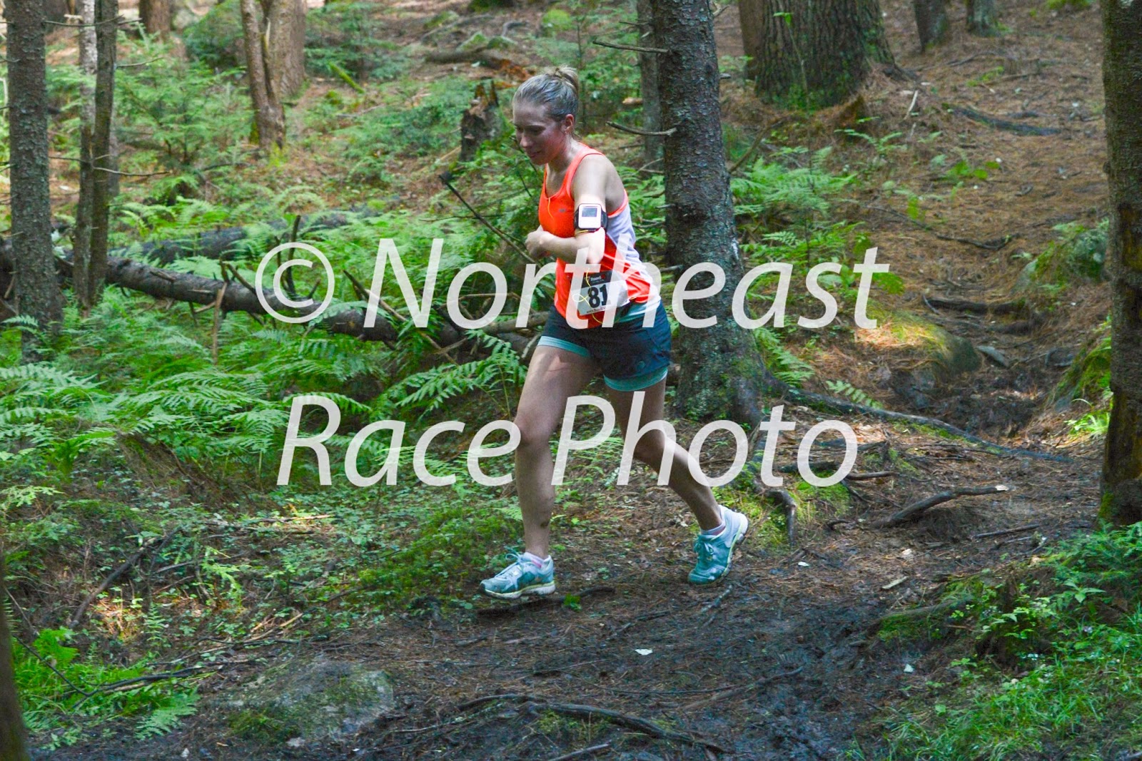
To a small band of impressively determined runners, Labor Day in western Massachusetts means the annual Mount Greylock Road Race. Participants run uphill for 8 miles from near the northern base of the auto road to 3,491 feet at the summit of the state's tallest mountain. The race is put on by Bob Dion of the Western Massachusetts Athletic Club (WMAC), and is part of the Northeast Uphill Mountain Series.
Although thunderstorms rolled through the region the night before and later in the day, they held off for the race and the weather was actually pretty great for a little hill climbing. Moderate temps, overcast sky, and only the lightest of breezes (though it was still a bit humid out). I took photos at three locations: just after a brief flat section at mile 1 (all runners), a scenic vista at mile 5 (all runners), and the summit (last 19 runners). The full photo gallery is up at Northeast Race Photo, and here's a brief sampling:


Although thunderstorms rolled through the region the night before and later in the day, they held off for the race and the weather was actually pretty great for a little hill climbing. Moderate temps, overcast sky, and only the lightest of breezes (though it was still a bit humid out). I took photos at three locations: just after a brief flat section at mile 1 (all runners), a scenic vista at mile 5 (all runners), and the summit (last 19 runners). The full photo gallery is up at Northeast Race Photo, and here's a brief sampling:


Monday, August 19, 2013
2013 Savoy Mountain Trail Race
After two unplanned, family emergency trips to MDI in one week (it's a 6-7 hour drive, one way), it's nice to be back in the Berkshires now. Or the foothills of the Berkshires. Or wherever one wants to conceive of Williamsburg being. Time to get back in the groove of race photo shoots and training for my first 50K ultra (only one month to go until Pisgah!).
Jen and I got home around 2 AM on Saturday night and then got up about 4 hours later to make the relatively quick drive out to Savoy for the Savoy Mountain Trail Races. I did the long course (15.7 miles) and Jen did the short course (4.6 miles). The longer one is part of WMAC's annual Grand Tree Trail Race Series. The route was new this year. I'd never run it in the past so I can't compare directly, but in my opinion this new route made for a really fantastic race.
The first few miles of singletrack near South Pond were the hardest for me, as there's a lot of roots and a bunch of those little low, cut-stump knobs that hurt like hell when you inadvertently kick them. It wasn't all that difficult and the ascents were fairly gentle, but you have to be very mindful of each step or you're likely gonna end up doing a painful mid-race faceplant. I was surprised that many of the intersections were completely unmarked, reminding me of some of the more confounding junctions in the Holyoke Range. This could be a tough race to scout out before it's flagged.
After the first water station (at mile 2.7), the climbing got a little steeper but it was still pretty manageable and no one walked. A guy I was running near joked that it was "too runnable" and he'd like to rest a little bit by hiking some on the climbs. I mentioned that the trail reminded me of the nearby Monroe-Dunbar trail race, except the climbing was less brutal since it doesn't come in one giant 3-4 mile ascent; he said he'd been thinking exactly the same thing. During this section, the lead woman runner put the rest of us to shame on the downhills. She was so incredibly fast and surefooted, she'd zip right past us and disappear ahead while I much more carefully placed each footstep, not wanting to roll my frustratingly weak left ankle again.
At one low spot, a few foot-wide wooden stumps dotted the way through a mud puddle, as if daring a runner to test the slipperyness of their flat surfaces. I took the bait and promptly slid off, nearly tweaking a groin muscle as my shoe splooshed way deeper into the mud than it would have otherwise. Lesson learned? Probably not.
At one low spot, a few foot-wide wooden stumps dotted the way through a mud puddle, as if daring a runner to test the slipperyness of their flat surfaces. I took the bait and promptly slid off, nearly tweaking a groin muscle as my shoe splooshed way deeper into the mud than it would have otherwise. Lesson learned? Probably not.
Just after the second aid station, at mile 5.4, the trail briefly gets MUCH steeper for the final ascent of Spruce Hill (2,566 ft.) and I even used my hands a little bit. Then suddenly we popped out on the peak and there was a fantastic view out across the valley below to Mt. Greylock. I'd been climbing next to the lead woman and she pointed along the rest of the Hoosac Ridge to the south and commented how sweet it would be to just go that way and keep running. No argument there. There were a few more vistas just to the north and then the trail plunged back into the woods again.
The next 5 miles of the race were by far my favorite part. The course follows the Hoosac Range trail for 2.5 miles to a parking area on Route 2, where you then turn around and come back. There are fun rises and falls along the way but the footing seemed significantly better (with far fewer mid-trail roots) and for the most part it's very runnable. Even the grade along the mile-long drop down to Route 2 was gradual enough to make for both a very pleasant descent and mostly runnable ascent. The trail junctions in this section were all well-marked, too. There's a nice map on the BNRC website.
It was nice to pass the competition in front of and behind me coming the other way in this section. Everyone was really good about making way for each other, even in the narrower spots. By the time I'd gotten back to the mile 11 aid station I was all alone. The guys handing out water and snacks there said there was a sizable pulse of runners just ahead of me but I never saw them again. My energy levels flagged slightly in the next section and my sweat-drenched t-shirt began to chafe around my neckline a little bit, but for the most part I felt pretty good. My lack of training the week before didn't hurt me too badly, it seemed.
The final 1.9 miles from the last aid station are almost entirely downhill, with one short climb in the middle. This section is roughly divided into two parts: a roller-coaster descent of steep, smooth ledges and gravelly flats along Old Florida Road and a longer, more soft-footed descent along the lower part of the Blackburnian Trail. The race eventually finishes at a slight incline along the road into the North Pond beach area. My final time was 2 hours and 55 minutes, good for a mid-pack 26th place finish (out of 66 runners).
Afterwards we took a refreshing dip in the pond and enjoyed a bite at the amazingly bountiful post-race pot-luck barbeque. To anyone who ran this race in the past and got turned off by the mud of Tyler Swamp or the lack of sweet ridge running, definitely give it a try again in 2014; the new course is aces!
Monday, August 12, 2013
For Dad
Last Friday, I got one of those phone calls that you’re never really prepared for, even if you think you are. My father died. And the time came to wrestle with all the personal emotions that come along with a parent dying.
Although I’ve never said it quite this publicly, it’s not really a secret that I struggled with my relationship to my father over the years (I’m saying it out loud now because I’m finding it helps me to let go). From my perspective, he grew out of the person I knew and became someone I didn’t. It seemed like we lived in very different worlds. I won’t go into the details here, but I think it’s fair to say we each were somewhat disappointed in the other. We maintained a civil family relationship, but the truth is we just weren’t very close.
I have one older brother, Alex, and two significantly younger twin half brothers, William and Andrew. While Dad was in the hospital, Alex and I discussed the best memory we had of him. He used to take us hiking in Acadia pretty frequently when we were little kids. Sometimes Mom came along (before the divorce, of course), but usually it was just the three of us, carrying a backpack stuffed with windbreakers, tuna-fish sandwiches, and sodas from either the Pine Tree Market or the Seal Harbor General Store. Dad's favorite mountain was Pemetic, but we went all over the island and hiked a wide variety of trails.
One day when I was maybe 7 or 8, we hiked up Dorr Mountain. From the summit, we descended the north slope. For the most part it was just a nice hike in Acadia, much like many others. But then suddenly we did something new. We started running down the trail, just letting gravity pull us along, flying down the open granite ledges completely unrestrained and making mid-air decisions about where each footstep should go. For almost a mile down to the saddle between Dorr and Kebo, we basically flung ourselves down that mountain. We whooped. We hollered. We laughed. And we loved every slightly risky second of it. It was absolutely exhilarating, to say the least. I kind of can't believe he did that with us (these days you'd have to wear a freakin' helmet or something equally idiotic), but he did. And now, as a 41 year-old semi-regular marathoner and very frequent trail runner, I think it's one of the best things he ever did for us.
One day when I was maybe 7 or 8, we hiked up Dorr Mountain. From the summit, we descended the north slope. For the most part it was just a nice hike in Acadia, much like many others. But then suddenly we did something new. We started running down the trail, just letting gravity pull us along, flying down the open granite ledges completely unrestrained and making mid-air decisions about where each footstep should go. For almost a mile down to the saddle between Dorr and Kebo, we basically flung ourselves down that mountain. We whooped. We hollered. We laughed. And we loved every slightly risky second of it. It was absolutely exhilarating, to say the least. I kind of can't believe he did that with us (these days you'd have to wear a freakin' helmet or something equally idiotic), but he did. And now, as a 41 year-old semi-regular marathoner and very frequent trail runner, I think it's one of the best things he ever did for us.
So on Saturday, Alex and I picked up William and Andrew and one of their good friends and hiked up the east face of Dorr Mtn. from Sieur de Monts. The views out over Bar Harbor, Frenchman’s Bay, and Downeast Maine were spectacular. A few clouds puffed around on the horizon and some leftover fog curled into coves up the coast, but otherwise the air was dry and it was pretty much a perfect summer day. Water cascaded everywhere from Friday's heavy rains, splashing down the sides and into the trail and over the edge towards the Tarn. You couldn't keep completely dry, but it was excellently refreshing in the warm morning sun.
Partway up, Alex and I told William and Andrew why we had brought them there. That we wanted to honor a good memory of Dad, and that we wanted to share it with them. So we did that. Despite the slickness, we ran down the north face of Dorr Mountain, leaping down ledges and swinging from trees and making lots of split-second decisions. I think everyone enjoyed it, and hopefully we all have that good Dad memory now.
During the last half mile or so as we walked back to the parking area, I lagged slightly behind for a bit (I didn't have to say anything; Alex got it and kept the others walking) and said my own personal goodbye. It just felt right to me. The exact place didn't matter that much. It was nowhere and everywhere, and definitely a thought-that-counts moment.
And the best part, dippy as it sounds, is that in the telling of that story to my mom that afternoon, and then later to my girlfriend, it felt like I released a lifetime of built-up emotions. Which I’m so glad for because really, what's the point in keeping any of that stuff now? It just doesn't matter anymore, and I certainly don't need or want it. I didn't see that cathartic part coming, but there it was. And here it is.
Goodbye, Dad. And for real: thanks.
Sunday, August 4, 2013
Indian Ladder 15K Trail Race Photoshoot
More or less on a whim, I drove west out to John Boyd Thacher State Park near Albany, NY to take photos of the Indian Ladder 15K Trail Race. This is at the outer edge of my travel radius for most photoshoots, but it looked like a cool race in a cool place.


Runners in the Indian Ladder 15K Trail Race
The park (and therefore this race) is all about location. It's situated at the northern edge of a forested plateau, with a sudden escarpment overlooking the broad valley below. From the top of the cliffs, you can see downtown Albany and all of the surrounding towns. Looking at the course map online, I saw that the race route comes out into an open grassy area near mile 1 and I thought that this spot could make for some particularly attractive photos that showed both the runners with good morning light on their faces and soaring scenery suggestive of the race's name.
Unfortunately, I had a miscommunication with the police about parking, and ended up missing the shot I actually wanted when they came out to make me move my car (I'd parked it along a roadside because the gates to the parking areas were locked until 9, which was when the race started). Adapting, I got some less attractive shots of runners in the woods at mile one and a half. Many thanks to the helpful volunteer directing runners at the junction there. Once they'd all gone by I went back to the original spot and managed to salvage the shoot by getting some nice photos of each runner with the escarpment in the background at about mile four and a half The full photo gallery can be seen at Northeast Race Photo.
Unfortunately, I had a miscommunication with the police about parking, and ended up missing the shot I actually wanted when they came out to make me move my car (I'd parked it along a roadside because the gates to the parking areas were locked until 9, which was when the race started). Adapting, I got some less attractive shots of runners in the woods at mile one and a half. Many thanks to the helpful volunteer directing runners at the junction there. Once they'd all gone by I went back to the original spot and managed to salvage the shoot by getting some nice photos of each runner with the escarpment in the background at about mile four and a half The full photo gallery can be seen at Northeast Race Photo.
Afterwards, I took a brief hike along the actual Indian Ladder Trail (which the race doesn't use, for obvious reasons as it's quite a popular tourist attraction) and was very pleasantly surprised at how cool it was.

Cool cliff cove along the Indian Ladder Trail
 The slowly-eroding escarpment at John Boyd Thacher State Park in New York

Saturday, August 3, 2013
2013 People's Forest 7-Mile Trail Race
I drove down to the People's Forest just west of Barkhamsted Reservoir in northern CT, unsure of whether I was going to photograph the trail race or run it. When I pulled into the parking lot a good half hour before the start and got a quick sense of the route, I made the call to run and then shoot what I could after finishing.
At the start, no one wanted to be at the head of the pack and only one guy actually went up and toed the line. I thought this was somewhat surprising since I recognized at least a couple of guys I knew were pretty fast. Maybe there were enough unknowns to them that even they were skittish? Anyway, I wasn't shy and went up to the front, knowing there was plenty of room and time for people to pass me in the first 400 meters.
With a "go!" from Will the race director we were off, zipping quietly along a wide, soft, flat stretch between rows of towering pines. Even keeping myself way in check I still found myself in second place. Those experienced fast guys apparently really know how to not go out too fast on a tough course (the director told me there's 1500 feet of climbing in the 7 miles). I slowed way down and let a few pass. Soon we veered right into an open grassy lawn/field, crossed the road with an assist from a volunteer, and got onto the singletrack trail network where the climbing began.
About a quarter mile further along there were about 10 people ahead of me and suddenly someone behind us called out that we'd all taken a wrong turn that hadn't been marked. We all turned and came back to the junction. For me it was only about a 20 second loss but for the leaders it must have taken minutes off their finish time. They all re-passed me in the next mile. Everyone seemed pretty relaxed about it though; just part of the game with trail racing, and to be expected from time to time. But still. Ouch for them.
Perhaps a mile and half into the race, there's a slight break in the climbing and you get to descend for a bit before beginning the steeper climb up to the scenic view ledges. Most of us slowed to a power hiking pace here. I felt strong despite having moved several days before and missing a couple of training days in favor of lifting boxes and cleaning apartments. I found myself loosely settling in with a group of five or six people who I would occasionally pass and/or be passed by for the rest of the race.
From the scenic viewpoints the trail gradually descends to an unmanned water station at mile four. I noticed that the people just ahead of me passed it by, but I took a quick sip here. Unfortunately, this required some fumbling to get a cup out of the packaging and I kind of wish I'd just sucked it up and gone on. After that there's some more climbing but nothing too strenuous. In general, I really enjoyed the course. Lots of variety and a great example of fun, somewhat challenging but not too brutal trail running. There was one lengthy section where three of us hadn't seen a marker in what felt like far too long and for a few minutes we kept running ahead thinking we might have to turn around. Finally we came up one of the white lime arrows on the ground and were able to breathe easier. Around mile 6, you begin a cruising descent through a conifer forest. There are a couple of twist and turns in the trail, along with a few rooty sections, but for the most part you can really let loose here.
I finished strong, with enough energy for a good sprint kick back down the pine rows, and took thirteenth place. Then I immediately went to my car and grabbed my camera and was able to take photos of all the rest of the finishers after 16th place. Full photo gallery at Northeast Race Photo.

a father/daughter duo on the last stretch of the 2013 People's Forest 7-Mile Trail Race
Sunday, July 28, 2013
A Pair of Marathons
This past weekend I took photos at two not-your-usual-marathon marathons.
On Friday evening I shot at the Ultra Around the Lake races in Wakefield, MA. After getting stuck in terrible traffic on 495 (big surprise on a Friday afternoon) I arrived just in time to try to take photos in a deluge. It was dark and wet and I was flustered from driving. But I managed to eke out a few good shots anyway. And eventually the rain let up enough for a spectacular double rainbow to form. True, it was in the wrong direction and I had to take a lot of shots of runner butts, but I figure most would understand and be forgiving and appreciative anyway. I continued to shoot right through the sunset, until it was simply too dark to get anything but lots and lots of blurry grain. Congratulations to everyone who endured the elements and ran these races.


On Saturday morning I took photos at the 2nd Annual Bear Brook Trail Marathon. Based on the online course map and description, I picked a spot around mile 3 or 4 where the runners would be coming east along a steep, wooded bluff above Bear Brook where I could get the morning light on their faces. Unfortunately, I didn't know that the course was being run in reverse this year, so I very literally ended up being in the wrong place at the wrong time. After some cursing and a bit of fiddling with my phone's Facebook app, I walked a few miles back along the route to somewhere near mile 21 to await the first runners. Eventually I decided these photos were likely too dark and I just gave up and headed to the finish to try and salvage some shots of people coming down the final stretch. I have to say I was astounded at how good so many of the runners looked after having spent hours out on this tough course. Made me want to run it myself!

Thursday, July 25, 2013
Vermont 100 Endurance Races
After a not-so-great photoshoot across the river in NH this past Saturday (see previous blog post), I headed west to see if I could catch some shots of racers in the famous Vermont 100 ultramarathon (one of the original Big Four races of the Grand Slam circuit of ultras). Well. To be perfectly honest, I'm proud to say I came away with what I think is some of my best photo work ever.
I set up at mile 48 along a very scenic stretch of dirt road and ended up shooting for about 5 hours as runners and riders came through just before the halfway point of their very long journey. During this window of time I
The photos below are just a small sampling of some of my favorite pictures. The full gallery can be seen here at Northeast Race Photo: Vermont 100 photo gallery


I set up at mile 48 along a very scenic stretch of dirt road and ended up shooting for about 5 hours as runners and riders came through just before the halfway point of their very long journey. During this window of time I
- met and joked around with a crew who were filming a documentary about one of the runners and his ultramarathon journey (this guy); can't wait to see it! special thanks to Doug Scott for helping me out with a couple of shots.
- was given a cold glass of icewater by the family who lived just down the road at the farmhouse where they spent the better part of the afternoon offering to hose down hot runners.
- encountered the most awesomely positive group of racers I've ever seen at any race ever; it was just endless smiles and laughs and positive energy.
- witnessed a woman come by on a prosthetic leg, having already run 48 miles and looking effortless; the inspiration I take from having seen her is tremendous and will last for a very long time.
The photos below are just a small sampling of some of my favorite pictures. The full gallery can be seen here at Northeast Race Photo: Vermont 100 photo gallery


L: Women's race winner, Larisa Dannis
R: Does anything more need to be said?

Look at how happy that horse is to get misted down with some spray from the hose!


L: First time I've ever seen runners and riders so effortlessly share a race course.
R: On the back of the prosthesis it said "LIVE LIFE WITHOUT LIMITATIONS"

After I took some regular shots of him approaching, he turned his back to me and grinned and said: "Elmo."

wahooooooo!
Sunday, July 21, 2013
Frenzy in the Forest
Yesterday I went to Sunapee, NH to take photos at Frenzy in the Forest, the latest race in the excellent Western New Hampshire Trail Race Series (website here). This is the third race in the series that I've photographed this year, and so far the race organizers and participants alike have been extremely friendly (even the runners who aren't necessarily thrilled when I catch them on an uphill or at a tough point in their race) and the courses look both challenging and very, very fun.
My photos weren't so great for that race, though. I prefer to get shots out on the course rather than at finish lines, especially at trail races, but I didn't make the best decision about where to set up this time out. For starters, I ran the first two miles or so of the course to get to the spot I was looking for, a short uphill at a clearing where Mt. Sunapee should have been looming the background. It was very humid that morning and I was in cotton shorts and a t-shirt with a backpack full of camera gear. By the time I found the spot I was completely drenched in sweat, and acting as a smelly magnet for mosquitoes and deerflies alike. And to my great disappointment I realized there would be no way to get both the mountain and the runners in the same shot. With the first runner due to arrive in minutes, I found a spot to catch them coming up the hill into the small clearing. I shot there for maybe the first 2/3 of the race, then moved further along to a spot where I could catch people coming downhill along a prettier stretch of the trail (there were many pretty stretches of trail in this race). As I said, I'm really not thrilled with the results, but for anyone who ran and is looking for the pictures, here they are.


2013 Frenzy in the Forest in Sunapee, NH