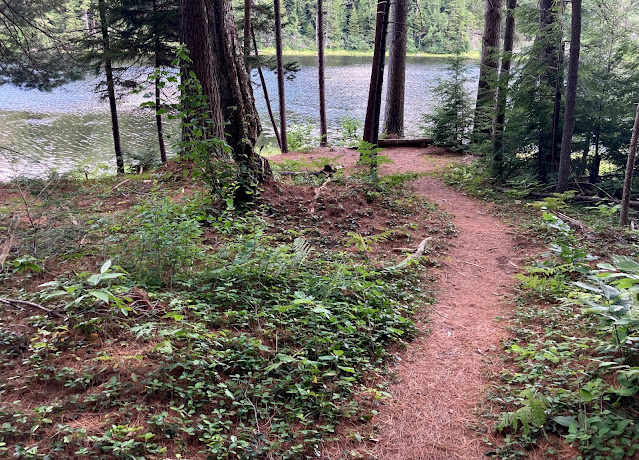
There's a pretty cool little 1-mile loop trail around Hallockville Pond in Hawley. It's on the current (undated) DCR map as "Pond Loop" but I'd never seen it before. Makes a great short hike up in them thar hills.
occasional ramblings on running, racing, triathlons, hiking, mountains, photography, and life.
Saturday, July 24, 2021
Hallockville Pond hike
Monday, July 12, 2021
Coming Soon...
Visitors to this site are likely already well aware of Trail Running Western Massachusetts, the guidebook I created several years ago profiling 51 great trail running sites in the west half of the state. I'm very pleased to be able to announce that a companion volume is in the works, and scheduled for release just 8 months from now in March of 2022. It will be called Trail Running Eastern Massachusetts and cover the rest of the state not already profiled in the first book. The completed manuscript is being edited at present, will get finalized later in the summer and go into design/layout in the fall, and finally will get printed over the winter.
There's SO much great stuff out there I can't wait to share. For now, here is a very brief teaser: a sampling of some of my favorite photos taken during site research over the past year:
 |
| There's a reason it's called the Skyline Trail (Middlesex Fells Reservation) |
 |
| Descending a ski slope in summer at the Blue Hills Reservation |
 |
| Deep woods singletrack at Willard Brook State Forest |
 |
| Winter trail running at Leadmine Mountain Conservation Area |
 |
| Lush hillside swooping in Sutton |
 |
| Peak autumn color at Mt. Wachusett north of Worcester |
 |
| Rainy day along the Western Greenway Trail near Boston |
 |
| Pamet Hollow on the Outer Cape |
 |
| Fancy trail bridge at the Ward Reservation in Andover |
 |
| Sandy singletrack at a conservation area in Sandwich |
Check back here in a few months for more details about when and where you can pick up a copy of Trail Running Eastern Massachusetts!
11/22/21 UPDATE: It is happening... https://www.amazon.com/gp/product/1625346352
Monday, July 5, 2021
Hawley Again
Having previously explored the mountain bike trail network from the Lime Kiln trailhead in Hawley (see 2019 post here), Jen and I set out from Hawley Bog a bit further north to try out a new hiking trail loop in Dubuque State Forest. I've cobbled together trail names from several sources but wouldn't vouch too heavily for their accuracy. It looks like DCR is in the process of adding a LOT of new trail signs to their properties, however, so it may already look different on the ground.
We headed west on the doubletrack-width Poverty Square Trail, which rolls along through the woods for a mile or so until it rater abruptly starts dropping down the slope to the west. At a junction not quite at the bottom, we veered hard left on Marsh Trail and climbed, steeply at times, back up the slope to the south and east. Then we headed east on Hunt Rd, taking a brief out-and-back excursion on an unnamed singletrack trail leading right/south.
At a near-4-way junction with State Forest Rd, we turned left and climbed north on Bog Trail, which we followed all the way back around to the trailhead. Then we took the short out-and-back spur trail out into Hawley Bog, which was totally worth it because a bunch of the peat-mat flowers were in bloom.
Thursday, July 1, 2021
Honoring Service
The latest issue of the Sugarloaf Mountain Athletic Club (SMAC)'s newsletter celebrates all aspects of "Service" in the running community, from volunteering to crewing and more. This baby is basically a mini-magazine about running in this region. Enjoy!


