Sunday, August 12, 2018

Trail Running Acadia, Part 3

Three years ago I wrote a post about trail running in Acadia National Park on Mount Desert Island in Maine (see it here), and then a few months later I had an article published in New England Runner about running on the island in general (see the article here). And then, last year, I did a follow-up post called Part 2. Keeping that same running commentary going, here's Part 3.

dropping down the south ridge of Gorham Mountain in Acadia

Once again, Jen and I took an August trip to Acadia to visit family and seek out fun summer adventures in the park (preferably away from crowds as much as possible). This visit was a super-abbreviated one because, although we planned to stay with my mother for a full week, Jen's 96-year-old great aunt out on the Cape was in her final days. Jen had been going out there to help take care of her for years, and this wasn't a surprise but it was a surprise that it happened just as our vacation started. Oh well, what are you gonna do. Anyway, the downshot was that we only had 3 days on the island. The upshot is that we made the most of it and really enjoyed ourselves while we were there.

Run 1: Mansell Mountain / Long Pond

On day 1 (August 6) we returned to a known fun section of trails on the western side of the island where we knew the crowds would be light. It turned out the crowds were REALLY light, and we had the Pine Hill parking area entirely to ourselves again.

we found a spot

We ran up the Great Notch Trail to the first junction, then turned left and descended Great Pond Trail to the western shore of Long Pond. The drop to the pond took longer than I remembered, and the footing was pretty rough at first. But it got more fun the lower we went, and by the time we were nearing the lake we were flying along in full stride down the delightfully soft trail, past mossy outcrops, and over occasional bridges and boardwalks. It was the middle of a heat wave and I melt in heat, so we stopped at one of the awesome ledges and I swam around in the lake for a bit. Then we continued south along the edge of the lake to the base of the Perpendicular Trail. After a brief wetting of our caps in the water, we took off up the talus slope and climbed the endless stone steps to the vista ledges a quarter mile or so below the top.

dropping down to the lake

dry boards

dry creek

swimming ledge

lakeside stroll

more lakeside stroll


climbing the Perpendicular Trail

most of the way up Mansell

From the ledge, we jogged up and over the top of Mansell Mountain and down to the Razorback Trail. At this point, we realized that it was really hot out, and we were both nearly out of water in our hydration packs even though we were only a few miles into the run. So we decided to abbreviate our run and head back to the car. Which was fine; we enjoyed ourselves and went for a nice cool-down swim in Somes Pond afterward.


Run 2: Ocean Drive at Dawn

On day 2 (Aug. 7), we got up before dawn (a miracle for me) and headed over to Ocean Drive to beat the heat and the crowds. We started our run from the empty parking lot at Fabri and did Ocean Drive in reverse to where the Shore Path starts on the southwest side of Otter Point. The sun rose over the ocean as we rounded Otter Point, and it was as majestic as we'd hoped. Up and over Otter Cliffs and then down and alongside Ocean Drive to Sand Beach, with a little side trip to Thunder Hole (which was doing nothing as the tide was all wrong at the time). One more climb and then a drop down to Sand Beach.


Sand Beach and The Beehive from Great Head


climbing The Beehive Trail


summit ledges of The Beehive

The Bowl, with Champlain Mountain behind it

Gorham Mtn. summit

flying down Gorham Mountain

On the far side of Sand Beach I anticipated needing to cross the brook, but it was all dried up due to the drought. We climbed up Great Head and navigated the very rocky trail around the perimeter. The footing was tough but the scenery is so worth it. The heat was intense, though. The temps were already in the 80s and the humidity was so high the air itself seemed to be sopping wet even though it was sunny out. It was barely an hour into the day and we were sweating buckets.

Jen had never climbed either The Precipice or The Beehive, so I made the call that she really needed to at least do one of them, just... because. So up The Beehive Trail we went. The initial climb from Ocean Drive was slightly longer and steeper than I'd remembered, but we worked our way up and then started up the side of the mountain proper.

Now, I'd hiked both The Precipice and The Beehive many times in my youth. Not once do I remember ever actually being scared or anxious. It was always just thrilling and cool. And in the case of The Beehive, I had it in my head as the easy younger sibling of The Precipice. Well. I don't know if I just got older, or if it was the combination of our sweat and the gallons of slippery sunscreen that we'd slathered on and that was making our hands so slippery, but dang. The Beehive was kind of freaky! A few of the iron rung sections, and definitely the iron bridges, seemed especially vertiginous and dangerous. But eventually we reached the top and I could tell that Jen had quickly transitioned from fear to enjoyment, and she was already plotting our return visit on a drier day.

On the other side of the summit, we took a quick dip in The Bowl to cool off. Then we made our way over to Gorham Mountain for the final climb and ridge descent of the day. On the other side, we took the new-to-me spur trail west over to the Fabri road (this trail serves as a connector to Blackwoods Campground and keeps hikers off the busy road; a very nice new addition to the trail network).


Run 3: Loop of Great Notch Trail and the Razorback Trail

On day 3 we split our running into two parts. Part 1 was a return to Western Mountain because I wanted Jen to see the southern part of the Razorback Trail (which we had originally planned to include as part of our route on day 1). So we did a little 2+ mile loop starting and ending at the small and relatively remote Gilley Field parking area. We slowly climbed up the south end of the Great Notch Trail, then climbed to the top of Razorback and enjoyed the hell out of the super-scenic descent along the semi-open ridge. The only not-good part is at the very bottom where the trail is basically just a bunch of loose small boulders and cobbles.
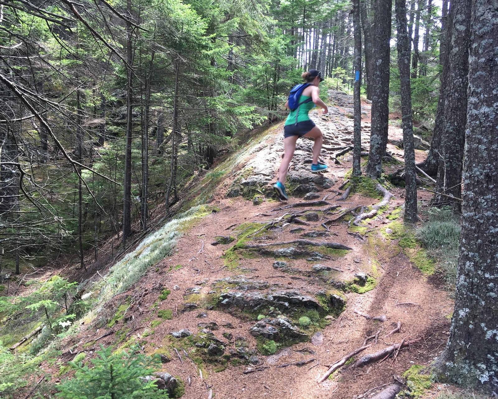


descending the Razorback Trail

Part 2 was a loop at Flying Mountain. It had been a long time since I'd been there, and it seemed like a nice short trip that fit well in our day. It was very hot again, so we didn't want to be out long anyway. So we slowly climbed up the south side, took some photos at the top, and dropped down to Valley Cove on the north side. The descent was quite fun. Normally I find the ocean super cold at MDI, but man it was really hot out, so we stripped to our shorts (and jog bra for Jen) and took a quick dip in Valley Cove. Which felt fantastic! I'm not sure I'd ever actually swam there before. After splashing about and watching hermit crabs for a while, we eventually returned via the fire road trail through the notch between Flying Mtn. and St. Sauveur.


summit of Flying Mountain


approaching Valley Cove


Valley Cove panorama

And then we had to leave. Jen got word that her Great Aunt was probably in her final days out on Cape Cod and we made the decision to abandon our vacation early the next morning. We made the right call, as she passed away only a few days later, and Jen was there for it with her sister, as it should have been.


On our way back to western Massachusetts, we stopped in at my friend Molly's ice cream place just off the island in Ellsworth, to say hello and treat ourselves to some terrific treats. And about an hour later we drove straight into what really looked like a tornado on the highway near Newport (it was just a shelf cloud in a really powerful weather front that was moving through).


a real pulse-quickener

Wednesday, August 1, 2018

Stratton Loop

One Friday in July, Jen had some work to do in southwest VT and I had the day off. While she did her field work in Arlington, I spent the morning tapping away at my laptop over a long brunch in a restaurant. Then around mid-day we drove up Kelley Stand Road, parked at the AT trailhead, and headed out for a much-anticipated trail run. She had done this particular loop several times before in recent years, and I had backpacked much of it (the Long Trail part) back in college, but we'd never run it together.


The ascent of Stratton Mountain on the AT / Long Trail is a fun one. There are just enough switchbacks to level the grade to a degree where you can run most of the way (though we hiked a few of the steeper bits). For several miles you climb through the forest -- hardwood at first, then mixed, and then finally spruce-fir conifers near the top. 


There's a fire tower in a small clearing at the actual summit where we chatted with a couple of through-hikers and took in the views. Then we jogged the spur trail over to the top of the ski trails and chair lifts of Stratton Mountain Ski Area, where apparently there was a yoga retreat event going on. That spur trail dips slightly into a saddle in the middle and crosses a section of boardwalks, but for the most part it's quite runnable and fun. 


The descent from the summit to Stratton Pond requires a little bit of trail running stamina, as there are a number of rocky bits and logs to jump over. But if you've been keeping your core fit you should be fine. I was not entirely fine, but that's another matter. At Stratton Pond, we took time out for a quick swim (delightful, of course) before lacing back up and heading out for the descent of the Stratton Pond Trail. 

Jen had done this loop several times before, and each time reported that the Stratton Pond Trail was pretty sloppy, with significant muddy patches. Well, let me tell you, we hit it on a good day, because it was easily one of the most fun little stretches of trail running I've done anywhere in New England. For a few miles we rolled along an undulating surface through mixed woods, and then dropped steadily back down to Kelley Stand Rd. Barely a patch of mud the entire way. It was a terrific way to cap off the loop. 


Except we weren't entirely done yet. There was still the small matter of a little road run back to the car at the other trailhead. It wasn't bad, though by that point we were pretty well tuckered out. And the deerflies did come out to feast a little bit, especially in the gravel parking lots. 


At the end, we capped the afternoon off with a quick swim in Grout Pond, just a few miles down the road. It was totally worth the side trip from the main road. A family was just finishing up their kayak trip and the whole thing just felt like exactly what people should be doing on a warm summer evening. 


Sunday, July 29, 2018

2018 Vermont 100 Endurance Races

I've photographed at the Vermont 100 Endurance Races for six years now, and I'm STILL figuring out the best way to try to catch all runners and riders in all of the various races. It ain't easy, given that the 2 running races (100-miler and 100K) and the three horse races (100-mile, 75-mile, and 50-mile) all start at different times and follow partly different courses. At any rate, this year I chose to set up for several hours at mile 47 of the 100-miler, and then for six hours at mile 72, where supposedly all racers would pass by (though not all before dark).

Since I'm not an "official" photographer for the event, per se, there's no specific mandate, but it's always nice to try to get as many runners and riders in scenic locations as I can. One unofficial mandate, however, is to get that elusive, primo shot with both runners and riders in it. This year I came as close as I think I've ever come to getting it. The runner in question is a guy I know (Carsten) from my town here in western MA (Greenfield), and the background is a farm up in the rural hills south of Woodstock.

the runner and the riders

Here's a few photo galleries from the shoot:
Runner Highlights:
Horses & Riders only:
The full album of all shots:

Friday, May 18, 2018

Mine Ledge

From Brattleboro, Vermont, it's hard to miss the towering mass of Mt. Wantastiquet looming large above the town just to the east across the Connecticut River. The wooded slope of the mountain's west face rises very steeply up from the river's edge and owns the scene. Most people in Brattleboro are familiar with the hiking trail that climbs for just under 2 miles to a clearing with a ledge and view out over town. But fewer are aware that the trail continues east from there (for quite a ways now, as part of the Wantastiquet-to-Monadnock Greenway) past the communications tower to Mine Ledge, Indian Pond, Daniels Mtn., Bear Mtn., Pisgah State Park, and more. One of the most dramatic vistas along the route, Mine Ledge, is only half a mile or so further along the trail from the Brattleboro vista on Wantastiquet.

Mine Ledge pano, looking west across Wantastiquet towards Vermont

On the afternoon of May 17, Jen and I set out to do a light after-work trail run to Mine Ledge and back. Conditions were great for it: a light breeze, partly cloudy with warm temps, and generally dry conditions (I've seen this route be pretty sloppy and slick in places in past springs). The eroded old dirt road that you use to climb to the vista from the bottom is fairly wide in most places and doesn't really feel much like a hiking trail. From the communications tower west, though, it's definitely much more of a singletrack hiking trail. It's surprisingly rugged as it undulates with the terrain along the summit plateau, rarely offering runners a chance to open up and get a good stride going. A little under two and a half miles from the start you arrive at the short spur trail to Mine Ledge.

My brightly clad hooves

Jen at Mine Ledge

That's a pretty sweet view.

site map (originally posted on the Chesterfield Cons Com website)

There's not too much more to say about this outing, other than we turned around after a brief rest at Mine Ledge and ran back to the trailhead. We were able to run pretty much the entire way, and the nearly 2-mile long descent from the vista ledge is actually pretty great, if a bit rough in spots. Afterwards we treated ourselves to a decent dinner at a terrific spot over at the Top of the Hill Grill just north of downtown Brattleboro.

dining on the outdoor deck patio of Top of the Hill Grill in Brattleboro

Monday, May 14, 2018

Taconic Crest Trail Run

A few weeks ago I received an invite to run the full 37-mile length of the Taconic Crest Trail from end to end. The distance actually fit well into my current training schedule and I'm so glad I said yes. It's not very often that I get a chance to take part in a legitimately "epic" adventure. When I do, though, it's always a good reminder to seize every opportunity to do it more often and just make 'em happen.

Getting There

On Thursday evening I drove out to the MA/NY state line with Jason Sarouhan where we met up with Peter "Rocky" Rockland and left a car at southern end of the trail (thanks for the loan, Sheldon!). Then we drove north to the next major pass through the range, in the relatively remote town of Hancock, MA, where we met up with our fourth member, Andy Wells. There we left a second car with mid-run drop bags and water (someone thought to put the water jugs in a stream, which was a fantastic idea). Then we all headed up to Williamstown in the northwest corner of MA, where Andy and his family now live. Andy had rented us a sweet cottage and stocked it with all sorts of carbs and such. After a good if somewhat overlong dinner at a pub in town, we headed to bed and got what sleep we could muster.

We rose around dawn, grabbed some breakfast, finalized our gear prep, and were driven north by Andy's super-helpful, star-athlete daughter Lilliana to the start of the trail just across the NY state line from North Pownal, VT. After applying some last-minute sunscreen and bug spray, and chugging some water and beet juice, etc., we set off up the trail at exactly 6:30 a.m.

Our crew: Jason, me, Peter, Andy (photo by Jason Sarouhan)


The First Section

About a tenth of a mile from the trailhead the trail started shooting straight up the super-steep slope and there was no question of running. Eventually the grade lessened, though, and we made pretty good time. And then the trail began its day-long habit of steeply rising and falling up and down every peak on the crest of the ridge. For the most part we hiked all uphills and gently ran most flats and all downhills.

one of the very steep climbs at the start

crossing a knob

descending the other side


Andy and Jason

Rocky on the road

After a few miles we arrived at a short (0.1-mile) spur path that led left/east down to a geologic feature called The Snow Hole. Plenty has been written about it elsewhere, but in short we all thought it looked pretty cool, and true to its name it was in fact still filled with snow at the bottom. It definitely invites further exploration, but we were on the clock with a mission for the day so we didn't linger long.

arriving at the Snow Hole

The Snow Hole

Knowing that we were in for an "ultra" day, we tried to eat something every half hour or so, and each of us went through 2 liters of water every 12 miles or so. Sometimes it was hard to eat when you just didn't want to, but everyone seemed to manage to do it anyway. I was pleased that my of-late perpetually tight hip and groin muscles, and upper hamstrings, were giving me no signs of trouble.

The running was really good in this section, and we were able to keep going at a pretty decent clip for the most part, though every now and then there'd be one of those super-steep uphills to slow us down, or an emergency quick trip off into the woods for some fertilizing. For the most part the route was pretty dry despite recent rains, though we did run across the occasional seepy slope and get our shoes sucked in by muddy ATV ruts.

Andy Wells

Peter Rockland

Jason Sarouhan

Around eight miles into our journey, we reached Route 2 where it crosses through Petersburg Pass and took a quick snack break out of the breeze on the far side of the huge dirt parking lot there.

The Middle Section

Leaving the pass, the trail immediately shot straight up in what felt like the steepest ascent of the day. I brought up the rear here, feeling acutely aware of the effort and wanting to keep my heart rate at a somewhat reasonable level. The grade soon lessened and the trail began to rise and fall along the crest of the ridge again. It continued to climb steadily, though, and after a fairly extended grind we finally topped out at the mostly open summit of 2,700-foot Berlin Mtn, the highest point along the Taconic Crest Trail.

approaching the summit of Berlin Mtn. (2,700 ft.)

Dropping down off the peak, we ran through the shade of some pretty green softwood stands. A mile or so later we reached a junction with a steep, 1.9-mile side path called the Phelps Trail, where Andy's daughter and some of her friends had hiked up several gallon jugs of water for us. For real. How awesome is that???

I didn't take many photos in this section; the next few miles were all about feet, trailfinding, and forward progress. And maybe a few more backwoods fertilization stops. Everyone's got a GI tract; best to just deal with it and move on. I'm afraid I wasn't much of a conversationalist on any of the uphills. I was close to my physical limits and needed every breath of oxygen I could get. I hope I was able to make up for my apparent unsociableness on the flats and downhills later.

For the most part the trail continued to rise and fall along the crest of the ridge, passing over peaks like Misery Mountain and Rounds Mtn. Early on, you could catch occasional glimpses of Mt. Greylock across the valley to the left, and later the windmills of the Brodie Mountain ridge. Temps were very pleasant and a cool north breeze at our backs provided a bit of a spring tailwind all day.

random ridgecrest bench: there's room for you!
(photo by Jason Sarouhan)

We took a (very forgivable) wrong turn for about a mile and then put our heads together to figure out what we'd done wrong and bushwhacked cross-ridge to get back on track. Then we did it again about a mile later, though all we had to do was backtrack about a quarter of a mile the second time. We were well aware that each of these accidental incidents added extra mileage to our already long day.

The trail has recently been re-routed in a few spots along this stretch, and the new path is really more of a notion of a trail at this point, mostly well-signed but very hard to follow otherwise, especially with lots of last year's dead leaves and branches still covering the ground. The Velcro kind. Andy noted that he was amazed by "how many times sticks on the ground stuck to the laces on my shoes for several paces."

There was one particularly grueling stretch, near what would have been mile 22 but was now mile 23 or 24 for us, where for about a mile the re-routed trail traversed the west side of the ridge at a decidedly off-camber pitch. (Interestingly, I later learned that at that point we were just upslope from a nudist resort called Berkshire Vista Resort; I didn't even know there was such a thing!)

pay very close attention when you see
TWO diamonds (photo by Jason)

At last our descent brought us to the upper reaches of Madden Road, which was basically a rugged old woods road at that point. Turning left, we dropped down about half a mile and arrived at our "mile 24" water drop. Everyone stayed admirably on task as we scarfed sandwiches (Jason had made a whole bunch to share!), addressed gear needs, and generally assessed ourselves. I had been feeling pretty knackered by this point and in some low moments doubted both my ability and/or desire to keep going, and I nearly admitted as much to Peter when he asked how I was feeling. But it's amazing how much the sandwiches, cookies, and rehydration adjusted my attitude about things. Before I knew it I was back in the game and ready to go. We did spare a few minutes to soak our sore feet in a small stream, but soon we packed up and set off again for the third and final leg of our journey.

The Final Section

descending to the valley from the mile-24 water drop

The road was paved below our car spot, and the initial drop was a bit of a quad-killer. But it soon leveled out in the valley below. We crossed Rte. 43 and then started up the gentle, lower slopes of Potter Mtn. Rd on the other side, passing several large pastoral pastures along the way. Hello cows. Soon that climb steepened as we re-entered the woods, and eventually we arrived at the turn back onto hiking trail.

The climb from Potter Mtn. Rd (a section that used to be called "The Thrasher" in earlier versions of the Free to Run Trail Races) steeply switches back and forth up a tough, recently logged slope. At the top the trail levels out and heads south along the ridge. I started to bonk a bit near the semi-open summit of a peak on Pease Ridge, feeling very low-energy all of a sudden. Fortunately I ate a chocolate Vi Fuel gel and chugged a bunch of Gatorade, and rebounded almost immediately.

We made great time and soon enough found ourselves popping out along the Berry Pond Circuit Road at Azalea Field and the big vista at the hairpin turn just beyond. I'd photographed and run at these spots for and with the excellent BURCS runners for several years and it was nice to be on familiar terrain for a few miles.

 a relatively nice section of well-groomed singletrack

We quickly passed Berry Pond and the campground, then headed back out on singletrack (at a sign that said 6.5 miles to the end at Rte. 20) towards Tower Mtn. I felt especially good along this well-maintained stretch of trail and even led the way for a bit, filled with energy and enjoying the high spirits as I chatted with Andy.

The descent from Tower Mtn. was also quite fun to run, and we continued to make good time all the way to a big beaver pond (that didn't show up on our maps). At the pond I darted out ahead and pulled out my iPhone camera and treated Peter and Andy to the way I all-too-frequently treat Jen on our trail runs: "Run FASTER! Open it UP! Go go go!" (sorry, everyone; I can't help myself)

late day strides at a beaver pond about a mile south of Tower Mtn.

The low point of the day for me came at mile 34 or 35 when we arrived a junction with the Lebanon Springs Trail, where Jason audibly let out an uncharacteristically dispirited, "oh, that's not good." It seemed like we'd been making such good time and we thought we were almost done, but in reality there were still about 3 miles left to go. That was a bit demoralizing for everyone. Our feet were really starting to hurt.

Continuing south, the trail actually steadily regains elevation as it traverses the west side of the ridge. It passes the very pretty Twin Pond, then subjects you to some more of the standard steep ups and gentle downs that we'd grown so familiar with throughout the day. This section of trail was probably the least well maintained we'd seen all day, and doesn't seem to get a lot of traffic. There were numerous blowdowns to skirt and many, many, many downed sticks and branches to kick up with one foot and smash into the other leg.

Botanically this section was fairly nondescript, but every now and then we'd pass across a nice rich slope filled with spring ephemeral wildflowers (trilliums, blue cohosh, waterleaf, etc.) and the occasional cove of fragrant ramps. The leaves and flowers of spring beauties and trout lilies seemed more or less ubiquitous throughout the day, though considerably more were actually in bloom later in the afternoon.

The battery on my GPS watch ran out a little over 2 miles short of the end, and I switched to tracking the final few miles on my phone. Jason and Andy somehow found some extra gas in the tank and ran all the way to the finish, even running most of the uphills, while Peter and I brought up the rear at a slightly less speedy but still enjoyable pace. Finally, we arrived at our car at Rte. 20 where we ripped the running shoes off our super sore feet, scarfed salty snacks, and cracked open well-earned celebratory beverages.

trail sign at the tail end of the trek 

Summary

By the end, we'd covered over 38 miles, climbed more than 9,000 feet of vertical, and burned dog only knows how many calories each. No sunburn (except on the back of Jason's knees and a bit on his arms), very few bugs, and no injuries. Total time from start to finish was about 12 and a half hours (maybe about 11 moving time). It was definitely harder and more rugged than I'd expected.

Overall, I have to say I probably wouldn't choose to revisit this route due to the general sketchiness of the trail re-routes in some spots (hopefully they become more "established" over time), though some sections, such as the part above Williamstown and the bits within a few miles of Berry Pond, are absolutely terrific for running. But I am super thrilled to have explored it and proud to have finished the trek. A zillion thanks to Jason, Andy, and Peter for making it happen, being a damn fine group of determined dudes, and for letting me join the fun.

our route
(map by the Taconic Hiking Club)

elevation profile (minus the "descent" of the last few miles)

Friday, May 4, 2018

cover shot

Hey I just made the cover photo of the new issue of Vermont Sports! I also got some photos in the article about the Vermont 100 ultramarathon and wrote an article about running (and love) along the Windmill Hill Pinnacle Ridge Trail.


https://www.facebook.com/VermontSportsMagazine/