Tuesday, May 1, 2018

West River Trail to Black Mountain and Back Run

Whenever we can, Jen and I like to go for mid-distance trail running adventures on weekends. It satisfies several of our desires at once: exercise, exploring, and outdoor activity excursion, all while spending some quality time together.

This past weekend's adventure took us to a pair of relatively local gems in southeastern Vermont: the West River Trail in Brattleboro and Black Mountain in Dummerston. The West River Trail is a terrific multi-use rail trail that heads upriver from Brattleboro and ends in South Londonderry (minus a missing section in the middle that hopefully can be added to connect the upper and lower ends). Black Mountain is a conservation property owned by The Nature Conservancy, focused on a geologic feature known as a ring dike (other examples of which can be found at Pawtuckaway, Cape Horn, and the Ossipee Range, all in New Hampshire).


striding it out a few miles from the start on the West River Trail

Starting from the eastern end of the trail (actually, from the Marina itself, a few hundred yards southeast of the Marina trailhead), we headed northwest at an easy pace. My legs were really wrecked from a 50-mile training week capped off by a 19-mile trail run the day before, so as far as I was concerned the slower the better. Jen was testing out some new orthothics, so she was OK with the gentle pace as well. We'd waited as long as we could as we watched a big blob of green and yellow swirl around on the radar, but it seemed to just keep filling in so eventually we just threw out the towels and set out in the rain. It was about 50 degrees out, and we felt a bit chilled.

This section of the trail is quite pretty as it variously hugs the side of the valley wall, passes right next to riffles in the river, and goes under the new bridges for I-91. All of it is flat. At one point a short spur trail branches off and crosses a floodplain section in the Riverstone Preserve; we took this worthwhile alternate route on the way out. Around mile 3 we left the cover of the woods and the next three quarters of a mile to Rice Farm Road were in the open along an old dirt road. Then we ran about a half mile along the dirt road to the trailhead for Black Mountain.

crossing under I-91

right between the rocks and the river

along the West River Trail

For the ascent of Black Mountain (a little over a mile of hiking trail), we slowed to a hiking pace, and as usual I kept pausing us to take pictures with my phone. Just before we reached the summit the rain began to let up and we could see spots of blue sky peeking through the clouds to the south. At the top, we enjoyed the limited view to the southeast, but didn't linger too long because the breeze made it a bit chilly up there and we didn't want to cool down too much.

climbing Black Mountain

nearing the summit of Black Mountain

view from the top

Speaking of down, we opted to take the new leg of the loop trail for our descent. It looks to be a little longer than the way up, but not by much. At first it seemed like it was going to be great, but then there was a quarter mile or so stretch where it just dropped on a straight diagonal down the slope and the water followed the same path so it was really sloppy and unpleasant. That section could really use some switchback re-routes. By the time it leveled out and turned right on a rocky old woods road we were regretting our decision to explore it.

But then it got a LOT better. It was super fun to run, and TNC work crews had clearly put a lot of time and effort into creating a great new trail. There were quite a few elaborate wooden structures that crossed streams and helped avoid sensitive wet areas. By the time we reached the bottom of the loop we were really glad we'd done it.

crossing the streams

passing by a pond

The return trip back along West River Trail was fairly pleasant and uneventful. It even got a little warm towards the end. My legs were really ready to stop. We changed in the car and capped our afternoon adventure off with what turned out to be a really terrific early dinner at The Marina restaurant. Our table was right above the river with a great view, and the food really was fantastic. All in all, another successful and enjoyable New England trail running trek.

 our route

elevation profile; guess which part is Black Mountain...

Running along the West River Trail in southeast Vermont

Monday, March 12, 2018

2018 U.S. Snowshoe Nationals

By mid-to-late February of this year, you'd be forgiven for thinking that winter was long gone and spring was just around the corner here in west-central New England. On one particularly toasty day I think I was sweating up a storm in shorts and t-shirt on a run with temps in the high 60s. Snow was long gone, and most of the last few scheduled snowshoe races morphed into regular trail races out of necessity. You'd be right if you guessed that most of us outdoorsy types enjoyed the oasis of warmth, even if we still gazed longingly over at our running snowshoes and cross-country skis. You'd still have been wrong about winter though; it definitely wasn't done yet.

Strong storms in early March dumped tons of snow in the highlands of the Berkshires and Green Mountains, with some areas getting several feet in a single day. Just in time for the 2018 U.S. Snowshoe Nationals races at Prospect Mountain Ski Area in Woodford, VT, just east of and up the hill from the town of Bennington in the southwest part of the state. The event weekend took place March 10-11, 2018. I had photographed at the event when it was held there in 2014 (see my snowshoe racing blog post from that era), and was fortunate enough to get to shoot there again this time around.

A racer summits the mountain in the Women's 10K championship race. 

Here is a representative sampling of the various races that took places over the weekend, including a Citizen's Race 5K, a kids race, the mens and women's 10K championship races, and a trail marathon and half-marathon (all photos copyright Ben Kimball Photography):

Start of the 2018 Women's 10K championship race. 


Elena Betke-Brunswick (left) with Laure and Tom Van den Broeck Raffensperger,
all from the happy Pioneer Valley of Western Massachusetts.

Bob Dion (left), founder and owner of Dion Snowshoes and sponsor of the event, with two strong guys from South America (who had never run in a snowshoe race before!).

Sunday, December 10, 2017

Cleaning Trail


In northwestern Massachusetts, the mostly singletrack Mahican - Mohawk Trail runs like a broken necklace from Deerfield to North Adams. I say "broken" for three reasons. Partly because there are missing sections, such as between Shelburne Falls and Mohawk Trail State Forest; partly because there are two newly closed sections in Conway and Shelburne (one due to washouts south of Bardwell's Ferry and one due to a landowner's reluctance to allow people to cross his property); and partly due to general decay of the trail's infrastructure.

I included the eastern part of the trail as a profiled site (#27) in my guidebook Trail Running Western Massachusetts. Since publication of that book the washout closure happened and the lack of general maintenance has seemed more and more evident to me. The big fiberglass bridge over the Cold River at Polly's Crossing is still safe and spectacular, but the descent to the bridge from the southern side is heavily eroded and could probably use some new switchbacking work. And in various places along the trail, small wooden bridges and log stair steps have rotted to the point where they may be unsafe to use (be careful if you do).

Furthermore, there seems to be a tendency along the section south of Polly's Crossing to collect leaves. A LOT of leaves. They accumulate along the trail in tremendous volume and perhaps because of the north-facing aspect of the slope above the Deerfield River they don't seem to rot away during the course of the summer. As a result, the trail becomes ever-more obscured year after year and it can be hard to tell where it is sometimes, even with the white blazes on the trees. Also, the impressive depth of leaves covers the log stairs and over time causes them to rot away prematurely.

As a result, this section of trail doesn't seem to get a lot of use, and it's hard to blame people for staying away. And I think that's a shame. People generally really like long-distance trails like the AT, the NET, the Long Trail, the Windmill Ridge Trail(s) in southeastern Vermont, and the Mid-State Trail, etc. In time, the Mahican-Mohawk Trail seems like it could be as popular as those other ones, and also be one of the few east-west routes in the region. If enough people discover it and talk about it, the appeal could catch on. But at the moment the trajectory seems to be heading in the other direction.

Which is a very long preamble to me saying that I recently went out and cleaned up this section of trail a little bit. I raked some of the parts where the trail was entirely obscured, cleaned all the leaves out of the rotting log stairs, and moved countless blowdowns that were lying across the trail. Much more could be done, like edging the upslope side of the trail with digging tools, creating new switchbacks on the steepest sections, replacing the rotted log stairs, trimming back branches growing into the path, and cutting through or moving the larger blowdowns, but at least this feels like a start.


I've since gone back and run the section between Deerfield and Conway, and I have to say it was pretty fun. I've contacted the Deerfield River Watershed Association about future volunteer maintenance opportunities and hope that more people discover this hidden gem. Who's with me?

For more info about the Mahican - Mohawk Trail, check out this page on the MA DCR website. 

Tuesday, November 14, 2017

The November Challenge (or, The Audacity of Leaves)

Since my birthday falls in early November, I probably like the much-maligned month more than most. A child’s happy memories of coming downstairs and seeing what is obviously a Star Wars action figure (“I hope it’s a new stormtrooper!”) wrapped in last weekend’s Sunday funnies (way back when Garfield was still funny) sitting on the coffee table… those can last a lifetime; thanks, Mom! The daylight savings time change seems to affect others more than me; just plop a headlamp on me and I’m good to go. No SAD issues for me, thankfully. And I don’t even mind the gray. Or grey? Or brown, or whatever color November actually is. But one thing does frequently hassle me on my early November runs: downed leaves.

an actually not-too-bad section of leaf-covered trail

Whether you’re running on narrow trails or old woods roads, a coating of dead leaves can make things difficult. On twisty mountain-bike singletrack, like the kind you find at Earl’s Trails in Hadley or the Saw Mill Hills conservation area in Northampton, the route can be completely obscured, and important trail junctions rendered invisible. This year I tried navigating the maze of faint paths just east of Fitzgerald Lake after leaf-fall, and even though I had a good map and knew the way I still found myself missing turns and bushwhacking by mistake. At times like that I stop to silently thank the oft-unappreciated ranks of Those Who Rake.

On the other end of the spectrum, wide open routes like the “carriage trails” at Northfield Mountain feature their own autumnal challenges. You can always find your way, but with a lot of leaves covering the surface you can still manage to somehow go astray. The likelihood of turning an ankle on uneven ground increases a lot, and the possibility of kicking a buried branch or protruding rock becomes a real threat. 

And what happens if you just add water? Oh, that’s a special treat. Wet leaves are slippery anytime, but just wait’ll you try to run across some on a slanted ledge in the woods. Whooooops!!! Ouch. The D.O.C., M-M, and Teabag Trails on Mt. Tom have a couple of spots where that’s a real concern. Wet leaves also make you slide backwards on uphills and can cause you to slip to your doom on steep downhills. 

Naturally, there ARE some upsides as well. The leafless trees let in more light, so it takes darkness longer to really set in, which is a nice (if somewhat slight) offset to a shorter day length. The decomposed foliage on the ground will eventually make new soil to replenish the ever-eroding trail’s treadway. And often the less-than-ideal conditions will drive fair-weather runners back to roads or onto treadmills, so you’ve got those sweet forest miles all to yourself for a change. 

Also, let’s be honest here, aren’t those leaves better off rotting away in the woods than filling up your yard? Plus, no matter how tough the leaves can make fall trail running, the snow won’t be too far off, and you know what that means… snowshoe racing season’s coming soon!!


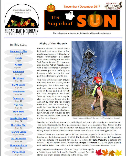
Ben is the editor of The Sugarloaf Sun newsletter and author of the guidebook Trail Running Western Massachusetts


Sunday, November 5, 2017

Bear Hole Run for the Trails 10K

The first annual running of the Bear Hole Run for the Trails 5K and 10K trail race took place on 11/4/17 in West Springfield, MA. The race, intended to benefit the trails of the Bear Hole watershed (the area south and west of Ashley Reservoir in Holyoke), drew a small but energetic field of zany knuckleheads, including me. The weather was perfect (cool, sunny, and dry), though the sun dapple was blinding at times (wearing a cap with a visor that I could adjust definitely helped), and the downed leaves hid some of the rockier and rootier portions of the singletrack, especially along the NET on East Mountain.

Gareth Buckley of South Hadley won by a longshot in 45:44 (he must have had leaf-ray vision). I managed to snag third place, in 54:04, but only because the guy who’d been in second place and the lead woman for most of the race both took a wrong turn at a particularly tricky junction on a short but steep incline in the woods near mile 5. For an easy cool-down, local trail runner friend Wayne Stocker led me, John Torrone, and Wayne Ball to an incredibly scenic waterfall (it’s totally worth seeking out sometime) and the rather depressing old cage where the former owner used to keep a bear.