occasional ramblings on running, racing, triathlons, hiking, mountains, photography, and life.
Monday, February 28, 2011
winterland
Saturday, February 19, 2011
Winter Wild #3: Pat's Peak
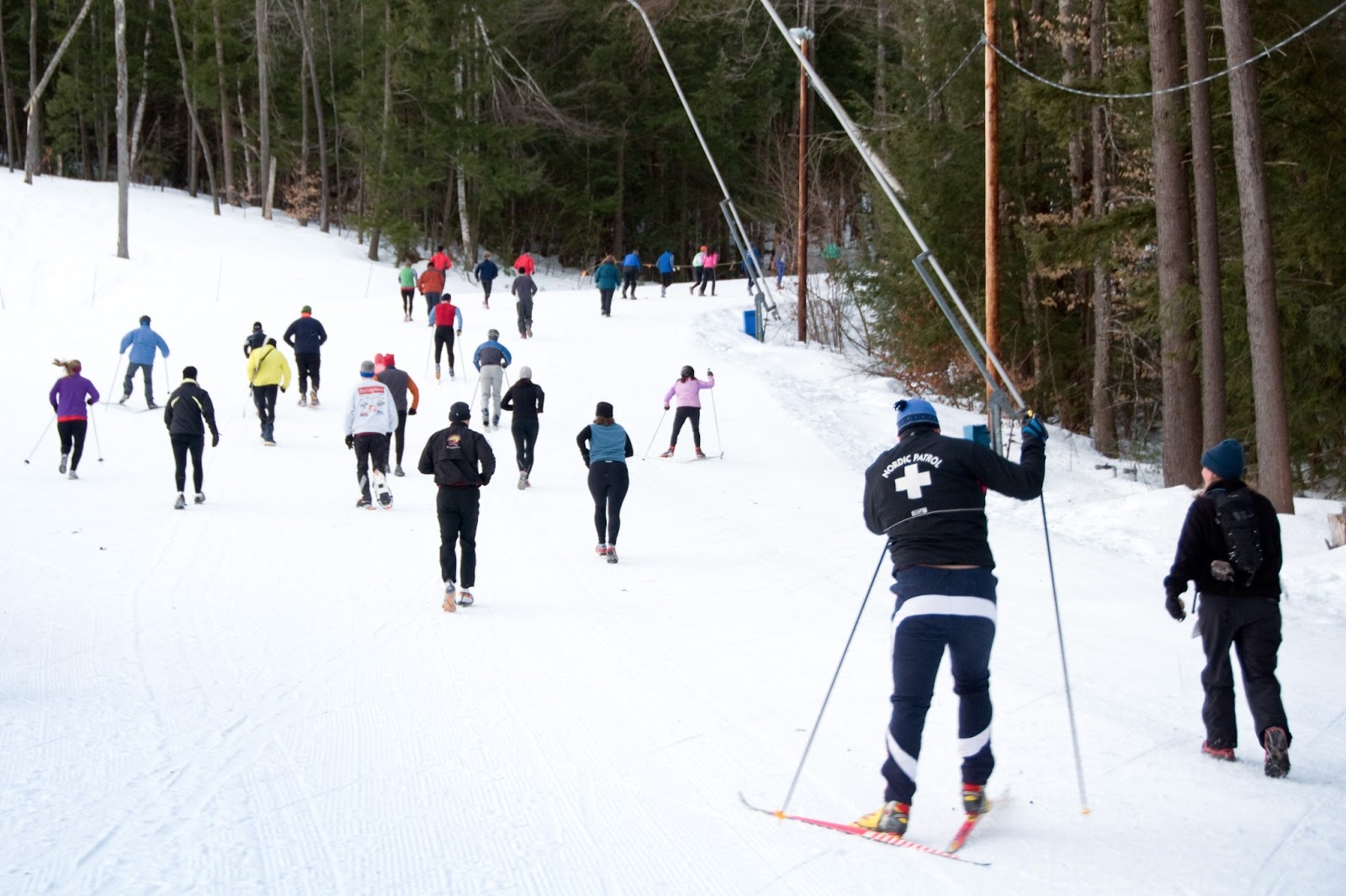
Winter Wild #3 was held today at Pat's Peak in Henniker, NH. The race climbs one ski trail to the top and descends another to the finish. You can do it on any kind of ski, snowboard, snowshoes, or running shoes with spikes. The only rules are you have to come down using the same gear you went up with, and you gotta have fun.
I did this one on backcountry skis, using climbing skins for the first time (love 'em) on the ascent. A few weeks ago I tried doing the Ragged Mountain one without skins. Big mistake, that. Anyway, because I'm basically an idiot and am always apparently looking for new ways to hobble myself, I brought my camera with me this time and took a couple of shots along the way (stashed it in my pack w/the skins on the descent). Despite the dumbness of that move, this really was quite a bit of fun.
pre-dawn
they're off!
looking back down on the way up
The pair of determined girls in the photo above made a pretty amazing ascent, laughing and encouraging each other the whole way and just flying right over the summit and down the other side. Side note: right about at this point a helpful spectator told me that I might race faster if I didn't have a five-hundred pound Nikon swinging from a strap around my neck. So noted.
The skier in front of me crests the summit at dawn.
Danny and Amber
(hey, it's Irongirl and Ultrarunning Boy!)
Ryan the Quick and some of my fellow Capital Multisporters
Saturday, February 5, 2011
Kancamagus Brook Ski Trail
We'd heard from several people that the Kancamagus Brook Ski Trail near Waterville Valley, NH might have been "destroyed" by the 2009 ice storm, but apparently volunteer trail crews have been out and done a fantastic job because on our 9.5 mile backcountry ski trek today we really only ever had to go around two large blowdowns, and step over maybe 2 smaller ones.
Winter fashion shoot. This was along the Greeley Ponds Trail portion.
This shot shows what a good portion of the lower part of the Kancamagus Brook Ski Trail is like, for maybe the first mile after it leaves the Greeley Ponds Trail. You climb occasional steeper pitches, then ascend smoothly along gentle grades like this one. Just off to the left is a steep drop to the brook itself.
The steep bit. There's one short section about half a mile up from the junction with the Greeley Ponds Trail where the route suddenly stops going straight above the ravine and veers steeply right up the slope to the left. L: This is looking back down as Sarah herringbones up it like a pro. It's really freakin' tiring to climb this way! R: The gang makes its way upward.
L: Alex in heavy snow on one of the hairpin turns.
R: a brief reprieve from climbing near the top of the trail.
Processing note: I did very little to the top part of the right image, but brought the curve WAY down in the middle for the track itself, in order to bring out some of the detail there.
L: Paul, Karen, and Alex near the height-of-land and top of the climb on the Kancamagus Brook Ski Trail. Mt. Osceola looms behind them in the background. R: Karen Langley at the height-of-land.
Becky ventures out onto one of the frozen bogs near Livermore Pass at the top of the Kancamagus Brook Ski Trail. This is about 6 miles into the trek, and at the top of all the climbing. She and I and one other of our group had gotten up super early and done the Winter Wild #2 hill climb at Ragged Mountain that morning (I forgot my skins!). Needless to say, we were pretty tired by this point.
About a minute after this, I was just skiing along minding my own business and to my sincere surprise I suddenly sunk up to my waist in a soft snow spot, dunking both my exposed camera and exposed hands. How to get chilly fast!
Group shot (minus me) as it starts snowing near the end of our 9.5 mile backcountry ski loop of the Kancamagus Brook Trail in the White Mountains. L to R: Ryan, Sarah, Jeff, Becky, Alex, Arielle, Kimball, Karen, and Paul. This was about halfway down the descent of Livermore Rd, near Waterville Valley, NH.
swift descent along Livermore Road
gear note: I had fallen over with my camera into deep snow at least two times by this point (lost a couple of action shots on the steeper part of the descent to fogged over lens).
Sunday, January 9, 2011
passing the eaglet spire
If you look up at just the right time as you drive through Franconia Notch, you can see "the Eaglet" sticking out from the sheer face of Eagle Cliff on Hounds Hump Ridge. The local climbing guide (Secrets of the Notch) says this spire of rock is the largest freestanding tower in the eastern U.S. While I can't vouch for that particular factoid, I can absolutely attest to the high drama of the location.
We started out hiking on the Greenleaf Trail to Mt. Lafayette. After half a mile or so, we left the trail and bushwhacked straight upslope through spruce-fir forest and open talus to the base of the cliff. From there we curved around to the right of the spire and came out on this open scree slope, which was lightly coated with a mix of ice and snow. After this, we ascended a steep gully to the top of the ridge.
Though the elevation wasn't nearly as high as some of the nearby alpine areas, the views back down into the notch and across to Cannon Cliff were some of the most dramatic I've seen in New Hampshire; I can't wait to go back in summer to watch climbers scale that wall.
badass
the talus below and Miles in style
passing the eaglet spire
the climb
cleavage
from above
Sunday, September 26, 2010
Friday, September 17, 2010
Timberman 2010
It's been a busy summer. This photo was from the finish of the Timberman 70.3 Half-Ironman Triathlon in August. At least I think it was at the finish. I certainly look like I'm ready to sit on the couch for a while. But it could have been the halfway-point of the run. Anyway, this shot was obviously taken by a race photographer, and I'm sorry I don't have a name to credit.
I spent a LOT of time training for this race, and it paid off. I came in at 5:29:51, taking a full 20 minutes off my time from the previous year.
Anyway, now I'm off this weekend to do yet another, the Ironman 70.3 Syracuse in New York. My friend Jason and I are road-tripping over there to see what we can do in this race's inaugural year.
[UPDATE: Syracuse was freakin' awesome. I took another 10 minutes off, finishing the race in 5:19:12. The swim was cold to start but went smoothly (despite all the weedy vegetation in the pond), the bike was hilly and hard but very scenic and tons of fun, and the run went so much better than any other half-iron run I've done.]
I spent a LOT of time training for this race, and it paid off. I came in at 5:29:51, taking a full 20 minutes off my time from the previous year.
Anyway, now I'm off this weekend to do yet another, the Ironman 70.3 Syracuse in New York. My friend Jason and I are road-tripping over there to see what we can do in this race's inaugural year.
[UPDATE: Syracuse was freakin' awesome. I took another 10 minutes off, finishing the race in 5:19:12. The swim was cold to start but went smoothly (despite all the weedy vegetation in the pond), the bike was hilly and hard but very scenic and tons of fun, and the run went so much better than any other half-iron run I've done.]
Sunday, August 8, 2010
previously, on LOST...
Part of the appeal was this long scar of open rock that, in the aerial photos, stands out like a beacon among the surrounding dark green forest. The photo above was taken after a mile-long bushwhack from the first stream crossing along the North Twin Trail. We discovered that the scar is not permanent, but rather a result of a huge landslide that must have swept down the stream valley from the higher slopes of the mountain, maybe after a really heavy rain. You can still see the open slide above. The sides were re-vegetating with alder and birch thickets, but we were able to easily walk right up the stream course to the head of the valley.
Our lunch rock was at the bottom of the steep part. From there, we veered to the left of what you can see here and climbed about 500 feet up an open rock slab. The slabs were steep and wet, and just past the edge of our comfort zone. It was pretty exhilarating. I didn't take any photos between the lunch rock and the top of the open slabs because the camera was buried deep in my pack. The slick ledges were right on the verge of being anything we felt safe freeclimbing, and they had soggy lichens too. I really wish I had shots that conveyed how sloped it was, because the photo below only shows the top part, and it was definitely steeper than that. The dog, of course, thought we were major wussies.
Then we bushwhacked through very steep and dense high-elevation spruce and fir forest towards the top. I'm not gonna lie to you; this part took a while. For every stretch of semi-open, mossy understory there was a corresponding dog-hair thicket of gnarly, interlocking spruce trees. Eventually we reached the trail along the crest of the northeast ridge. From there it was an easy walk to the top of the mountain (4,760 ft.), where there were spectacular views from several open ledges. At the end of the day we descended via the North Twin Trail back down to the trailhead.
pretty little falls on the bushwhack up to the slide
lowest parts of the slide
revegetation happens
lunching in the hidden valley
boggy fringe at the top of the left slide
view from the top of the open slabs of the left slide
one last little pitch in the open...
...before the last quarter mile or so of boreal bushwhack ascent
through steep, rugged spruce-fir forest
scenic overlook ledge near the summit of North Twin Mtn.
the view down into the Pemi Wilderness (with Galehead Hut in the saddle below)
on the way down off the top
the route